TopoQuest Logo
Do you find TopoQuest useful?
Help keep TopoQuest running and adding new maps/features by donating!
Bitcoin:  19c7KJd3qBynnjoSw5npx9KScwjBe4ifkT
Litecoin:  LXs6TkuXGGXo1vDsWCkWVdjQX94eUKd6ui
Home View Maps Find Maps Find Places Resources & Links


Telephone, Texas Topographic Map

USGS Map Title: Telephone, TX
USGS Map MRC: 33096G1
DRG (GeoTIFF) Download: o33096g1.tif


Neighboring USGS Topographic Map Quads:


  Blue, OK  
33096H2
 

  Bennington South, OK  
33096H1
 

  Lake West, OK  
33095H8
 

  Yuba, OK  
33096G2
 

  Telephone, TX  
33096G1
 

  Monkstown, TX  
33095G8
 

  Lake Bonham, TX  
33096F2
 

  Lamasco, TX  
33096F1
 

  Selfs, TX  
33095F8


Map MRC Location:

N34°
W97°
N34°
W96°
H8 H7 H6 H5 H4 H3 H2 H1
G8 G7 G6 G5 G4 G3 G2 G1
F8 F7 F6 F5 F4 F3 F2 F1
E8 E7 E6 E5 E4 E3 E2 E1
D8 D7 D6 D5 D4 D3 D2 D1
C8 C7 C6 C5 C4 C3 C2 C1
B8 B7 B6 B5 B4 B3 B2 B1
A8 A7 A6 A5 A4 A3 A2 A1
N33°
W97°
N33°
W96°

Telephone, TX USGS 1:24K Topographic Map Preview:
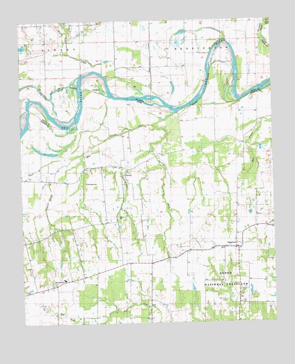
Telephone, TX USGS Topographic Map
Click on map above to begin viewing in our Map Viewer.

This topographic map contains these locations and features:
Feature Name Type Latitude Longitude GNIS ID View Map
Black BranchStreamN33.8334°W96.0964°1383375View Map
Black BranchStreamN33.8168°W96.1116°1352292View Map
Carman Lake Number 2ReservoirN33.8627°W96.1239°1757870View Map
Carman Lake Number 2 DamDamN33.8634°W96.1236°1757869View Map
ElwoodPopulated PlaceN33.8118°W96.0739°1379724View Map
Elwood CemeteryCemeteryN33.7940°W96.0780°1383441View Map
Elwood CreekStreamN33.8370°W96.0469°1356997View Map
Elwood CreekStreamN33.8370°W96.0472°1383346View Map
Island BayouStreamN33.8476°W96.1041°1101483View Map
Narvaugh CreekStreamN33.8315°W96.0591°1383347View Map
Narvaugh CreekStreamN33.8318°W96.0597°1363591View Map
Old Elwood CemeteryCemeteryN33.8079°W96.0930°1383440View Map
Ravenna-Telephone DivisionCivilN33.7528°W96.0785°1939121View Map
Reward Ranch AirportAirportN33.7681°W96.1208°2675931View Map
Rice CreekStreamN33.8470°W96.0589°1101625View Map
Robert Springs BranchStreamN33.8332°W96.0975°1366580View Map
Roberts Springs BranchStreamN33.8165°W96.1119°1383439View Map
Sam Rayburn Elementary SchoolSchoolN33.7681°W96.1046°2005855View Map
Sam Rayburn High SchoolSchoolN33.7689°W96.1049°1383438View Map
TelephonePopulated PlaceN33.7812°W96.0180°1369685View Map
Telephone Post OfficePost OfficeN33.7817°W96.0190°2731683View Map
Telephone Volunteer Fire DepartmentBuildingN33.7808°W96.0255°2655712View Map
Tuklo CreekStreamN33.8523°W96.0811°1101702View Map

Note: Coordinates in the location and feature list above are referenced to NAD83 datum.


Copyright (C) 2008-2025 Ryan Niemi / Sunset Dynamics ... All Rights Reserved