TopoQuest Logo
Do you find TopoQuest useful?
Help keep TopoQuest running and adding new maps/features by donating!
Bitcoin:  19c7KJd3qBynnjoSw5npx9KScwjBe4ifkT
Litecoin:  LXs6TkuXGGXo1vDsWCkWVdjQX94eUKd6ui
Home View Maps Find Maps Find Places Resources & Links


Bloomville, New York Topographic Map

USGS Map Title: Bloomville, NY
USGS Map MRC: 42074C7
DRG (GeoTIFF) Download: o42074c7.tif


Neighboring USGS Topographic Map Quads:


  West Davenport, NY  
42074D8
 

  Davenport, NY  
42074D7
 

  Harpersfield, NY  
42074D6
 

  Delhi, NY  
42074C8
 

  Bloomville, NY  
42074C7
 

  Hobart, NY  
42074C6
 

  Hamden, NY  
42074B8
 

  Andes, NY  
42074B7
 

  Margaretville, NY  
42074B6


Map MRC Location:

N43°
W75°
N43°
W74°
H8 H7 H6 H5 H4 H3 H2 H1
G8 G7 G6 G5 G4 G3 G2 G1
F8 F7 F6 F5 F4 F3 F2 F1
E8 E7 E6 E5 E4 E3 E2 E1
D8 D7 D6 D5 D4 D3 D2 D1
C8 C7 C6 C5 C4 C3 C2 C1
B8 B7 B6 B5 B4 B3 B2 B1
A8 A7 A6 A5 A4 A3 A2 A1
N42°
W75°
N42°
W74°

Bloomville, NY USGS 1:24K Topographic Map Preview:
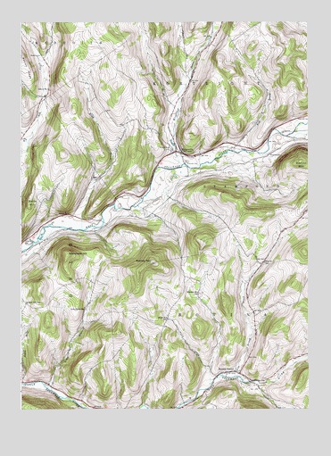
Bloomville, NY USGS Topographic Map
Click on map above to begin viewing in our Map Viewer.

This topographic map contains these locations and features:
Feature Name Type Latitude Longitude GNIS ID View Map
Betts HillSummitN42.3176°W74.8713°943811View Map
BloomvillePopulated PlaceN42.3334°W74.8077°944294View Map
Bloomville Census Designated PlaceCensusN42.3339°W74.8181°2627981View Map
Bloomville Post OfficePost OfficeN42.3330°W74.8077°2617822View Map
Bloomville United Methodist ChurchChurchN42.3331°W74.8095°2615623View Map
Bloomville Volunteer Fire Department Station 1BuildingN42.3354°W74.8114°2735056View Map
Boomhower HillSummitN42.2998°W74.8546°944441View Map
Bovina CemeteryCemeteryN42.2576°W74.7760°2548272View Map
Bovina CenterPopulated PlaceN42.2620°W74.7846°944503View Map
Bovina Public LibraryBuildingN42.2626°W74.7814°2617229View Map
Bovina United Presbyterian ChurchChurchN42.2614°W74.7805°2615627View Map
Bovina Volunteer Fire DepartmentBuildingN42.2625°W74.7807°2735058View Map
Bramley MountainSummitN42.2976°W74.8182°944615View Map
Bramley Mountain FarmLocaleN42.2631°W74.7922°2560263View Map
Bramley Mountain SchoolSchoolN42.2876°W74.7974°944616View Map
Brush BrookStreamN42.2612°W74.7888°944973View Map
Brush CemeteryCemeteryN42.2623°W74.7815°2548273View Map
Byebrook FarmLocaleN42.3275°W74.7814°2560282View Map
Coulter BrookStreamN42.2581°W74.7713°947542View Map
Dry BrookStreamN42.3359°W74.8718°948684View Map
Elk Creek CemeteryCemeteryN42.3637°W74.8667°943659View Map
Federal Hill SchoolSchoolN42.2840°W74.8729°949956View Map
Glen BurnieValleyN42.2577°W74.8627°951168View Map
Glen Burnie SchoolSchoolN42.2826°W74.8471°951169View Map
Grace's LandingAirportN42.3383°W74.7508°978310View Map
High Meadows FarmLocaleN42.3242°W74.8453°2560283View Map
Kidd BrookStreamN42.3079°W74.8485°954593View Map
Kiff BrookStreamN42.3331°W74.7799°954597View Map
Maple Shade FarmLocaleN42.3003°W74.8725°2560287View Map
Miller Avenue SchoolSchoolN42.2790°W74.8113°957295View Map
Old United Presbyterian Church CemeteryCemeteryN42.2594°W74.7698°2548274View Map
Pink Street SchoolSchoolN42.2973°W74.7690°960595View Map
Riverside CemeteryCemeteryN42.3300°W74.8035°962580View Map
Rose BrookStreamN42.3395°W74.7560°962899View Map
Sackrider CemeteryCemeteryN42.3441°W74.7518°963172View Map
School Number 1 (historical)SchoolN42.3131°W74.8540°974869View Map
School Number 1 (historical)SchoolN42.3531°W74.8627°974870View Map
School Number 2 (historical)SchoolN42.3342°W74.8102°975161View Map
Town of BovinaCivilN42.2681°W74.7584°978745View Map
Wetmore CemeteryCemeteryN42.3325°W74.7667°970956View Map
Wright BrookStreamN42.3287°W74.8054°971748View Map

Note: Coordinates in the location and feature list above are referenced to NAD83 datum.


Copyright (C) 2008-2025 Ryan Niemi / Sunset Dynamics ... All Rights Reserved