TopoQuest Logo
Do you find TopoQuest useful?
Help keep TopoQuest running and adding new maps/features by donating!
Bitcoin:  19c7KJd3qBynnjoSw5npx9KScwjBe4ifkT
Litecoin:  LXs6TkuXGGXo1vDsWCkWVdjQX94eUKd6ui
Home View Maps Find Maps Find Places Resources & Links


Templeton, Virginia Topographic Map

USGS Map Title: Templeton, VA
USGS Map MRC: 37077A3
DRG (GeoTIFF) Download: o37077a3.tif


Neighboring USGS Topographic Map Quads:


  Petersburg, VA  
37077B4
 

  Prince George, VA  
37077B3
 

  Disputanta North, VA  
37077B2
 

  Carson, VA  
37077A4
 

  Templeton, VA  
37077A3
 

  Disputanta South, VA  
37077A2
 

  Stony Creek, VA  
36077H4
 

  Sussex, VA  
36077H3
 

  Littleton, VA  
36077H2


Map MRC Location:

N38°
W78°
N38°
W77°
H8 H7 H6 H5 H4 H3 H2 H1
G8 G7 G6 G5 G4 G3 G2 G1
F8 F7 F6 F5 F4 F3 F2 F1
E8 E7 E6 E5 E4 E3 E2 E1
D8 D7 D6 D5 D4 D3 D2 D1
C8 C7 C6 C5 C4 C3 C2 C1
B8 B7 B6 B5 B4 B3 B2 B1
A8 A7 A6 A5 A4 A3 A2 A1
N37°
W78°
N37°
W77°

Templeton, VA USGS 1:24K Topographic Map Preview:
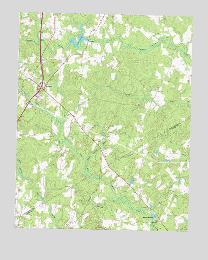
Templeton, VA USGS Topographic Map
Click on map above to begin viewing in our Map Viewer.

This topographic map contains these locations and features:
Feature Name Type Latitude Longitude GNIS ID View Map
Belsches DamDamN37.0068°W77.2747°1490946View Map
Belsches Mill SwampStreamN37.0113°W77.2778°1463065View Map
Belsches MillpondReservoirN37.0087°W77.2749°1463066View Map
Bexley Trailer ParkPopulated PlaceN37.0757°W77.3594°1739864View Map
Cherry Orchard BranchStreamN37.0388°W77.3247°1464780View Map
Coddyshore (historical)Populated PlaceN37.0299°W77.2980°1690190View Map
Couches PondReservoirN37.0284°W77.2911°1465283View Map
Derby (historical)Populated PlaceN37.1099°W77.3441°1739877View Map
Hakks School (historical)SchoolN37.0102°W77.3189°1690203View Map
Indian SwampStreamN37.0238°W77.3611°1468490View Map
Interchange 41CrossingN37.0815°W77.3583°1739898View Map
Johnson DamDamN37.0301°W77.2564°1490967View Map
Johnsons PondReservoirN37.0287°W77.2566°1490968View Map
Jones Hole SwampStreamN37.0179°W77.2994°1468845View Map
Lees DamDamN37.1104°W77.3253°1490720View Map
Lees MillPopulated PlaceN37.1090°W77.3244°1499653View Map
Lees MillpondReservoirN37.1108°W77.3321°1502056View Map
Little Mount CemeteryCemeteryN37.0129°W77.2789°1690225View Map
Little Mount ChurchChurchN37.0132°W77.2780°1469601View Map
Loving Union CemeteryCemeteryN37.0818°W77.2747°1739910View Map
Loving Union ChurchChurchN37.0813°W77.2744°1469883View Map
Moores Mill (historical)LocaleN37.0049°W77.2761°1690230View Map
Mount Zion ChurchChurchN37.0238°W77.3361°1471125View Map
Providence ChurchChurchN37.0932°W77.3733°1472821View Map
Reeves (historical)Populated PlaceN37.0982°W77.3580°1739933View Map
Salem ChurchChurchN37.0449°W77.3450°1473940View Map
Sunny Brook FarmsLocaleN37.1224°W77.3616°1739956View Map
Talpa (historical)Populated PlaceN37.0249°W77.3547°1739958View Map
Tar Road ChurchChurchN37.0763°W77.3625°1475477View Map
TempletonPopulated PlaceN37.0824°W77.3550°1500210View Map
Templeton Census Designated PlaceCensusN37.0810°W77.3563°2629847View Map
Templeton DistrictCivilN37.0813°W77.3086°1927535View Map
Templeton School (historical)SchoolN37.0340°W77.3544°1739960View Map
Warwick Church (historical)ChurchN37.1104°W77.2639°1739961View Map

Note: Coordinates in the location and feature list above are referenced to NAD83 datum.


Copyright (C) 2008-2025 Ryan Niemi / Sunset Dynamics ... All Rights Reserved