TopoQuest Logo
Do you find TopoQuest useful?
Help keep TopoQuest running and adding new maps/features by donating!
Bitcoin:  19c7KJd3qBynnjoSw5npx9KScwjBe4ifkT
Litecoin:  LXs6TkuXGGXo1vDsWCkWVdjQX94eUKd6ui
Home View Maps Find Maps Find Places Resources & Links


Red Bluff Draw, New Mexico Topographic Map

USGS Map Title: Red Bluff Draw, NM
USGS Map MRC: 32104C6
DRG (GeoTIFF) Download: o32104c6.tif


Neighboring USGS Topographic Map Quads:


  Texas Hill, NM  
32104D7
 

  Cawley Draw, NM  
32104D6
 

  Martha Creek, NM  
32104D5
 

  Ares Peak, NM  
32104C7
 

  Red Bluff Draw, NM  
32104C6
 

  Bandanna Point, NM  
32104C5
 

  Pickett Hill, NM  
32104B7
 

  Queen, NM  
32104B6
 

  Serpentine Bends, NM  
32104B5


Map MRC Location:

N33°
W105°
N33°
W104°
H8 H7 H6 H5 H4 H3 H2 H1
G8 G7 G6 G5 G4 G3 G2 G1
F8 F7 F6 F5 F4 F3 F2 F1
E8 E7 E6 E5 E4 E3 E2 E1
D8 D7 D6 D5 D4 D3 D2 D1
C8 C7 C6 C5 C4 C3 C2 C1
B8 B7 B6 B5 B4 B3 B2 B1
A8 A7 A6 A5 A4 A3 A2 A1
N32°
W105°
N32°
W104°

Red Bluff Draw, NM USGS 1:24K Topographic Map Preview:
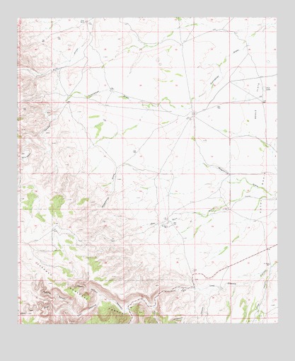
Red Bluff Draw, NM USGS Topographic Map
Click on map above to begin viewing in our Map Viewer.

This topographic map contains these locations and features:
Feature Name Type Latitude Longitude GNIS ID View Map
06685 Water WellWellN32.2976°W104.6441°931080View Map
07037 Water WellWellN32.2501°W104.6363°931086View Map
20096 Water WellWellN32.3371°W104.6613°931074View Map
20097 Water WellWellN32.2662°W104.6602°931088View Map
20141 Water WellWellN32.3418°W104.6286°931075View Map
Anderson CanyonValleyN32.2643°W104.6570°903156View Map
Baker Pen DrawValleyN32.2546°W104.7302°903506View Map
Bogle FlatsFlatN32.3407°W104.6358°903988View Map
Burleson WellLocaleN32.2896°W104.6780°904206View Map
Dunnaway CanyonValleyN32.3390°W104.7297°905903View Map
Four WellsPopulated PlaceN32.3732°W104.7172°906353View Map
Gilson CanyonValleyN32.2565°W104.6849°906552View Map
H Bar Y RanchLocaleN32.3351°W104.6661°906798View Map
J D WellLocaleN32.2968°W104.6488°907271View Map
Line Water Storage TankReservoirN32.2912°W104.7330°913370View Map
Natural BridgeArchN32.2533°W104.7194°2632196View Map
Red Bluff DrawValleyN32.3054°W104.6377°910039View Map
Roberts CanyonValleyN32.2565°W104.7252°910343View Map
Sitting Bull CanyonValleyN32.2559°W104.6977°911095View Map
Sitting Bull Communication FacilityLocaleN32.2651°W104.7080°1985888View Map
Tin Henry WellLocaleN32.2743°W104.6291°911719View Map
Trimble CanyonValleyN32.2724°W104.6290°911814View Map
Tule LakeLakeN32.3457°W104.6313°911637View Map
Tule LakeLakeN32.3458°W104.6316°913376View Map
Tule WellWellN32.3404°W104.6308°913377View Map
White Oaks CanyonValleyN32.2533°W104.7194°912314View Map
Wilson CanyonValleyN32.2615°W104.7097°912422View Map

Note: Coordinates in the location and feature list above are referenced to NAD83 datum.


Copyright (C) 2008-2025 Ryan Niemi / Sunset Dynamics ... All Rights Reserved