TopoQuest Logo
Do you find TopoQuest useful?
Help keep TopoQuest running and adding new maps/features by donating!
Bitcoin:  19c7KJd3qBynnjoSw5npx9KScwjBe4ifkT
Litecoin:  LXs6TkuXGGXo1vDsWCkWVdjQX94eUKd6ui
Home View Maps Find Maps Find Places Resources & Links


Thalmann, Georgia Topographic Map

USGS Map Title: Thalmann, GA
USGS Map MRC: 31081C6
DRG (GeoTIFF) Download: o31081c6.tif


Neighboring USGS Topographic Map Quads:


  Manningtown, GA  
31081D7
 

  Everett, GA  
31081D6
 

  Cox, GA  
31081D5
 

  Browntown, GA  
31081C7
 

  Thalmann, GA  
31081C6
 

  Sterling, GA  
31081C5
 

  Waynesville, GA  
31081B7
 

  Bladen, GA  
31081B6
 

  Brunswick West, GA  
31081B5


Map MRC Location:

N32°
W82°
N32°
W81°
H8 H7 H6 H5 H4 H3 H2 H1
G8 G7 G6 G5 G4 G3 G2 G1
F8 F7 F6 F5 F4 F3 F2 F1
E8 E7 E6 E5 E4 E3 E2 E1
D8 D7 D6 D5 D4 D3 D2 D1
C8 C7 C6 C5 C4 C3 C2 C1
B8 B7 B6 B5 B4 B3 B2 B1
A8 A7 A6 A5 A4 A3 A2 A1
N31°
W82°
N31°
W81°

Thalmann, GA USGS 1:24K Topographic Map Preview:
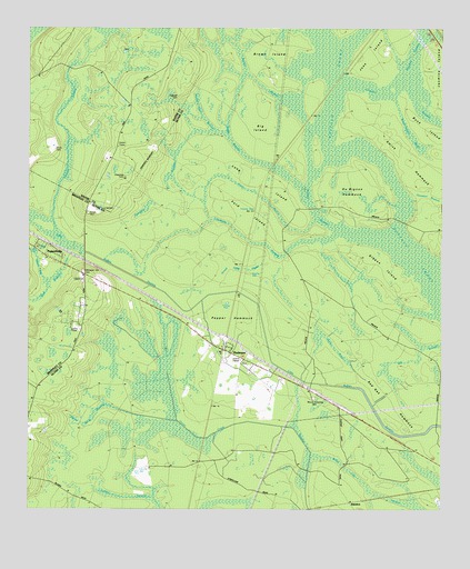
Thalmann, GA USGS Topographic Map
Click on map above to begin viewing in our Map Viewer.

This topographic map contains these locations and features:
Feature Name Type Latitude Longitude GNIS ID View Map
Akins PondReservoirN31.3102°W81.7232°341075View Map
Akins Pond DamDamN31.3102°W81.7232°341074View Map
Arnett CemeteryCemeteryN31.3272°W81.7321°310626View Map
Arnett Field DrainSwampN31.3129°W81.6823°310627View Map
Belle VistaPopulated PlaceN31.3577°W81.7373°326178View Map
Big IslandIslandN31.3494°W81.6787°311393View Map
Blount Crossing CemeteryCemeteryN31.2791°W81.6634°311536View Map
Blunt (historical)Populated PlaceN31.2811°W81.6646°334670View Map
Boggy BranchSwampN31.3458°W81.6884°311612View Map
Brown BranchSwampN31.3611°W81.6798°311855View Map
Brown IslandIslandN31.3697°W81.6765°311871View Map
Buck IslandIslandN31.3480°W81.6265°311968View Map
Buck Island DrainSwampN31.3472°W81.6343°311969View Map
Burnt BaySwampN31.3133°W81.7471°312062View Map
Burnt Scrub SwampSwampN31.2744°W81.7298°312070View Map
Chapman CemeteryCemeteryN31.3366°W81.7209°312566View Map
Crum CemeteryCemeteryN31.3436°W81.7421°313192View Map
DuBignon HammockIslandN31.3327°W81.6523°313690View Map
Fishhole SwampSwampN31.3189°W81.6797°314149View Map
Ford (historical)Populated PlaceN31.3274°W81.6815°334674View Map
Ford SwampSwampN31.3258°W81.6818°314258View Map
Gibson IslandIslandN31.3130°W81.6432°314581View Map
Glynn Missionary ChurchChurchN31.2924°W81.6912°1671516View Map
Gum PondSwampN31.2928°W81.6587°314975View Map
Hopewell Baptist ChurchChurchN31.3691°W81.7071°315641View Map
Hopewell School (historical)SchoolN31.3686°W81.7076°334750View Map
JamaicaPopulated PlaceN31.2519°W81.6523°332087View Map
Jasmine IslandIslandN31.3658°W81.6276°316055View Map
Jenks (historical)Populated PlaceN31.3266°W81.6873°1671539View Map
Joes IslandIslandN31.3694°W81.6434°316127View Map
Leicht (historical)Populated PlaceN31.2649°W81.6318°334675View Map
Liberty ChurchChurchN31.2994°W81.7329°1671548View Map
Long IslandIslandN31.3355°W81.6798°317361View Map
Lotts (historical)Populated PlaceN31.3141°W81.7329°334676View Map
Maple BranchStreamN31.3255°W81.6634°317669View Map
Martin StrandSwampN31.3696°W81.6532°317749View Map
Meadow SwampSwampN31.3674°W81.6343°317981View Map
Pepper HammockIslandN31.2999°W81.6884°320376View Map
Popwell CemeteryCemeteryN31.3572°W81.7046°321060View Map
PopwellvillePopulated PlaceN31.3161°W81.7451°321061View Map
Powder Horn BranchSwampN31.3519°W81.6968°321106View Map
Pumpkin SwampSwampN31.3352°W81.7079°321230View Map
Red Oak HammockIslandN31.2797°W81.6421°321405View Map
Smith HammockIslandN31.3344°W81.6284°323137View Map
Sumlin SwampSwampN31.3280°W81.6640°323735View Map
Tenmile SwampStreamN31.3227°W81.7412°323999View Map
ThalmannPopulated PlaceN31.2908°W81.6887°333211View Map
Trinity ChurchChurchN31.2811°W81.7471°324304View Map
Turkey SwampSwampN31.2529°W81.7149°324398View Map
Well BranchStreamN31.3177°W81.7373°324990View Map
Whitaker Hill CemeteryCemeteryN31.3122°W81.7332°325135View Map
White Oak SwampSwampN31.2568°W81.6481°325182View Map

Note: Coordinates in the location and feature list above are referenced to NAD83 datum.


Copyright (C) 2008-2024 Ryan Niemi / Sunset Dynamics ... All Rights Reserved