TopoQuest Logo
Do you find TopoQuest useful?
Help keep TopoQuest running and adding new maps/features by donating!
Bitcoin:  19c7KJd3qBynnjoSw5npx9KScwjBe4ifkT
Litecoin:  LXs6TkuXGGXo1vDsWCkWVdjQX94eUKd6ui
Home View Maps Find Maps Find Places Resources & Links


Everett, Georgia Topographic Map

USGS Map Title: Everett, GA
USGS Map MRC: 31081D6
DRG (GeoTIFF) Download: o31081d6.tif


Neighboring USGS Topographic Map Quads:


  Jesup East, GA  
31081E7
 

  Bug Island, GA  
31081E6
 

  Townsend, GA  
31081E5
 

  Manningtown, GA  
31081D7
 

  Everett, GA  
31081D6
 

  Cox, GA  
31081D5
 

  Browntown, GA  
31081C7
 

  Thalmann, GA  
31081C6
 

  Sterling, GA  
31081C5


Map MRC Location:

N32°
W82°
N32°
W81°
H8 H7 H6 H5 H4 H3 H2 H1
G8 G7 G6 G5 G4 G3 G2 G1
F8 F7 F6 F5 F4 F3 F2 F1
E8 E7 E6 E5 E4 E3 E2 E1
D8 D7 D6 D5 D4 D3 D2 D1
C8 C7 C6 C5 C4 C3 C2 C1
B8 B7 B6 B5 B4 B3 B2 B1
A8 A7 A6 A5 A4 A3 A2 A1
N31°
W82°
N31°
W81°

Everett, GA USGS 1:24K Topographic Map Preview:
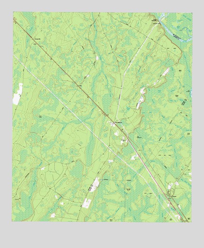
Everett, GA USGS Topographic Map
Click on map above to begin viewing in our Map Viewer.

This topographic map contains these locations and features:
Feature Name Type Latitude Longitude GNIS ID View Map
AkinPopulated PlaceN31.4561°W81.7043°331004View Map
Akin ChurchChurchN31.4366°W81.6779°310416View Map
Aleck IslandIslandN31.4788°W81.6393°310430View Map
Aleck Island BranchStreamN31.4719°W81.6409°334748View Map
Barker LakeLakeN31.4910°W81.6365°310799View Map
Bear IslandIslandN31.3966°W81.6384°310946View Map
Bear Island SwampSwampN31.3983°W81.6273°310947View Map
Blue RidgeRidgeN31.4394°W81.6298°311552View Map
Briar IslandIslandN31.3933°W81.6565°311769View Map
Bridge BranchStreamN31.4294°W81.6298°311783View Map
Buck IslandIslandN31.4383°W81.7329°311966View Map
Buck Pond (historical)LakeN31.4433°W81.6393°334749View Map
Bull BranchStreamN31.4738°W81.6884°312011View Map
Bull Island School (historical)SchoolN31.4041°W81.6304°334672View Map
Buzzards Roost BranchStreamN31.4874°W81.6437°312124View Map
Campbell LakeLakeN31.4942°W81.6349°312268View Map
Canal BranchSwampN31.4469°W81.6322°312277View Map
County Line SwampSwampN31.4098°W81.6557°313040View Map
Creels LakeLakeN31.4669°W81.6276°313103View Map
Deep BranchSwampN31.4547°W81.6460°313406View Map
EverettPopulated PlaceN31.3905°W81.6387°355733View Map
Everett ChurchChurchN31.3916°W81.6407°1671495View Map
Gardi SwampSwampN31.4892°W81.7396°314514View Map
GrangervilleLocaleN31.4838°W81.7362°356074View Map
Johns BaySwampN31.4402°W81.6559°316139View Map
Layway SwampSwampN31.4065°W81.6393°316707View Map
Log LandingLocaleN31.4538°W81.6259°332258View Map
Lower SansavillaPopulated PlaceN31.4955°W81.6487°332275View Map
Lyles Old FieldFlatN31.4149°W81.6429°317498View Map
Mason Cowpen BranchStreamN31.4827°W81.6926°317774View Map
Mays BaySwampN31.4530°W81.6468°317823View Map
Mount PleasantPopulated PlaceN31.4341°W81.6793°332435View Map
Mount Pleasant CemeteryCemeteryN31.4252°W81.6726°318819View Map
Pigeon BranchSwampN31.3802°W81.6779°320506View Map
Pigeonroost CreekStreamN31.4652°W81.6876°320509View Map
Piney BaySwampN31.4427°W81.6693°320691View Map
Red Oak IslandIslandN31.3949°W81.6682°321406View Map
Rozier BranchStreamN31.4558°W81.6565°321982View Map
Sallons IslandIslandN31.4508°W81.6346°322375View Map
Saltons BranchSwampN31.4541°W81.6362°322385View Map
Sandhill BaySwampN31.4169°W81.6579°322446View Map
Sansavilla BluffCliffN31.4941°W81.6471°322505View Map
Smith BranchStreamN31.4555°W81.6251°323095View Map
Smith IslandIslandN31.4647°W81.6329°323139View Map
Smith LakeLakeN31.4863°W81.6263°323140View Map
Tob HammockIslandN31.4258°W81.6634°324201View Map
Wayne County Fire Department Mount Pleasant StationBuildingN31.4330°W81.6805°2604788View Map

Note: Coordinates in the location and feature list above are referenced to NAD83 datum.


Copyright (C) 2008-2025 Ryan Niemi / Sunset Dynamics ... All Rights Reserved