TopoQuest Logo
Do you find TopoQuest useful?
Help keep TopoQuest running and adding new maps/features by donating!
Bitcoin:  19c7KJd3qBynnjoSw5npx9KScwjBe4ifkT
Litecoin:  LXs6TkuXGGXo1vDsWCkWVdjQX94eUKd6ui
Home View Maps Find Maps Find Places Resources & Links


Lenoxville, Pennsylvania Topographic Map

USGS Map Title: Lenoxville, PA
USGS Map MRC: 41075F6
DRG (GeoTIFF) Download: o41075f6.tif


Neighboring USGS Topographic Map Quads:


  Montrose East, PA  
41075G7
 

  Harford, PA  
41075G6
 

  Thompson, PA  
41075G5
 

  Hop Bottom, PA  
41075F7
 

  Lenoxville, PA  
41075F6
 

  Clifford, PA  
41075F5
 

  Factoryville, PA  
41075E7
 

  Dalton, PA  
41075E6
 

  Carbondale, PA  
41075E5


Map MRC Location:

N42°
W76°
N42°
W75°
H8 H7 H6 H5 H4 H3 H2 H1
G8 G7 G6 G5 G4 G3 G2 G1
F8 F7 F6 F5 F4 F3 F2 F1
E8 E7 E6 E5 E4 E3 E2 E1
D8 D7 D6 D5 D4 D3 D2 D1
C8 C7 C6 C5 C4 C3 C2 C1
B8 B7 B6 B5 B4 B3 B2 B1
A8 A7 A6 A5 A4 A3 A2 A1
N41°
W76°
N41°
W75°

Lenoxville, PA USGS 1:24K Topographic Map Preview:
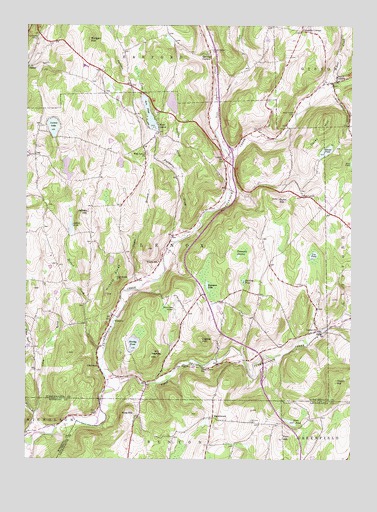
Lenoxville, PA USGS Topographic Map
Click on map above to begin viewing in our Map Viewer.

This topographic map contains these locations and features:
Feature Name Type Latitude Longitude GNIS ID View Map
Acre PondLakeN41.7249°W75.7027°1168054View Map
Acre Pond DamDamN41.7167°W75.6996°1195747View Map
Bear Swamp CreekStreamN41.7331°W75.6321°1168952View Map
Bell CreekStreamN41.7334°W75.6335°1169146View Map
Butler CreekStreamN41.7287°W75.6760°1170794View Map
Carey HillSummitN41.7223°W75.6352°1171204View Map
Cobble HillSummitN41.6595°W75.6819°1172095View Map
Columbia CornersLocaleN41.7484°W75.6441°1172244View Map
East Branch Tunkhannock CreekStreamN41.6440°W75.7185°1173778View Map
East LenoxPopulated PlaceN41.7006°W75.6435°1203477View Map
Finn HillSummitN41.6315°W75.6510°1174767View Map
Finn PondLakeN41.6359°W75.6475°1174769View Map
GlenwoodPopulated PlaceN41.6517°W75.7199°1175739View Map
Green Grove SchoolSchoolN41.6515°W75.6816°1176070View Map
Gunn HillSummitN41.7004°W75.6532°1176320View Map
Harding CemeteryCemeteryN41.6362°W75.6630°1176508View Map
Harding CornersLocaleN41.7417°W75.6791°1176509View Map
Harding PondLakeN41.6764°W75.6661°1176511View Map
Hartley HillSummitN41.6562°W75.7002°1176607View Map
Hartley PondLakeN41.6584°W75.7082°1176608View Map
Hickory RidgeRidgeN41.6754°W75.7174°1176971View Map
Horton LakeReservoirN41.7278°W75.6939°1195754View Map
Horton Lake DamDamN41.7251°W75.6930°1195755View Map
Jeffers HillSummitN41.6965°W75.7263°1178005View Map
Jeffers PondReservoirN41.6921°W75.7324°1178006View Map
Jeffers Pond DamDamN41.7401°W75.7330°1195771View Map
LenoxPopulated PlaceN41.7117°W75.6730°1179200View Map
LenoxvillePopulated PlaceN41.6623°W75.6371°1179201View Map
Loomis LakeLakeN41.7208°W75.7395°1179937View Map
Maplewood CemeteryCemeteryN41.7462°W75.7463°1180378View Map
MarshbrookPopulated PlaceN41.6373°W75.6774°1204106View Map
Millard CreekStreamN41.6570°W75.7191°1181198View Map
Morgan HillSummitN41.7459°W75.7255°1181549View Map
Nine Partners CreekStreamN41.7120°W75.6707°1182461View Map
Oak KnobSummitN41.6776°W75.7149°1182781View Map
Partners CreekStreamN41.6895°W75.6874°1183350View Map
Pine HillSummitN41.6376°W75.7102°1183832View Map
Pratt HollowValleyN41.6386°W75.7459°1184385View Map
Robinson LakeLakeN41.6751°W75.6801°1185227View Map
Round PondLakeN41.7139°W75.6347°1185536View Map
South GibsonPopulated PlaceN41.7342°W75.6302°1188069View Map
South Gibson CemeteryCemeteryN41.7251°W75.6463°1188070View Map
South Gibson Post OfficePost OfficeN41.7339°W75.6312°2780030View Map
South Harford CemeteryCemeteryN41.7428°W75.6788°1188075View Map
Sterling BrookStreamN41.7073°W75.6896°1199616View Map
Tamarack SwampSwampN41.6850°W75.6669°1189249View Map
Tea PondLakeN41.6838°W75.6393°1189328View Map
Thorn HillSummitN41.6476°W75.6299°1189523View Map
Tower BranchStreamN41.6759°W75.7049°1189677View Map
Township of LenoxCivilN41.6836°W75.7027°1217091View Map
West LenoxPopulated PlaceN41.7209°W75.6991°1191059View Map
West Lenox ChurchChurchN41.7134°W75.7044°1191060View Map
Willow BrookStreamN41.6376°W75.7449°1191497View Map
Wright SchoolSchoolN41.6817°W75.6988°1191807View Map

Note: Coordinates in the location and feature list above are referenced to NAD83 datum.


Copyright (C) 2008-2024 Ryan Niemi / Sunset Dynamics ... All Rights Reserved