TopoQuest Logo
Do you find TopoQuest useful?
Help keep TopoQuest running and adding new maps/features by donating!
Bitcoin:  19c7KJd3qBynnjoSw5npx9KScwjBe4ifkT
Litecoin:  LXs6TkuXGGXo1vDsWCkWVdjQX94eUKd6ui
Home View Maps Find Maps Find Places Resources & Links


Clifford, Pennsylvania Topographic Map

USGS Map Title: Clifford, PA
USGS Map MRC: 41075F5
DRG (GeoTIFF) Download: o41075f5.tif


Neighboring USGS Topographic Map Quads:


  Harford, PA  
41075G6
 

  Thompson, PA  
41075G5
 

  Orson, PA  
41075G4
 

  Lenoxville, PA  
41075F6
 

  Clifford, PA  
41075F5
 

  Forest City, PA  
41075F4
 

  Dalton, PA  
41075E6
 

  Carbondale, PA  
41075E5
 

  Waymart, PA  
41075E4


Map MRC Location:

N42°
W76°
N42°
W75°
H8 H7 H6 H5 H4 H3 H2 H1
G8 G7 G6 G5 G4 G3 G2 G1
F8 F7 F6 F5 F4 F3 F2 F1
E8 E7 E6 E5 E4 E3 E2 E1
D8 D7 D6 D5 D4 D3 D2 D1
C8 C7 C6 C5 C4 C3 C2 C1
B8 B7 B6 B5 B4 B3 B2 B1
A8 A7 A6 A5 A4 A3 A2 A1
N41°
W76°
N41°
W75°

Clifford, PA USGS 1:24K Topographic Map Preview:
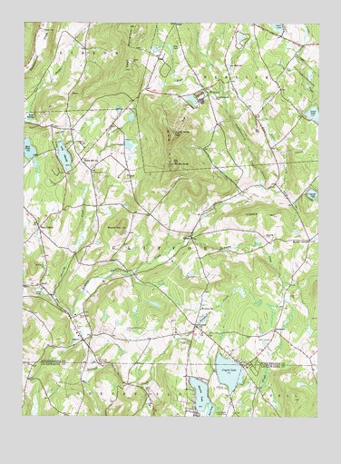
Clifford, PA USGS Topographic Map
Click on map above to begin viewing in our Map Viewer.

This topographic map contains these locations and features:
Feature Name Type Latitude Longitude GNIS ID View Map
Bear SwampSwampN41.7206°W75.6220°1168949View Map
BirchtownPopulated PlaceN41.6526°W75.5180°1203100View Map
Burdick CemeteryCemeteryN41.6829°W75.5216°1170702View Map
Burdick CornersLocaleN41.6809°W75.5032°1170704View Map
Carbondale-Clifford Airport (historical)AirportN41.6542°W75.5788°1194269View Map
CliffordPopulated PlaceN41.6490°W75.5988°1171999View Map
Clifford CemeteryCemeteryN41.6545°W75.6021°1172000View Map
Clifford Post OfficePost OfficeN41.6508°W75.5999°2773099View Map
Clifford Township Volunteer Fire CompanyBuildingN41.6419°W75.5932°2653592View Map
Cosklos Elkview AirportAirportN41.6276°W75.5373°1194265View Map
Coterell LakeLakeN41.6958°W75.5021°1172483View Map
Coterell Lake DamDamN41.6967°W75.5046°1214118View Map
Crystal LakeReservoirN41.6392°W75.5371°1172800View Map
DundaffPopulated PlaceN41.6540°W75.5516°1173602View Map
Dundaff CemeteryCemeteryN41.6487°W75.5544°1173603View Map
Dundaff CreekStreamN41.6570°W75.6041°1173604View Map
East MountainSummitN41.7490°W75.5774°1173848View Map
Elk HillSummitN41.7106°W75.5627°1174113View Map
Elk Hill Fire TowerTowerN41.7151°W75.5607°1212965View Map
Elk Mountain Ski CenterLocaleN41.7201°W75.5571°1205842View Map
ElkdalePopulated PlaceN41.6817°W75.5532°1203506View Map
Elkview Country ClubLocaleN41.6345°W75.5421°1213197View Map
Idlewild CreekStreamN41.6634°W75.6130°1177685View Map
Lake IdlewildLakeN41.7076°W75.6076°1177686View Map
Lewis LakeReservoirN41.7210°W75.5013°1179239View Map
Little CreekStreamN41.6954°W75.5249°1179516View Map
Lyon Street CemeteryCemeteryN41.7357°W75.5383°1180141View Map
Lyons Street ChurchChurchN41.7265°W75.5344°1180142View Map
Manzar CemeteryCemeteryN41.7476°W75.6171°1180312View Map
Mud PondLakeN41.6309°W75.5482°1192988View Map
Mud PondLakeN41.7097°W75.6226°1192989View Map
Newton LakeLakeN41.6320°W75.5491°1182417View Map
North KnobSummitN41.7154°W75.5605°1182603View Map
PalmaLocaleN41.7326°W75.6174°1212967View Map
Ross DamDamN41.7384°W75.5613°1195769View Map
Ross LakeReservoirN41.7384°W75.5613°1195768View Map
Round HillSummitN41.6851°W75.5830°1185519View Map
RoyalPopulated PlaceN41.6670°W75.6174°1185589View Map
Saint Johns ChurchChurchN41.6592°W75.5494°1186166View Map
South KnobSummitN41.7051°W75.5607°1188085View Map
Tinker CreekStreamN41.6826°W75.5532°1189583View Map
Tinker HillSummitN41.6887°W75.5288°1189584View Map
Tinker HollowValleyN41.6965°W75.5154°1189585View Map
Township of CliffordCivilN41.6772°W75.5558°1217080View Map
Township of HerrickCivilN41.7437°W75.5221°1217087View Map
Welch Hill ChurchChurchN41.7059°W75.5994°1190797View Map
West CliffordPopulated PlaceN41.6848°W75.6182°1190944View Map
Willow View CemeteryCemeteryN41.6565°W75.6010°1191513View Map

Note: Coordinates in the location and feature list above are referenced to NAD83 datum.


Copyright (C) 2008-2024 Ryan Niemi / Sunset Dynamics ... All Rights Reserved