TopoQuest Logo
Do you find TopoQuest useful?
Help keep TopoQuest running and adding new maps/features by donating!
Bitcoin:  19c7KJd3qBynnjoSw5npx9KScwjBe4ifkT
Litecoin:  LXs6TkuXGGXo1vDsWCkWVdjQX94eUKd6ui
Home View Maps Find Maps Find Places Resources & Links


Almont, Michigan Topographic Map

USGS Map Title: Almont, MI
USGS Map MRC: 42083H1
DRG (GeoTIFF) Download: o42083h1.tif


Neighboring USGS Topographic Map Quads:


  Attica, MI  
43083A2
 

  Imlay City, MI  
43083A1
 

  Capac, MI  
43082A8
 

  Thornville, MI  
42083H2
 

  Almont, MI  
42083H1
 

  Allenton, MI  
42082H8
 

  Lake Orion, MI  
42083G2
 

  Romeo, MI  
42083G1
 

  Armada, MI  
42082G8


Map MRC Location:

N43°
W84°
N43°
W83°
H8 H7 H6 H5 H4 H3 H2 H1
G8 G7 G6 G5 G4 G3 G2 G1
F8 F7 F6 F5 F4 F3 F2 F1
E8 E7 E6 E5 E4 E3 E2 E1
D8 D7 D6 D5 D4 D3 D2 D1
C8 C7 C6 C5 C4 C3 C2 C1
B8 B7 B6 B5 B4 B3 B2 B1
A8 A7 A6 A5 A4 A3 A2 A1
N42°
W84°
N42°
W83°

Almont, MI USGS 1:24K Topographic Map Preview:
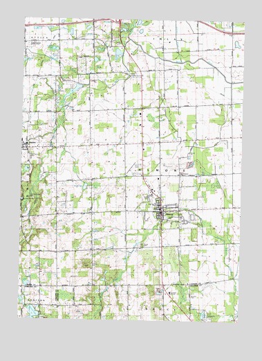
Almont, MI USGS Topographic Map
Click on map above to begin viewing in our Map Viewer.

This topographic map contains these locations and features:
Feature Name Type Latitude Longitude GNIS ID View Map
AlmontPopulated PlaceN42.9206°W83.0449°620014View Map
Almont Airport (historical)AirportN42.9398°W83.0619°1623774View Map
Almont Community ParkParkN42.9169°W83.0417°2575832View Map
Almont Elementary SchoolSchoolN42.9236°W83.0483°2575789View Map
Almont Fire DepartmentBuildingN42.9357°W83.0466°2620045View Map
Almont High SchoolSchoolN42.9300°W83.0450°2575790View Map
Almont Middle SchoolSchoolN42.9319°W83.0358°2575787View Map
Almont Police DepartmentBuildingN42.9282°W83.0467°2575783View Map
Almont Post OfficePost OfficeN42.9211°W83.0450°2575784View Map
Almont Vineyard ChurchChurchN42.9214°W83.0319°2575781View Map
Bethany Mennonite CemeteryCemeteryN42.9900°W83.1197°2575821View Map
Brinker DrainStreamN42.9981°W83.0638°622002View Map
Camp SkylineLocaleN42.8981°W83.0891°622634View Map
Community Park Church of GodChurchN42.9898°W83.1208°1625050View Map
Corneil DrainCanalN42.9992°W83.0394°623838View Map
Currier House Historical MarkerParkN42.9208°W83.0422°2571251View Map
DrydenPopulated PlaceN42.9461°W83.1238°624906View Map
Dryden Depot Historical MarkerParkN42.9458°W83.1219°2571266View Map
Dryden Elementary SchoolSchoolN42.9494°W83.1247°2575744View Map
Dryden Post OfficePost OfficeN42.9464°W83.1222°2575742View Map
Dryden Township Fire Department Station 1BuildingN42.9457°W83.1245°2575743View Map
Ferguson CemeteryCemeteryN42.9364°W83.0341°625903View Map
First Baptist ChurchChurchN42.9286°W83.0514°2575782View Map
First Baptist ChurchChurchN42.9284°W83.0519°1618797View Map
First Congregational ChurchChurchN42.9208°W83.0436°2575779View Map
General Squier Memorial ParkParkN42.9264°W83.1235°1618799View Map
Goodrich CemeteryCemeteryN42.8853°W83.0272°626949View Map
Heather Hills Golf CourseLocaleN42.8784°W83.0908°1618798View Map
Heenan DrainCanalN42.9950°W83.1008°628047View Map
Henry Stephens Memorial LibraryBuildingN42.9208°W83.0467°2575785View Map
Henry Stephens Memorial Library Historical MarkerParkN42.9204°W83.0472°2571252View Map
Hough CemeteryCemeteryN42.9061°W83.0552°628656View Map
Interchange 168CrossingN42.9994°W83.0708°2575826View Map
Kingsbrook Mobile Home EstatesPopulated PlaceN42.9278°W83.0506°2575786View Map
Light of Christ Community ChurchChurchN42.9872°W83.1244°2575673View Map
McNally LakeLakeN42.9874°W83.1069°632006View Map
Mexican Calvary Church (historical)ChurchN42.9997°W83.0724°1618804View Map
Mount Pleasant CemeteryCemeteryN42.9434°W83.1199°632837View Map
Mud LakeLakeN42.9830°W83.0840°632952View Map
North Branch Belle RiverStreamN42.9920°W83.0658°633490View Map
O'Neil LakeLakeN42.9878°W83.0824°633801View Map
Omans HeliportAirportN42.9189°W83.0616°1623775View Map
Orchard Primary SchoolSchoolN42.9306°W83.0358°2575788View Map
Pickerel PondLakeN42.9956°W83.0687°634802View Map
Potter's House Christian ChurchChurchN42.9208°W83.0425°2575780View Map
Saint Joseph HospitalHospitalN42.8867°W83.0402°1618800View Map
Sand Hill CemeteryCemeteryN42.8978°W83.0836°2575819View Map
Secord LakeLakeN42.8769°W83.1166°637532View Map
Township of AlmontCivilN42.9349°W83.0451°1625830View Map
Village of AlmontCivilN42.9206°W83.0430°2397941View Map
Village of DrydenCivilN42.9456°W83.1240°2398749View Map
Webster CemeteryCemeteryN42.9778°W83.0616°1615948View Map
West LakeLakeN42.9304°W83.0885°1616134View Map
Weston DrainCanalN42.9811°W83.1035°1616222View Map
Young LakeLakeN42.9824°W83.1248°1616903View Map

Note: Coordinates in the location and feature list above are referenced to NAD83 datum.


Copyright (C) 2008-2024 Ryan Niemi / Sunset Dynamics ... All Rights Reserved