TopoQuest Logo
Do you find TopoQuest useful?
Help keep TopoQuest running and adding new maps/features by donating!
Bitcoin:  19c7KJd3qBynnjoSw5npx9KScwjBe4ifkT
Litecoin:  LXs6TkuXGGXo1vDsWCkWVdjQX94eUKd6ui
Home View Maps Find Maps Find Places Resources & Links


Thurston Peaks, California Topographic Map

USGS Map Title: Thurston Peaks, CA
USGS Map MRC: 40123H2
DRG (GeoTIFF) Download: o40123h2.tif


Neighboring USGS Topographic Map Quads:


  Dees Peak, CA  
41123A3
 

  Cecil Lake, CA  
41123A2
 

  Thompson Peak, CA  
41123A1
 

  Jim Jam Ridge, CA  
40123H3
 

  Thurston Peaks, CA  
40123H2
 

  Mount Hilton, CA  
40123H1
 

  Del Loma, CA  
40123G3
 

  Helena, CA  
40123G2
 

  Dedrick, CA  
40123G1


Map MRC Location:

N41°
W124°
N41°
W123°
H8 H7 H6 H5 H4 H3 H2 H1
G8 G7 G6 G5 G4 G3 G2 G1
F8 F7 F6 F5 F4 F3 F2 F1
E8 E7 E6 E5 E4 E3 E2 E1
D8 D7 D6 D5 D4 D3 D2 D1
C8 C7 C6 C5 C4 C3 C2 C1
B8 B7 B6 B5 B4 B3 B2 B1
A8 A7 A6 A5 A4 A3 A2 A1
N40°
W124°
N40°
W123°

Thurston Peaks, CA USGS 1:24K Topographic Map Preview:
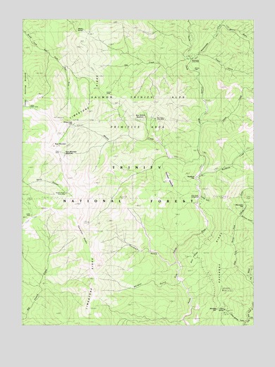
Thurston Peaks, CA USGS Topographic Map
Click on map above to begin viewing in our Map Viewer.

This topographic map contains these locations and features:
Feature Name Type Latitude Longitude GNIS ID View Map
Backbone CreekStreamN40.9357°W123.1550°218500View Map
Backbone RidgeRidgeN40.8938°W123.1514°218501View Map
Backbone Ridge LookoutLocaleN40.8896°W123.1425°218502View Map
Bear Wallow CampLocaleN40.9587°W123.1814°218902View Map
Bear Wallow MeadowsAreaN40.9632°W123.1834°218907View Map
Blue RidgeRidgeN40.9046°W123.1503°219514View Map
China CreekStreamN40.9574°W123.1542°221024View Map
China SpringsSpringN40.8804°W123.1436°221061View Map
China Springs GulchValleyN40.8765°W123.1303°221062View Map
East Branch East Fork North Fork Trinity RiverStreamN40.8926°W123.1270°222852View Map
French GulchValleyN40.9857°W123.1525°223910View Map
Gas CreekStreamN40.9843°W123.1623°224086View Map
Hangers Roost Camp (historical)LocaleN40.9285°W123.2275°1665360View Map
Hobo GulchValleyN40.9279°W123.1542°1665367View Map
Hobo Gulch CampgroundLocaleN40.9254°W123.1539°225378View Map
Hunters CampLocaleN40.9696°W123.2064°225792View Map
Jakes Upper CampLocaleN40.9643°W123.2478°226117View Map
Keystone FlatFlatN40.9357°W123.1550°226558View Map
Keystone MeadowsAreaN40.9304°W123.1664°226559View Map
Ladder CampLocaleN40.9199°W123.2459°1665379View Map
Limestone RidgeRidgeN40.9268°W123.2184°227115View Map
Manzanita FlatFlatN40.9232°W123.1306°228039View Map
Marble SpringsSpringN40.9965°W123.2175°228073View Map
Martin GulchValleyN40.9974°W123.1414°228173View Map
Noonan GulchValleyN40.9193°W123.1323°229576View Map
Norway GulchValleyN40.8924°W123.1664°229788View Map
Pony CampLocaleN40.9468°W123.2287°230921View Map
Pony MountainSummitN40.9482°W123.2342°230923View Map
Pony Mountain MeadowsAreaN40.9454°W123.2292°1665406View Map
Rattlesnake CampLocaleN40.9826°W123.1598°231249View Map
Rattlesnake CreekStreamN40.9840°W123.1595°231261View Map
Stoveleg GapGapN40.8813°W123.1461°235561View Map
Strunce CabinLocaleN40.9793°W123.1578°235608View Map
Thurston GulchValleyN40.9004°W123.1681°236334View Map
Thurston PeaksSummitN40.9121°W123.2153°236336View Map
Todd CabinLocaleN40.8868°W123.1250°268313View Map
Whites CreekStreamN40.9446°W123.1548°237692View Map
Whites Creek LakeLakeN40.9568°W123.2236°237693View Map
Yellow Jacket CreekStreamN40.8779°W123.1286°238244View Map

Note: Coordinates in the location and feature list above are referenced to NAD83 datum.


Copyright (C) 2008-2025 Ryan Niemi / Sunset Dynamics ... All Rights Reserved