TopoQuest Logo
Do you find TopoQuest useful?
Help keep TopoQuest running and adding new maps/features by donating!
Bitcoin:  19c7KJd3qBynnjoSw5npx9KScwjBe4ifkT
Litecoin:  LXs6TkuXGGXo1vDsWCkWVdjQX94eUKd6ui
Home View Maps Find Maps Find Places Resources & Links


Dedrick, California Topographic Map

USGS Map Title: Dedrick, CA
USGS Map MRC: 40123G1
DRG (GeoTIFF) Download: o40123g1.tif


Neighboring USGS Topographic Map Quads:


  Thurston Peaks, CA  
40123H2
 

  Mount Hilton, CA  
40123H1
 

  Siligo Peak, CA  
40122H8
 

  Helena, CA  
40123G2
 

  Dedrick, CA  
40123G1
 

  Rush Creek Lakes, CA  
40122G8
 

  Hayfork Bally, CA  
40123F2
 

  Junction City, CA  
40123F1
 

  Weaverville, CA  
40122F8


Map MRC Location:

N41°
W124°
N41°
W123°
H8 H7 H6 H5 H4 H3 H2 H1
G8 G7 G6 G5 G4 G3 G2 G1
F8 F7 F6 F5 F4 F3 F2 F1
E8 E7 E6 E5 E4 E3 E2 E1
D8 D7 D6 D5 D4 D3 D2 D1
C8 C7 C6 C5 C4 C3 C2 C1
B8 B7 B6 B5 B4 B3 B2 B1
A8 A7 A6 A5 A4 A3 A2 A1
N40°
W124°
N40°
W123°

Dedrick, CA USGS 1:24K Topographic Map Preview:
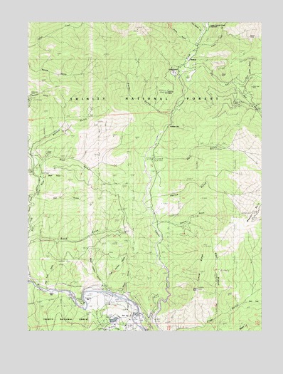
Dedrick, CA USGS Topographic Map
Click on map above to begin viewing in our Map Viewer.

This topographic map contains these locations and features:
Feature Name Type Latitude Longitude GNIS ID View Map
Barney GulchValleyN40.8257°W123.1231°256540View Map
Bear GulchValleyN40.8485°W123.0148°256671View Map
Big East Fork Canyon CreekStreamN40.8549°W123.0436°256921View Map
Brock GulchValleyN40.7882°W123.1242°257469View Map
Canyon CityLocaleN40.8315°W123.0528°257940View Map
Conner CreekStreamN40.7529°W123.0689°258646View Map
Conrad GulchValleyN40.7946°W123.0559°258647View Map
Coopers BarBarN40.7643°W123.0961°258694View Map
DedrickPopulated PlaceN40.8626°W123.0367°1655959View Map
Dedrick LookoutLocaleN40.8465°W123.0523°259175View Map
Dedrick PointSummitN40.8463°W123.0523°1665338View Map
East Fork Clear GulchValleyN40.7618°W123.0092°259725View Map
East Valdor GulchValleyN40.7701°W123.0839°259773View Map
Ellen GulchValleyN40.8535°W123.0073°1665343View Map
Ellen MineMineN40.8599°W123.0048°1665344View Map
Enterprise MineMineN40.8465°W123.1228°259949View Map
Fisher GulchValleyN40.8374°W123.0509°260163View Map
Fox GulchValleyN40.8038°W123.1214°260327View Map
Grasshopper FlatFlatN40.8560°W123.0489°260797View Map
Gwin GulchValleyN40.8207°W123.0561°260997View Map
HelenaLocaleN40.7649°W123.1014°276936View Map
Idaho BarBarN40.7663°W123.1136°261682View Map
Jones GulchValleyN40.8665°W123.0381°262002View Map
Junction City Fire Protection District Station 2BuildingN40.7572°W123.0847°2622217View Map
Little BallySummitN40.7676°W123.0361°262518View Map
Little East Fork Canyon CreekStreamN40.8660°W123.0359°262596View Map
Lone Jack MineMineN40.8457°W123.1245°262798View Map
Lower Canyon Creek MeadowsFlatN40.8740°W123.0339°263008View Map
Maple MineMineN40.8540°W123.0134°263179View Map
Mason and Thayer MineMineN40.8424°W123.0167°263255View Map
McCartneys PondLakeN40.7557°W123.0676°1665393View Map
McGillivrays Ranch (historical)LocaleN40.7624°W123.0923°1683050View Map
Noonan GulchValleyN40.8457°W123.1245°264114View Map
Ozark MineMineN40.8229°W123.1153°264429View Map
Pear Tree GulchValleyN40.7679°W123.1159°264595View Map
Ralston GroupMineN40.8688°W123.0081°265155View Map
Rarick GulchValleyN40.8043°W123.0595°265187View Map
Red HillSummitN40.7560°W123.0739°1665410View Map
Red Hill MineMineN40.7563°W123.0770°265281View Map
Rich GulchValleyN40.8188°W123.1170°265403View Map
Silver Grey MineMineN40.8490°W123.0053°266188View Map
Store GulchValleyN40.8140°W123.1167°267794View Map
Tunnel RidgeRidgeN40.7765°W123.0331°268480View Map
Weaver Bally LookoutLocaleN40.7974°W123.0039°276947View Map
West Branch Clear GulchValleyN40.7582°W123.0234°268864View Map
West Valdor GulchValleyN40.7696°W123.0856°268936View Map
Wheel GulchValleyN40.7657°W123.0750°268955View Map

Note: Coordinates in the location and feature list above are referenced to NAD83 datum.


Copyright (C) 2008-2025 Ryan Niemi / Sunset Dynamics ... All Rights Reserved