TopoQuest Logo
Do you find TopoQuest useful?
Help keep TopoQuest running and adding new maps/features by donating!
Bitcoin:  19c7KJd3qBynnjoSw5npx9KScwjBe4ifkT
Litecoin:  LXs6TkuXGGXo1vDsWCkWVdjQX94eUKd6ui
Home View Maps Find Maps Find Places Resources & Links


Tilly, Arkansas Topographic Map

USGS Map Title: Tilly, AR
USGS Map MRC: 35092F7
DRG (GeoTIFF) Download: o35092f7.tif


Neighboring USGS Topographic Map Quads:


  Moore, AR  
35092G8
 

  Witts Springs, AR  
35092G7
 

  Canaan, AR  
35092G6
 

  Smyrna, AR  
35092F8
 

  Tilly, AR  
35092F7
 

  Alread, AR  
35092F6
 

  Solo, AR  
35092E8
 

  Lost Corner, AR  
35092E7
 

  Rex, AR  
35092E6


Map MRC Location:

N36°
W93°
N36°
W92°
H8 H7 H6 H5 H4 H3 H2 H1
G8 G7 G6 G5 G4 G3 G2 G1
F8 F7 F6 F5 F4 F3 F2 F1
E8 E7 E6 E5 E4 E3 E2 E1
D8 D7 D6 D5 D4 D3 D2 D1
C8 C7 C6 C5 C4 C3 C2 C1
B8 B7 B6 B5 B4 B3 B2 B1
A8 A7 A6 A5 A4 A3 A2 A1
N35°
W93°
N35°
W92°

Tilly, AR USGS 1:24K Topographic Map Preview:
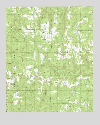
Tilly, AR USGS Topographic Map
Click on map above to begin viewing in our Map Viewer.

This topographic map contains these locations and features:
Feature Name Type Latitude Longitude GNIS ID View Map
Alread HillSummitN35.6867°W92.8513°70436View Map
Archer Valley SchoolSchoolN35.6998°W92.7791°70459View Map
Archey Valley ChurchChurchN35.6998°W92.7793°78879View Map
Bear HollowValleyN35.6256°W92.8346°70564View Map
Brown MountainSummitN35.6495°W92.8677°70844View Map
Burnett CreekStreamN35.6259°W92.8346°70929View Map
Cossey SchoolSchoolN35.6870°W92.8310°71236View Map
DabneyPopulated PlaceN35.6317°W92.7866°71325View Map
Ella (historical)Populated PlaceN35.7015°W92.8141°62002View Map
Lick HollowValleyN35.7187°W92.8707°72343View Map
Nogo SchoolSchoolN35.6456°W92.8743°72875View Map
Oak Ridge SchoolSchoolN35.6354°W92.7810°72916View Map
Parks CemeteryCemeteryN35.7462°W92.7532°73006View Map
Shields KnobSummitN35.6995°W92.8607°73540View Map
TillyPopulated PlaceN35.7201°W92.8329°73873View Map
Tilly Missionary Baptist ChurchChurchN35.7198°W92.8235°62001View Map
Tilly Post OfficePost OfficeN35.7204°W92.8238°84049View Map
Turkey Pen HollowValleyN35.6751°W92.7585°73911View Map
Union Hill CemeteryCemeteryN35.7187°W92.8096°68705View Map
Union Hill ChurchChurchN35.7179°W92.8099°59206View Map
Union Hill ChurchChurchN35.7154°W92.8232°59207View Map
Union Hill SchoolSchoolN35.7156°W92.8232°73941View Map
Walker MountainSummitN35.6715°W92.8627°73989View Map
Zion HillPopulated PlaceN35.6609°W92.8052°59214View Map
Zion Hill ChurchChurchN35.6590°W92.8113°59215View Map
Zion Hill SchoolSchoolN35.6584°W92.8116°74235View Map

Note: Coordinates in the location and feature list above are referenced to NAD83 datum.


Copyright (C) 2008-2025 Ryan Niemi / Sunset Dynamics ... All Rights Reserved