TopoQuest Logo
Do you find TopoQuest useful?
Help keep TopoQuest running and adding new maps/features by donating!
Bitcoin:  19c7KJd3qBynnjoSw5npx9KScwjBe4ifkT
Litecoin:  LXs6TkuXGGXo1vDsWCkWVdjQX94eUKd6ui
Home View Maps Find Maps Find Places Resources & Links


Moore, Arkansas Topographic Map

USGS Map Title: Moore, AR
USGS Map MRC: 35092G8
DRG (GeoTIFF) Download: o35092g8.tif


Neighboring USGS Topographic Map Quads:


  Mount Judea, AR  
35093H1
 

  Eula, AR  
35092H8
 

  Snowball, AR  
35092H7
 

  Lurton, AR  
35093G1
 

  Moore, AR  
35092G8
 

  Witts Springs, AR  
35092G7
 

  Sand Gap, AR  
35093F1
 

  Smyrna, AR  
35092F8
 

  Tilly, AR  
35092F7


Map MRC Location:

N36°
W93°
N36°
W92°
H8 H7 H6 H5 H4 H3 H2 H1
G8 G7 G6 G5 G4 G3 G2 G1
F8 F7 F6 F5 F4 F3 F2 F1
E8 E7 E6 E5 E4 E3 E2 E1
D8 D7 D6 D5 D4 D3 D2 D1
C8 C7 C6 C5 C4 C3 C2 C1
B8 B7 B6 B5 B4 B3 B2 B1
A8 A7 A6 A5 A4 A3 A2 A1
N35°
W93°
N35°
W92°

Moore, AR USGS 1:24K Topographic Map Preview:
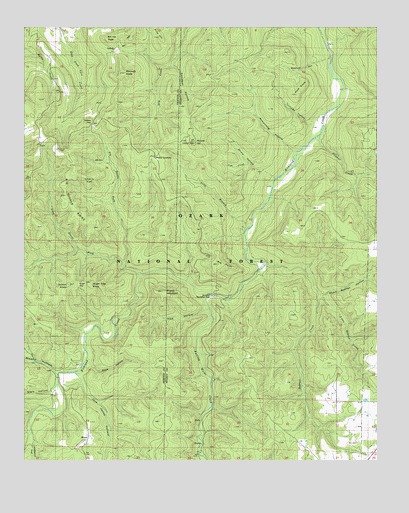
Moore, AR USGS Topographic Map
Click on map above to begin viewing in our Map Viewer.

This topographic map contains these locations and features:
Feature Name Type Latitude Longitude GNIS ID View Map
Armstrong HollowValleyN35.8390°W92.9043°59392View Map
Bearcat HollowValleyN35.8667°W92.8918°59389View Map
Big Devils ForkStreamN35.8056°W92.9652°70667View Map
Big Middle RidgeRidgeN35.8245°W92.9866°70673View Map
Big PointSummitN35.8065°W92.9327°70676View Map
Bill Hill PeakSummitN35.8706°W92.9716°70683View Map
Blaylock KnobSummitN35.8609°W92.9671°70719View Map
Bobtail CreekStreamN35.8065°W92.9154°70752View Map
Campbell HollowValleyN35.8642°W92.9485°70978View Map
Cherry FlatFlatN35.8309°W92.9802°71123View Map
Clark HollowValleyN35.7709°W92.9893°71155View Map
Cub CreekStreamN35.8356°W92.9224°71309View Map
Dickey JunctionPopulated PlaceN35.8376°W92.9546°71385View Map
Drury HollowValleyN35.8301°W92.9127°71424View Map
Falling Water CreekStreamN35.7976°W92.9352°71584View Map
Hideout HollowValleyN35.7542°W92.9977°72000View Map
Hideout TrailTrailN35.7598°W92.9935°72001View Map
Hill CemeteryCemeteryN35.8362°W92.9724°72021View Map
IceledoLocaleN35.8679°W92.9668°72138View Map
Iceledo GapGapN35.8473°W92.9866°72139View Map
Jack Jones HollowValleyN35.7740°W92.9816°72160View Map
Leigo (historical)Populated PlaceN35.8417°W92.9404°69965View Map
Little Bobtail CreekStreamN35.7976°W92.8960°59391View Map
Long BranchStreamN35.8173°W92.9207°72465View Map
Long Devils ForkStreamN35.8048°W92.9604°72473View Map
Meeks HollowValleyN35.7756°W92.9896°59377View Map
MoorePopulated PlaceN35.7551°W92.9782°72719View Map
Moore School (historical)SchoolN35.7542°W92.9785°69928View Map
Pine HollowValleyN35.7934°W92.9352°73092View Map
Pine KnobSummitN35.8579°W92.9060°73094View Map
Richland Creek WildernessReserveN35.8016°W92.9686°74274View Map
Richland Recreation AreaLocaleN35.7965°W92.9332°74532View Map
Richland Recreation AreaParkN35.7970°W92.9343°59388View Map
Rose HollowValleyN35.7781°W92.9780°73379View Map
Round HillSummitN35.8412°W92.9402°73402View Map
Short Bobtail HollowValleyN35.7981°W92.8952°59390View Map
Stump MountainSummitN35.7981°W92.9527°73743View Map
Sugar GapGapN35.8004°W92.9810°73755View Map
Sugar Tree KnobSummitN35.7998°W92.9777°73758View Map
Sulphur CreekStreamN35.8434°W92.8971°73774View Map
Sutton KnobSummitN35.8004°W92.9849°73791View Map
Taylor BenchBenchN35.8662°W92.9718°73833View Map
Township of JonesCivilN35.7694°W92.9861°69680View Map
Turnpike HollowValleyN35.8473°W92.8968°73919View Map
Wasson SchoolSchoolN35.8448°W92.8952°74015View Map

Note: Coordinates in the location and feature list above are referenced to NAD83 datum.


Copyright (C) 2008-2024 Ryan Niemi / Sunset Dynamics ... All Rights Reserved