TopoQuest Logo
Do you find TopoQuest useful?
Help keep TopoQuest running and adding new maps/features by donating!
Bitcoin:  19c7KJd3qBynnjoSw5npx9KScwjBe4ifkT
Litecoin:  LXs6TkuXGGXo1vDsWCkWVdjQX94eUKd6ui
Home View Maps Find Maps Find Places Resources & Links


Tioga, Pennsylvania Topographic Map

USGS Map Title: Tioga, PA
USGS Map MRC: 41077H2
DRG (GeoTIFF) Download: o41077h2.tif


Neighboring USGS Topographic Map Quads:


  Borden, NY  
42077A3
 

  Addison, NY  
42077A2
 

  Caton, NY  
42077A1
 

  Elkland, PA  
41077H3
 

  Tioga, PA  
41077H2
 

  Jackson Summit, PA  
41077H1
 

  Keeneyville, PA  
41077G3
 

  Crooked Creek, PA  
41077G2
 

  Mansfield, PA  
41077G1


Map MRC Location:

N42°
W78°
N42°
W77°
H8 H7 H6 H5 H4 H3 H2 H1
G8 G7 G6 G5 G4 G3 G2 G1
F8 F7 F6 F5 F4 F3 F2 F1
E8 E7 E6 E5 E4 E3 E2 E1
D8 D7 D6 D5 D4 D3 D2 D1
C8 C7 C6 C5 C4 C3 C2 C1
B8 B7 B6 B5 B4 B3 B2 B1
A8 A7 A6 A5 A4 A3 A2 A1
N41°
W78°
N41°
W77°

Tioga, PA USGS 1:24K Topographic Map Preview:
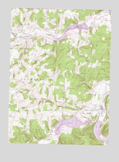
Tioga, PA USGS Topographic Map
Click on map above to begin viewing in our Map Viewer.

This topographic map contains these locations and features:
Feature Name Type Latitude Longitude GNIS ID View Map
Baldwin CreekStreamN41.9717°W77.1903°1168654View Map
Bear CreekStreamN41.9251°W77.1294°1168861View Map
Bill Hess CreekStreamN41.9767°W77.2491°943975View Map
Boom Pumping StationLocaleN41.9551°W77.1511°1213150View Map
Borough of LawrencevilleCivilN41.9959°W77.1304°1215623View Map
Borough of TiogaCivilN41.9073°W77.1335°1215628View Map
BrooklynPopulated PlaceN41.9092°W77.1414°1203163View Map
Buffalo CreekStreamN41.9204°W77.1480°1198049View Map
Cook CreekStreamN41.9829°W77.1608°1172380View Map
Cowanesque DamDamN41.9817°W77.1714°1195878View Map
Cowanesque LakeReservoirN41.9832°W77.1733°1211965View Map
Crawford RunStreamN41.9631°W77.1911°1172654View Map
Crooked CreekStreamN41.9234°W77.1294°1172716View Map
Cummings CreekStreamN41.9745°W77.2269°1172831View Map
Dailey CemeteryCemeteryN41.8815°W77.1302°1172885View Map
Elkhorn CreekStreamN41.9076°W77.1569°1174132View Map
Evergreen - Tioga CemeteryCemeteryN41.9048°W77.1480°1189590View Map
Farmington HillPopulated PlaceN41.9226°W77.2411°1203556View Map
Farmington Hill CemeteryCemeteryN41.9215°W77.2429°2774815View Map
Gee HollowValleyN41.9632°W77.1917°1175498View Map
H&H Personal Use AirportAirportN41.9034°W77.2301°1194308View Map
HammondPopulated PlaceN41.8829°W77.1947°1203746View Map
Hammond CemeteryCemeteryN41.8848°W77.2030°2774819View Map
Hammond DamDamN41.9017°W77.1447°1195845View Map
Hammond LakeReservoirN41.9021°W77.1439°1195846View Map
Hughes AirportAirportN41.9015°W77.2308°1198010View Map
Ives RunStreamN41.8915°W77.1850°1177893View Map
LawrencevillePopulated PlaceN41.9976°W77.1261°1192754View Map
Lawrenceville Borough Police DepartmentBuildingN41.9978°W77.1252°2775189View Map
Lawrenceville CemeteryCemeteryN41.9915°W77.1405°1179059View Map
Lawrenceville Post OfficePost OfficeN41.9982°W77.1267°2772785View Map
Mapes CreekStreamN41.9742°W77.1944°1180313View Map
Mill CreekStreamN41.8790°W77.1261°1181154View Map
Mill CreekPopulated PlaceN41.8815°W77.1261°1204174View Map
NelsonPopulated PlaceN41.9784°W77.2361°1204270View Map
Nelson CemeteryCemeteryN41.9773°W77.2319°1182238View Map
Nelson Post OfficePost OfficeN41.9767°W77.2440°2772860View Map
Nelson Volunteer Fire CompanyBuildingN41.9768°W77.2442°2653038View Map
Nielsen AirportAirportN41.9206°W77.1401°2442915View Map
Palmer Pumping StationLocaleN41.9334°W77.2172°1213316View Map
Pritchard (historical)Populated PlaceN41.9865°W77.1575°1217366View Map
State Game Lands Number 37ParkN41.8834°W77.1664°1208053View Map
Stephenhouse RunStreamN41.8795°W77.1953°1188607View Map
Strait CreekStreamN41.9776°W77.2183°966618View Map
Strait CreekStreamN41.9776°W77.2361°1188846View Map
TiogaPopulated PlaceN41.9087°W77.1330°1189589View Map
Tioga DamDamN41.9017°W77.1280°1195844View Map
Tioga Fire DepartmentBuildingN41.9094°W77.1320°2652982View Map
Tioga Police DepartmentBuildingN41.9095°W77.1326°2775194View Map
Tioga Post OfficePost OfficeN41.9113°W77.1329°2773003View Map
Tioga ReservoirReservoirN41.8976°W77.1355°1198263View Map
TompkinsPopulated PlaceN41.9767°W77.1908°1204817View Map
Tompkins ChurchChurchN41.9706°W77.1900°1189643View Map
Township of LawrenceCivilN41.9700°W77.1358°1217114View Map

Note: Coordinates in the location and feature list above are referenced to NAD83 datum.


Copyright (C) 2008-2024 Ryan Niemi / Sunset Dynamics ... All Rights Reserved