TopoQuest Logo
Do you find TopoQuest useful?
Help keep TopoQuest running and adding new maps/features by donating!
Bitcoin:  19c7KJd3qBynnjoSw5npx9KScwjBe4ifkT
Litecoin:  LXs6TkuXGGXo1vDsWCkWVdjQX94eUKd6ui
Home View Maps Find Maps Find Places Resources & Links


Crooked Creek, Pennsylvania Topographic Map

USGS Map Title: Crooked Creek, PA
USGS Map MRC: 41077G2
DRG (GeoTIFF) Download: o41077g2.tif


Neighboring USGS Topographic Map Quads:


  Elkland, PA  
41077H3
 

  Tioga, PA  
41077H2
 

  Jackson Summit, PA  
41077H1
 

  Keeneyville, PA  
41077G3
 

  Crooked Creek, PA  
41077G2
 

  Mansfield, PA  
41077G1
 

  Antrim, PA  
41077F3
 

  Cherry Flats, PA  
41077F2
 

  Blossburg, PA  
41077F1


Map MRC Location:

N42°
W78°
N42°
W77°
H8 H7 H6 H5 H4 H3 H2 H1
G8 G7 G6 G5 G4 G3 G2 G1
F8 F7 F6 F5 F4 F3 F2 F1
E8 E7 E6 E5 E4 E3 E2 E1
D8 D7 D6 D5 D4 D3 D2 D1
C8 C7 C6 C5 C4 C3 C2 C1
B8 B7 B6 B5 B4 B3 B2 B1
A8 A7 A6 A5 A4 A3 A2 A1
N41°
W78°
N41°
W77°

Crooked Creek, PA USGS 1:24K Topographic Map Preview:
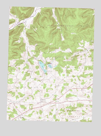
Crooked Creek, PA USGS Topographic Map
Click on map above to begin viewing in our Map Viewer.

This topographic map contains these locations and features:
Feature Name Type Latitude Longitude GNIS ID View Map
Bald HillSummitN41.8665°W77.1730°1168637View Map
Bluff PointSummitN41.7598°W77.1875°1197644View Map
Brown RunStreamN41.8545°W77.1761°1170375View Map
Bullock CemeteryCemeteryN41.7888°W77.1760°1170661View Map
CharlestonPopulated PlaceN41.7684°W77.2444°1203247View Map
Charleston Consolidated SchoolSchoolN41.7537°W77.2297°1171580View Map
Crooked CreekPopulated PlaceN41.8559°W77.2372°1172712View Map
Dartt Settlement CemeteryCemeteryN41.7685°W77.2400°1172966View Map
East Charleston ChurchChurchN41.7712°W77.1991°1173790View Map
Elk Run CemeteryCemeteryN41.7549°W77.1371°1174129View Map
Fairview CemeteryCemeteryN41.8596°W77.2356°2774813View Map
Hills CreekStreamN41.8584°W77.2250°1177104View Map
Hills Creek CemeteryCemeteryN41.8043°W77.2138°2774823View Map
Hills Creek ChurchChurchN41.8040°W77.2141°1177105View Map
Hills Creek DamDamN41.8051°W77.1964°1195797View Map
Hills Creek LakeReservoirN41.8098°W77.1988°1177106View Map
Hills Creek State ParkParkN41.8134°W77.1664°1200591View Map
Holiday StationLocaleN41.8545°W77.2414°1177200View Map
MardinPopulated PlaceN41.7987°W77.1652°1197643View Map
North RunStreamN41.8545°W77.2380°1182628View Map
North Schodac Road CemeteryCemeteryN41.7878°W77.1391°2774840View Map
Old Dartt CemeteryCemeteryN41.7690°W77.2434°2774842View Map
Reese HillSummitN41.8045°W77.2364°1184842View Map
Tauscher PondReservoirN41.8106°W77.1882°1189292View Map
Tioga County Memorial Gardens CemeteryCemeteryN41.7610°W77.2146°2774858View Map
Township of CharlestonCivilN41.7535°W77.2294°1217101View Map
West CovingtonPopulated PlaceN41.7526°W77.1530°1202032View Map
WhitneyvillePopulated PlaceN41.7731°W77.2005°1191362View Map

Note: Coordinates in the location and feature list above are referenced to NAD83 datum.


Copyright (C) 2008-2025 Ryan Niemi / Sunset Dynamics ... All Rights Reserved