TopoQuest Logo
Do you find TopoQuest useful?
Help keep TopoQuest running and adding new maps/features by donating!
Bitcoin:  19c7KJd3qBynnjoSw5npx9KScwjBe4ifkT
Litecoin:  LXs6TkuXGGXo1vDsWCkWVdjQX94eUKd6ui
Home View Maps Find Maps Find Places Resources & Links


Jackson Summit, Pennsylvania Topographic Map

USGS Map Title: Jackson Summit, PA
USGS Map MRC: 41077H1
DRG (GeoTIFF) Download: o41077h1.tif


Neighboring USGS Topographic Map Quads:


  Addison, NY  
42077A2
 

  Caton, NY  
42077A1
 

  Seeley Creek, NY  
42076A8
 

  Tioga, PA  
41077H2
 

  Jackson Summit, PA  
41077H1
 

  Millerton, PA  
41076H8
 

  Crooked Creek, PA  
41077G2
 

  Mansfield, PA  
41077G1
 

  Roseville, PA  
41076G8


Map MRC Location:

N42°
W78°
N42°
W77°
H8 H7 H6 H5 H4 H3 H2 H1
G8 G7 G6 G5 G4 G3 G2 G1
F8 F7 F6 F5 F4 F3 F2 F1
E8 E7 E6 E5 E4 E3 E2 E1
D8 D7 D6 D5 D4 D3 D2 D1
C8 C7 C6 C5 C4 C3 C2 C1
B8 B7 B6 B5 B4 B3 B2 B1
A8 A7 A6 A5 A4 A3 A2 A1
N41°
W78°
N41°
W77°

Jackson Summit, PA USGS 1:24K Topographic Map Preview:
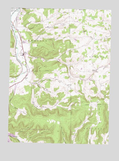
Jackson Summit, PA USGS Topographic Map
Click on map above to begin viewing in our Map Viewer.

This topographic map contains these locations and features:
Feature Name Type Latitude Longitude GNIS ID View Map
Barber HollowValleyN41.9307°W77.0902°1168695View Map
BeemanPopulated PlaceN41.9551°W77.1169°1203053View Map
Bentley CreekStreamN41.9340°W77.1144°1169277View Map
Buck HillSummitN41.9620°W77.0689°1170515View Map
Buckwheat HollowValleyN41.9811°W77.1044°1192215View Map
C V JunctionPopulated PlaceN41.9823°W77.1233°1203204View Map
Daily CreekStreamN41.9981°W77.1158°1172886View Map
Dark HollowValleyN41.9263°W77.1190°1172937View Map
Dickenson CemeteryCemeteryN41.9932°W77.0270°1173244View Map
East LawrencePopulated PlaceN41.9823°W77.0761°1203476View Map
Gobblers KnobSummitN41.9792°W77.0347°1175767View Map
Harts CreekStreamN41.9773°W77.1175°1176619View Map
Jackson SummitPopulated PlaceN41.9434°W77.0166°1177935View Map
Lawrence Township Police DepartmentBuildingN41.9823°W77.1181°2775195View Map
Lawrenceville Fire DepartmentBuildingN41.9974°W77.1247°2653577View Map
Maple Ridge CemeteryCemeteryN41.9294°W77.0111°1180360View Map
Middaugh CemeteryCemeteryN41.9852°W77.0606°1181000View Map
Mitchell CreekStreamN41.9381°W77.1094°1181369View Map
Mitchell CreekPopulated PlaceN41.9351°W77.1061°1204194View Map
Morrell CemeteryCemeteryN41.9420°W77.0168°1181565View Map
Mount Pleasant ChurchChurchN41.9290°W77.0519°1181827View Map
Mutton Lane CreekStreamN41.9484°W77.1086°1182125View Map
Phoenix RunStreamN41.8804°W77.1144°1183689View Map
RisingPopulated PlaceN41.9648°W77.1172°1197649View Map
Rowe HillSummitN41.9423°W77.0880°1185573View Map
Shanty CreekStreamN41.9301°W77.0961°1187364View Map
Smith CreekStreamN41.9770°W77.1189°1193381View Map
Somers LanePopulated PlaceN41.9676°W77.1105°1204684View Map
Steam Mill CreekStreamN41.9312°W77.0897°1188575View Map
Tioga DamDamN41.9084°W77.1197°1195850View Map
Tioga JunctionPopulated PlaceN41.9579°W77.1072°1204814View Map
Tower HillSummitN41.9098°W77.0108°1189680View Map
Tower Hill CemeteryCemeteryN41.8953°W77.0124°1189681View Map
Township of TiogaCivilN41.8984°W77.1134°1217124View Map
Williamson Senior High SchoolSchoolN41.9572°W77.1088°1191487View Map

Note: Coordinates in the location and feature list above are referenced to NAD83 datum.


Copyright (C) 2008-2024 Ryan Niemi / Sunset Dynamics ... All Rights Reserved