TopoQuest Logo
Do you find TopoQuest useful?
Help keep TopoQuest running and adding new maps/features by donating!
Bitcoin:  19c7KJd3qBynnjoSw5npx9KScwjBe4ifkT
Litecoin:  LXs6TkuXGGXo1vDsWCkWVdjQX94eUKd6ui
Home View Maps Find Maps Find Places Resources & Links


Tollesboro, Kentucky Topographic Map

USGS Map Title: Tollesboro, KY
USGS Map MRC: 38083E5
DRG (GeoTIFF) Download: o38083e5.tif


Neighboring USGS Topographic Map Quads:


  Maysville East, KY  
38083F6
 

  Manchester Islands, KY  
38083F5
 

  Concord, KY  
38083F4
 

  Orangeburg, KY  
38083E6
 

  Tollesboro, KY  
38083E5
 

  Charters, KY  
38083E4
 

  Flemingsburg, KY  
38083D6
 

  Burtonville, KY  
38083D5
 

  Stricklett, KY  
38083D4


Map MRC Location:

N39°
W84°
N39°
W83°
H8 H7 H6 H5 H4 H3 H2 H1
G8 G7 G6 G5 G4 G3 G2 G1
F8 F7 F6 F5 F4 F3 F2 F1
E8 E7 E6 E5 E4 E3 E2 E1
D8 D7 D6 D5 D4 D3 D2 D1
C8 C7 C6 C5 C4 C3 C2 C1
B8 B7 B6 B5 B4 B3 B2 B1
A8 A7 A6 A5 A4 A3 A2 A1
N38°
W84°
N38°
W83°

Tollesboro, KY USGS 1:24K Topographic Map Preview:
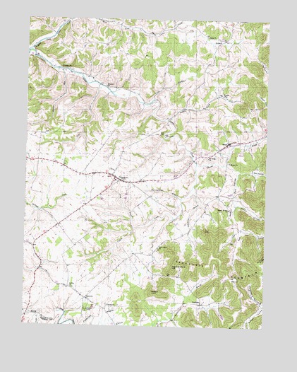
Tollesboro, KY USGS Topographic Map
Click on map above to begin viewing in our Map Viewer.

This topographic map contains these locations and features:
Feature Name Type Latitude Longitude GNIS ID View Map
Bethel ChurchChurchN38.5670°W83.5188°486991View Map
Bethel CreekStreamN38.5665°W83.5360°486996View Map
Boggs Post Office (historical)Post OfficeN38.5970°W83.5785°2362962View Map
Browns RunStreamN38.6042°W83.6066°488040View Map
Browns Run School (historical)SchoolN38.6036°W83.6053°2364891View Map
Cabin Creek Bridge (historical)BridgeN38.6095°W83.6213°2362967View Map
Cabin Creek Bridge Historical MarkerParkN38.6094°W83.6211°2744486View Map
Cabin Creek Point of Entry Historical MarkerParkN38.5679°W83.5373°2744487View Map
Cabin Creek Post Office (historical)Post OfficeN38.6041°W83.6061°2362968View Map
Canaan ChurchChurchN38.5087°W83.5813°488750View Map
Canaan SchoolSchoolN38.5056°W83.5805°488751View Map
Clear CreekStreamN38.5981°W83.5871°489608View Map
CottagevillePopulated PlaceN38.6045°W83.6027°507765View Map
East Fork Bethel CreekStreamN38.5665°W83.5207°491440View Map
East Fork Cabin CreekStreamN38.6117°W83.6246°491442View Map
Ebenezer ChurchChurchN38.5976°W83.5835°491540View Map
EpworthPopulated PlaceN38.5112°W83.5927°491803View Map
Epworth Post Office (historical)Post OfficeN38.5116°W83.5930°2362982View Map
Eskalapia HollowValleyN38.5091°W83.5006°491814View Map
Eskalapia MountainSummitN38.5248°W83.5371°491815View Map
Everetts House Post Office (historical)Post OfficeN38.5945°W83.5239°2362983View Map
Fite HollowValleyN38.5396°W83.5118°492149View Map
Flat GapGapN38.5204°W83.5496°492192View Map
Fry BranchStreamN38.6215°W83.5482°492588View Map
Gallilee ChurchChurchN38.5154°W83.6002°492657View Map
Grog BranchStreamN38.5395°W83.5677°493416View Map
Happy HollowValleyN38.5661°W83.5209°493703View Map
Happy Hollow ChurchChurchN38.5479°W83.5191°493708View Map
Happy Hollow School (historical)SchoolN38.5448°W83.5187°2363000View Map
Indian CreekStreamN38.5842°W83.5510°494924View Map
Indian RunStreamN38.5779°W83.5007°494983View Map
May HollowValleyN38.5632°W83.5142°497710View Map
McKenzie Post Office (historical)Post OfficeN38.6222°W83.5486°2363024View Map
Mount Tabor ChurchChurchN38.5687°W83.5302°498872View Map
Myers SchoolSchoolN38.6028°W83.5299°2363033View Map
NashtownPopulated PlaceN38.5092°W83.5327°508673View Map
Nashtown Post Office (historical)Post OfficeN38.5093°W83.5323°2363035View Map
Oak Hill School (historical)SchoolN38.6133°W83.5850°2363038View Map
Peach Orchard HillSummitN38.5231°W83.5474°500320View Map
Pine KnobSummitN38.5390°W83.5313°500704View Map
Pine Valley ChurchChurchN38.5317°W83.5552°500721View Map
Pine Valley School (historical)SchoolN38.5310°W83.5565°2363046View Map
Poplar FlatPopulated PlaceN38.5945°W83.5235°508853View Map
RiboltPopulated PlaceN38.5751°W83.5196°501765View Map
Ribolt Post Office (historical)Post OfficeN38.5752°W83.5192°2363055View Map
Richland School (historical)SchoolN38.5321°W83.6196°2363056View Map
Ruggles CampLocaleN38.5065°W83.5921°502462View Map
Salem ChurchChurchN38.6184°W83.5313°502797View Map
Stouts HollowValleyN38.5500°W83.5156°504536View Map
Tanbark HillSummitN38.5140°W83.5580°504936View Map
Thoroughman BranchStreamN38.5520°W83.5438°505228View Map
TollesboroPopulated PlaceN38.5595°W83.5760°505325View Map
Tollesboro DivisionCivilN38.5876°W83.5469°1937291View Map
Tollesboro Volunteer Fire DepartmentBuildingN38.5599°W83.5762°2636644View Map
Trotter CreekStreamN38.5040°W83.6166°485706View Map
Union BranchStreamN38.5917°W83.5588°505763View Map
White Corner (historical)LocaleN38.6235°W83.5191°2363099View Map
Whitehouse Post OfficePost OfficeN38.5608°W83.5788°2363100View Map
Yellowlick BranchStreamN38.5573°W83.5374°507225View Map

Note: Coordinates in the location and feature list above are referenced to NAD83 datum.


Copyright (C) 2008-2024 Ryan Niemi / Sunset Dynamics ... All Rights Reserved