TopoQuest Logo
Do you find TopoQuest useful?
Help keep TopoQuest running and adding new maps/features by donating!
Bitcoin:  19c7KJd3qBynnjoSw5npx9KScwjBe4ifkT
Litecoin:  LXs6TkuXGGXo1vDsWCkWVdjQX94eUKd6ui
Home View Maps Find Maps Find Places Resources & Links


Charters, Kentucky Topographic Map

USGS Map Title: Charters, KY
USGS Map MRC: 38083E4
DRG (GeoTIFF) Download: o38083e4.tif


Neighboring USGS Topographic Map Quads:


  Manchester Islands, KY  
38083F5
 

  Concord, KY  
38083F4
 

  Buena Vista, OH  
38083F3
 

  Tollesboro, KY  
38083E5
 

  Charters, KY  
38083E4
 

  Vanceburg, KY  
38083E3
 

  Burtonville, KY  
38083D5
 

  Stricklett, KY  
38083D4
 

  Head of Grassy, KY  
38083D3


Map MRC Location:

N39°
W84°
N39°
W83°
H8 H7 H6 H5 H4 H3 H2 H1
G8 G7 G6 G5 G4 G3 G2 G1
F8 F7 F6 F5 F4 F3 F2 F1
E8 E7 E6 E5 E4 E3 E2 E1
D8 D7 D6 D5 D4 D3 D2 D1
C8 C7 C6 C5 C4 C3 C2 C1
B8 B7 B6 B5 B4 B3 B2 B1
A8 A7 A6 A5 A4 A3 A2 A1
N38°
W84°
N38°
W83°

Charters, KY USGS 1:24K Topographic Map Preview:
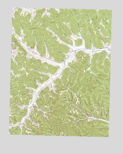
Charters, KY USGS Topographic Map
Click on map above to begin viewing in our Map Viewer.

This topographic map contains these locations and features:
Feature Name Type Latitude Longitude GNIS ID View Map
Ben Willim BranchStreamN38.5851°W83.4177°486842View Map
Big BranchStreamN38.5659°W83.4371°487140View Map
Big John Hackworth HollowValleyN38.5416°W83.4697°487201View Map
Big Sulphur BranchStreamN38.5834°W83.3977°487281View Map
Bivens BranchStreamN38.5548°W83.4493°2364902View Map
Boles ForkStreamN38.5162°W83.4102°487637View Map
Boles HollowValleyN38.5278°W83.4127°487638View Map
Carr HollowValleyN38.5889°W83.4212°488976View Map
Cedar Grove ChurchChurchN38.5459°W83.4299°489210View Map
ChartersPopulated PlaceN38.5737°W83.4332°489374View Map
Charters Post Office (historical)Post OfficeN38.5739°W83.4332°2362973View Map
Clary BranchStreamN38.5706°W83.4338°489562View Map
Esculapia Springs Historical MarkerParkN38.5725°W83.4332°2744488View Map
Esham BranchStreamN38.5198°W83.4013°491812View Map
Fryer BranchStreamN38.5131°W83.4830°492589View Map
Ghost HollowValleyN38.5877°W83.3826°492799View Map
Ginn HollowValleyN38.5490°W83.4621°492864View Map
Glen SpringsPopulated PlaceN38.5109°W83.4852°508097View Map
Glen Springs HillSummitN38.5040°W83.4913°492890View Map
Glen Springs Post Office (historical)Post OfficeN38.5104°W83.4859°2364894View Map
Goodwin BranchStreamN38.5304°W83.4721°492986View Map
Grandison BranchStreamN38.5845°W83.3957°493096View Map
Hackworth CemeteryCemeteryN38.5351°W83.4730°493522View Map
Hackworth HollowValleyN38.5273°W83.4763°493523View Map
Harris HollowValleyN38.5344°W83.4233°493810View Map
Hatcher BranchStreamN38.5392°W83.4685°493857View Map
Hazelton Post Office (historical)Post OfficeN38.5283°W83.4722°2363001View Map
Herron HillPopulated PlaceN38.5898°W83.4969°508226View Map
Heselton SchoolSchoolN38.5290°W83.4710°494093View Map
Holly SchoolSchoolN38.5217°W83.4041°494414View Map
Horsley BranchStreamN38.5192°W83.3963°494614View Map
Horsley BranchStreamN38.5970°W83.4155°494615View Map
Jack Harrison HollowValleyN38.5758°W83.4544°495075View Map
Kegley BranchStreamN38.5151°W83.3791°495604View Map
Kentucky RidgeRidgeN38.5401°W83.4899°495678View Map
Killfillian HollowValleyN38.5431°W83.4681°495725View Map
Kinney HollowValleyN38.5267°W83.4838°495778View Map
Lee HollowValleyN38.5313°W83.4209°496168View Map
Left Fork Greenhow BranchStreamN38.6209°W83.4560°496219View Map
Lewis CountyCivilN38.5315°W83.3781°516914View Map
Liberty ChurchChurchN38.5851°W83.4763°496380View Map
Little BranchStreamN38.5659°W83.4371°496642View Map
Little Sulphur BranchStreamN38.5856°W83.3810°496874View Map
Magnificent Pin Oak Historical MarkerParkN38.5850°W83.4201°2744489View Map
Manley HollowValleyN38.5944°W83.4891°497493View Map
McCoy CemeteryCemeteryN38.5181°W83.4749°497816View Map
Meenach HollowValleyN38.5806°W83.4742°498029View Map
Mefford BranchStreamN38.5929°W83.4888°498039View Map
Moore BranchStreamN38.5206°W83.4769°498535View Map
Moore HollowValleyN38.5812°W83.4692°498557View Map
Pell BranchStreamN38.5656°W83.3994°500364View Map
Pleasant RidgeRidgeN38.6134°W83.4363°500889View Map
Pleasant Ridge CemeteryCemeteryN38.6145°W83.3821°500891View Map
Redden BranchStreamN38.5787°W83.4230°501680View Map
Right Fork Greenhow BranchStreamN38.6209°W83.4560°501887View Map
Runyan HollowValleyN38.5085°W83.4998°502470View Map
Shaw HollowValleyN38.5583°W83.4481°503279View Map
Shaw HollowValleyN38.5778°W83.4998°503280View Map
Shaw HollowValleyN38.6234°W83.4723°503281View Map
Sugarcamp BranchStreamN38.5695°W83.4013°504689View Map
Sugartree BranchStreamN38.5173°W83.3832°504708View Map
Sulphur Springs HollowValleyN38.5114°W83.4896°504775View Map
Swearingen BranchStreamN38.5854°W83.4094°504842View Map
Toller BranchStreamN38.5120°W83.4857°515964View Map
Valley CemeteryCemeteryN38.5778°W83.4319°505937View Map
Valley School (historical)SchoolN38.5839°W83.4196°2363094View Map
Webster CemeteryCemeteryN38.5901°W83.3771°506346View Map
Willim BranchStreamN38.5695°W83.4010°506841View Map

Note: Coordinates in the location and feature list above are referenced to NAD83 datum.


Copyright (C) 2008-2025 Ryan Niemi / Sunset Dynamics ... All Rights Reserved