TopoQuest Logo
Do you find TopoQuest useful?
Help keep TopoQuest running and adding new maps/features by donating!
Bitcoin:  19c7KJd3qBynnjoSw5npx9KScwjBe4ifkT
Litecoin:  LXs6TkuXGGXo1vDsWCkWVdjQX94eUKd6ui
Home View Maps Find Maps Find Places Resources & Links


Torrey Mountain, Montana Topographic Map

USGS Map Title: Torrey Mountain, MT
USGS Map MRC: 45112D8
DRG (GeoTIFF) Download: o45112d8.tif


Neighboring USGS Topographic Map Quads:


  Maurice Mountain, MT  
45113E1
 

  Mount Tahepia, MT  
45112E8
 

  Storm Peak, MT  
45112E7
 

  Elkhorn Hot Springs, MT  
45113D1
 

  Torrey Mountain, MT  
45112D8
 

  Twin Adams Mountain, MT  
45112D7
 

  Polaris, MT  
45113C1
 

  Ermont, MT  
45112C8
 

  Argenta, MT  
45112C7


Map MRC Location:

N46°
W113°
N46°
W112°
H8 H7 H6 H5 H4 H3 H2 H1
G8 G7 G6 G5 G4 G3 G2 G1
F8 F7 F6 F5 F4 F3 F2 F1
E8 E7 E6 E5 E4 E3 E2 E1
D8 D7 D6 D5 D4 D3 D2 D1
C8 C7 C6 C5 C4 C3 C2 C1
B8 B7 B6 B5 B4 B3 B2 B1
A8 A7 A6 A5 A4 A3 A2 A1
N45°
W113°
N45°
W112°

Torrey Mountain, MT USGS 1:24K Topographic Map Preview:
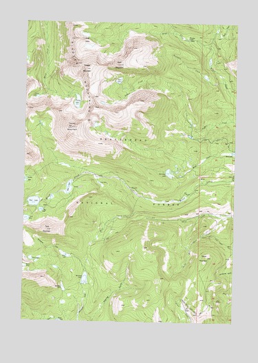
Torrey Mountain, MT USGS Topographic Map
Click on map above to begin viewing in our Map Viewer.

This topographic map contains these locations and features:
Feature Name Type Latitude Longitude GNIS ID View Map
Anchor Lake North DamDamN45.4349°W112.9992°796617View Map
Anchor South DamDamN45.4333°W112.9992°795912View Map
Barb LakeLakeN45.4757°W112.9456°779344View Map
Barb MountainSummitN45.4821°W112.9459°779345View Map
Boatman LakeLakeN45.3889°W112.9767°780177View Map
Bond LakeReservoirN45.4456°W112.8760°780212View Map
Boot LakeReservoirN45.4309°W112.9742°780231View Map
Boot Lake DamDamN45.4333°W112.9725°795916View Map
Buckhorn CreekStreamN45.4752°W112.8825°780525View Map
Dearhead Lake DamDamN45.4349°W112.9159°795908View Map
Deerhead LakeLakeN45.4370°W112.9148°782274View Map
Deerhead LakeReservoirN45.4349°W112.9159°795909View Map
Dinner Station CampgroundLocaleN45.4283°W112.9023°794598View Map
Estler CreekStreamN45.3758°W112.9795°783233View Map
Glacier LakeLakeN45.4686°W112.9938°783966View Map
Gorge CreekStreamN45.4896°W112.8914°784126View Map
Gorge LakesLakeN45.4897°W112.9645°784128View Map
Humbolt Mountain MineMineN45.3844°W112.8850°802424View Map
Indian Squaw MineMineN45.3919°W112.8936°802464View Map
Lily LakeLakeN45.4326°W112.9559°786116View Map
Mast DitchCanalN45.4505°W112.8895°786922View Map
May LakeLakeN45.4214°W112.9907°786957View Map
Minneopa LakeSwampN45.3927°W112.9639°787482View Map
Mule CreekStreamN45.4274°W112.9309°787836View Map
Pear LakeLakeN45.4247°W112.9950°788728View Map
Pear Lake DamDamN45.4249°W112.9925°795910View Map
Pioneer MountainsRangeN45.4985°W112.9736°788938View Map
South Fork Thief CreekStreamN45.4199°W112.8759°791070View Map
Tent LakeLakeN45.4029°W112.9760°791967View Map
Tent MountainSummitN45.4130°W112.9867°791968View Map
Torrey LakeLakeN45.4667°W112.9701°792285View Map
Torrey MountainSummitN45.4558°W112.9728°792286View Map
Tower MountainSummitN45.4019°W112.8911°792293View Map
Tub LakeReservoirN45.4178°W112.9996°792426View Map
Tub Lake DamDamN45.4183°W112.9975°795914View Map
Tweedy MountainSummitN45.4805°W112.9653°792484View Map
Twin LakesLakeN45.4011°W112.9963°792513View Map
Uphill CreekStreamN45.4963°W112.8884°792603View Map
US Treasurer MineMineN45.3899°W112.8920°802474View Map
Winkley CampLocaleN45.4933°W112.9045°793419View Map

Note: Coordinates in the location and feature list above are referenced to NAD83 datum.


Copyright (C) 2008-2025 Ryan Niemi / Sunset Dynamics ... All Rights Reserved