TopoQuest Logo
Do you find TopoQuest useful?
Help keep TopoQuest running and adding new maps/features by donating!
Bitcoin:  19c7KJd3qBynnjoSw5npx9KScwjBe4ifkT
Litecoin:  LXs6TkuXGGXo1vDsWCkWVdjQX94eUKd6ui
Home View Maps Find Maps Find Places Resources & Links


Twin Adams Mountain, Montana Topographic Map

USGS Map Title: Twin Adams Mountain, MT
USGS Map MRC: 45112D7
DRG (GeoTIFF) Download: o45112d7.tif


Neighboring USGS Topographic Map Quads:


  Mount Tahepia, MT  
45112E8
 

  Storm Peak, MT  
45112E7
 

  Earls Gulch, MT  
45112E6
 

  Torrey Mountain, MT  
45112D8
 

  Twin Adams Mountain, MT  
45112D7
 

  Glen, MT  
45112D6
 

  Ermont, MT  
45112C8
 

  Argenta, MT  
45112C7
 

  Bond, MT  
45112C6


Map MRC Location:

N46°
W113°
N46°
W112°
H8 H7 H6 H5 H4 H3 H2 H1
G8 G7 G6 G5 G4 G3 G2 G1
F8 F7 F6 F5 F4 F3 F2 F1
E8 E7 E6 E5 E4 E3 E2 E1
D8 D7 D6 D5 D4 D3 D2 D1
C8 C7 C6 C5 C4 C3 C2 C1
B8 B7 B6 B5 B4 B3 B2 B1
A8 A7 A6 A5 A4 A3 A2 A1
N45°
W113°
N45°
W112°

Twin Adams Mountain, MT USGS 1:24K Topographic Map Preview:
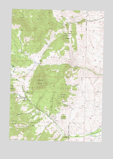
Twin Adams Mountain, MT USGS Topographic Map
Click on map above to begin viewing in our Map Viewer.

This topographic map contains these locations and features:
Feature Name Type Latitude Longitude GNIS ID View Map
05S10W02DABB01 SpringSpringN45.3871°W112.7992°809234View Map
Armstrong GulchValleyN45.4058°W112.8392°779136View Map
Armstrong MountainSummitN45.3919°W112.8725°779137View Map
Aspen CampgroundLocaleN45.4208°W112.8545°779179View Map
Barbour GulchValleyN45.4444°W112.7756°779349View Map
Barbour Gulch MineMineN45.4255°W112.7981°802485View Map
Birch Creek Ranger StationLocaleN45.4155°W112.8548°779932View Map
Bond CreekStreamN45.4485°W112.8375°780209View Map
Bond Lake DamDamN45.4449°W112.8742°796017View Map
Bridge GulchValleyN45.3927°W112.8186°780402View Map
Call MountainSummitN45.4935°W112.8611°780787View Map
Canyon GulchValleyN45.3821°W112.8034°780911View Map
Cow CampLocaleN45.4485°W112.8395°781767View Map
DuBois CreekStreamN45.4566°W112.8536°782674View Map
Farlin (historical)LocaleN45.3866°W112.8036°1797336View Map
Farlin GulchValleyN45.3994°W112.8220°783307View Map
Farlin Post Office (historical)Post OfficeN45.3866°W112.8036°1797234View Map
Farlin School (historical)SchoolN45.3866°W112.8036°1797335View Map
Glowworm/Greenhorn MineMineN45.4255°W112.8028°802460View Map
Greenstone MineMineN45.4127°W112.8039°784316View Map
Greenstone MountainSummitN45.4183°W112.8039°784317View Map
Indian Queen MineMineN45.3974°W112.8195°785277View Map
Lime GulchValleyN45.3946°W112.8148°786132View Map
Lime Gulch MineMineN45.3991°W112.8064°802494View Map
Limestone MountainSummitN45.3971°W112.8031°786151View Map
Lost Fraction MineMineN45.4766°W112.8025°802440View Map
Lower Bridge Gulch MineMineN45.3777°W112.8342°802489View Map
Meyers GulchValleyN45.4066°W112.8395°787201View Map
Middle MountainSummitN45.4255°W112.8736°787318View Map
North CreekStreamN45.4483°W112.8375°788077View Map
SE SW Section 16 MineMineN45.3930°W112.8467°802468View Map
Sheep CreekStreamN45.4010°W112.8273°790325View Map
Spring GulchValleyN45.4021°W112.8328°791283View Map
Sugar Loaf MineMineN45.4860°W112.8031°802432View Map
Thief CreekStreamN45.4158°W112.8542°792063View Map
Thunderhead MountainSummitN45.4308°W112.8348°792154View Map
Twin Adams MineMineN45.4752°W112.8031°802336View Map
Twin Adams MountainSummitN45.4746°W112.8042°792497View Map
Upper Bridge Gulch MineMineN45.3755°W112.8378°802488View Map

Note: Coordinates in the location and feature list above are referenced to NAD83 datum.


Copyright (C) 2008-2025 Ryan Niemi / Sunset Dynamics ... All Rights Reserved