TopoQuest Logo
Do you find TopoQuest useful?
Help keep TopoQuest running and adding new maps/features by donating!
Bitcoin:  19c7KJd3qBynnjoSw5npx9KScwjBe4ifkT
Litecoin:  LXs6TkuXGGXo1vDsWCkWVdjQX94eUKd6ui
Home View Maps Find Maps Find Places Resources & Links


Cameron, New York Topographic Map

USGS Map Title: Cameron, NY
USGS Map MRC: 42077B4
DRG (GeoTIFF) Download: o42077b4.tif


Neighboring USGS Topographic Map Quads:


  Canisteo, NY  
42077C5
 

  Towlesville, NY  
42077C4
 

  Bath, NY  
42077C3
 

  South Canisteo, NY  
42077B5
 

  Cameron, NY  
42077B4
 

  Rathbone, NY  
42077B3
 

  Troupsburg, NY  
42077A5
 

  Woodhull, NY  
42077A4
 

  Borden, NY  
42077A3


Map MRC Location:

N43°
W78°
N43°
W77°
H8 H7 H6 H5 H4 H3 H2 H1
G8 G7 G6 G5 G4 G3 G2 G1
F8 F7 F6 F5 F4 F3 F2 F1
E8 E7 E6 E5 E4 E3 E2 E1
D8 D7 D6 D5 D4 D3 D2 D1
C8 C7 C6 C5 C4 C3 C2 C1
B8 B7 B6 B5 B4 B3 B2 B1
A8 A7 A6 A5 A4 A3 A2 A1
N42°
W78°
N42°
W77°

Cameron, NY USGS 1:24K Topographic Map Preview:
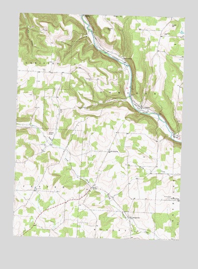
Cameron, NY USGS Topographic Map
Click on map above to begin viewing in our Map Viewer.

This topographic map contains these locations and features:
Feature Name Type Latitude Longitude GNIS ID View Map
Allen School (historical)SchoolN42.1592°W77.4039°2375589View Map
Averell HillSummitN42.2456°W77.3847°942727View Map
Averell Hill CemeteryCemeteryN42.2403°W77.3899°942728View Map
Boyd CemeteryCemeteryN42.1520°W77.4437°2547949View Map
Boyd Corners Baptist ChurchChurchN42.1370°W77.4816°2597644View Map
Boyd School (historical)SchoolN42.1500°W77.4447°2375591View Map
Boyds CornersLocaleN42.1545°W77.4403°944544View Map
Browns CrossingPopulated PlaceN42.2492°W77.4508°972269View Map
CameronPopulated PlaceN42.1992°W77.4064°945525View Map
Cameron CemeteryCemeteryN42.2055°W77.4147°945526View Map
Cameron Volunteer Fire DepartmentBuildingN42.1979°W77.4058°2700991View Map
Clark CemeteryCemeteryN42.1952°W77.4675°946746View Map
Cobble KnobSummitN42.1831°W77.4755°946969View Map
Eight Square CemeteryCemeteryN42.1512°W77.4846°949434View Map
Eight Square School (historical)SchoolN42.1514°W77.4839°2375598View Map
French School (historical)SchoolN42.2436°W77.3903°2375601View Map
Gerdner School (historical)SchoolN42.1358°W77.4822°2375602View Map
Gothic School (historical)SchoolN42.1847°W77.4167°2375603View Map
HedgesvillePopulated PlaceN42.1376°W77.4125°952530View Map
Hedgesville CemeteryCemeteryN42.1367°W77.4129°2547950View Map
Kinners KnobSummitN42.2423°W77.4333°954695View Map
Lower Swale CemeteryCemeteryN42.2138°W77.4443°956114View Map
Lower Swale School (historical)SchoolN42.2192°W77.4492°2375605View Map
North Jasper School (historical)SchoolN42.1775°W77.4758°2375607View Map
Northrup Hill CemeteryCemeteryN42.1488°W77.3841°958976View Map
Northrup Street School (historical)SchoolN42.1479°W77.3753°958977View Map
Randall's Roost AirportAirportN42.1632°W77.4269°2443149View Map
Roosa School (historical)SchoolN42.2358°W77.4722°2375610View Map
South CameronPopulated PlaceN42.1740°W77.4303°973090View Map
South Hill School (historical)SchoolN42.1767°W77.4278°2375614View Map
Talbot CreekStreamN42.1587°W77.4480°967003View Map
Talbot Creek CemeteryCemeteryN42.1761°W77.4766°958830View Map
Town of CameronCivilN42.2132°W77.4050°978778View Map
Upper Swale CemeteryCemeteryN42.2176°W77.4803°966873View Map
Upper Swale School (historical)SchoolN42.2181°W77.4975°2375619View Map
Valley Elementary SchoolSchoolN42.1822°W77.3756°2597627View Map
West CameronPopulated PlaceN42.2240°W77.4194°969159View Map

Note: Coordinates in the location and feature list above are referenced to NAD83 datum.


Copyright (C) 2008-2025 Ryan Niemi / Sunset Dynamics ... All Rights Reserved