TopoQuest Logo
Do you find TopoQuest useful?
Help keep TopoQuest running and adding new maps/features by donating!
Bitcoin:  19c7KJd3qBynnjoSw5npx9KScwjBe4ifkT
Litecoin:  LXs6TkuXGGXo1vDsWCkWVdjQX94eUKd6ui
Home View Maps Find Maps Find Places Resources & Links


Pembine, Wisconsin Topographic Map

USGS Map Title: Pembine, WI
USGS Map MRC: 45087F8
DRG (GeoTIFF) Download: o45087f8.tif


Neighboring USGS Topographic Map Quads:


  Iron Mountain, MI  
45088G1
 

  Norway, MI  
45087G8
 

  Vulcan, MI  
45087G7
 

  Dunbar NE, WI  
45088F1
 

  Pembine, WI  
45087F8
 

  Faithorn, MI  
45087F7
 

  Town Corner Lake, WI  
45088E1
 

  Amberg, WI  
45087E8
 

  Miscauno Island, WI  
45087E7


Map MRC Location:

N46°
W88°
N46°
W87°
H8 H7 H6 H5 H4 H3 H2 H1
G8 G7 G6 G5 G4 G3 G2 G1
F8 F7 F6 F5 F4 F3 F2 F1
E8 E7 E6 E5 E4 E3 E2 E1
D8 D7 D6 D5 D4 D3 D2 D1
C8 C7 C6 C5 C4 C3 C2 C1
B8 B7 B6 B5 B4 B3 B2 B1
A8 A7 A6 A5 A4 A3 A2 A1
N45°
W88°
N45°
W87°

Pembine, WI USGS 1:24K Topographic Map Preview:
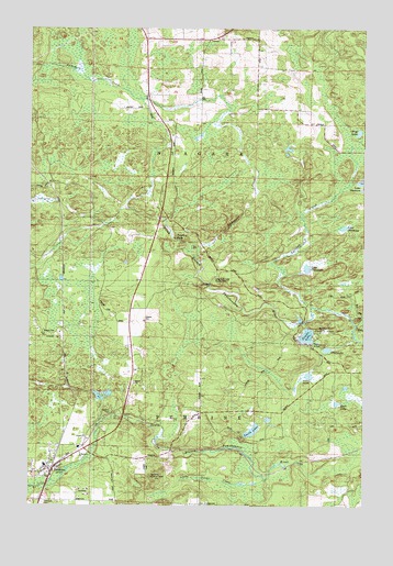
Pembine, WI USGS Topographic Map
Click on map above to begin viewing in our Map Viewer.

This topographic map contains these locations and features:
Feature Name Type Latitude Longitude GNIS ID View Map
1.35 ReservoirReservoirN45.7333°W87.9301°1792525View Map
Back LakeLakeN45.6561°W87.8817°2784446View Map
Goldmeyer School (historical)SchoolN45.7288°W87.9004°1876849View Map
Joe Panis, Jr E4083 DamDamN45.7333°W87.9301°1792524View Map
Lake ChapmanLakeN45.6873°W87.8965°1562950View Map
Lake DowningLakeN45.6980°W87.8829°1564092View Map
Little Silver CreekStreamN45.6322°W87.9129°1568411View Map
Long Slide FallsFallsN45.6833°W87.9335°1568594View Map
Long Slide Falls County ParkParkN45.6855°W87.9335°1845581View Map
Moreau School (historical)SchoolN45.7475°W87.9362°1876859View Map
Morgan County ParkParkN45.6716°W87.8935°1569734View Map
Niagara TownhallBuildingN45.7469°W87.9337°1845605View Map
Otter LakeLakeN45.6661°W87.8887°1570912View Map
PembinePopulated PlaceN45.6352°W87.9910°1571162View Map
Pembine CemeteryCemeteryN45.6258°W87.9954°1571163View Map
Pembine Census Designated PlaceCensusN45.6368°W87.9917°2586540View Map
Pembine Elementary SchoolSchoolN45.6361°W87.9946°2713439View Map
Pembine High SchoolSchoolN45.6361°W87.9946°1845612View Map
Pembine Lookout TowerTowerN45.6330°W87.9548°1845613View Map
Rock LakeLakeN45.6519°W87.8851°1845625View Map
Saint Margaret ChurchChurchN45.6389°W87.9810°1845632View Map
Smalley FallsFallsN45.6950°W87.9471°1574285View Map
Smith LakeLakeN45.6447°W87.9166°1574305View Map
Spikehorn CreekStreamN45.6927°W87.9379°1574550View Map
Sullivan CreekStreamN45.6775°W87.8951°1575045View Map
Timms LakeLakeN45.6700°W87.8968°1575466View Map
Town of NiagaraCivilN45.7169°W87.9417°1583820View Map
Town of PembineCivilN45.6353°W87.9355°1583905View Map
Wolf LakeLakeN45.7229°W87.8773°1576940View Map

Note: Coordinates in the location and feature list above are referenced to NAD83 datum.


Copyright (C) 2008-2025 Ryan Niemi / Sunset Dynamics ... All Rights Reserved