TopoQuest Logo
Do you find TopoQuest useful?
Help keep TopoQuest running and adding new maps/features by donating!
Bitcoin:  19c7KJd3qBynnjoSw5npx9KScwjBe4ifkT
Litecoin:  LXs6TkuXGGXo1vDsWCkWVdjQX94eUKd6ui
Home View Maps Find Maps Find Places Resources & Links


Amberg, Wisconsin Topographic Map

USGS Map Title: Amberg, WI
USGS Map MRC: 45087E8
DRG (GeoTIFF) Download: o45087e8.tif


Neighboring USGS Topographic Map Quads:


  Dunbar NE, WI  
45088F1
 

  Pembine, WI  
45087F8
 

  Faithorn, MI  
45087F7
 

  Town Corner Lake, WI  
45088E1
 

  Amberg, WI  
45087E8
 

  Miscauno Island, WI  
45087E7
 

  Athelstane, WI  
45088D1
 

  Wausaukee North, WI  
45087D8
 

  Resort Lake, MI  
45087D7


Map MRC Location:

N46°
W88°
N46°
W87°
H8 H7 H6 H5 H4 H3 H2 H1
G8 G7 G6 G5 G4 G3 G2 G1
F8 F7 F6 F5 F4 F3 F2 F1
E8 E7 E6 E5 E4 E3 E2 E1
D8 D7 D6 D5 D4 D3 D2 D1
C8 C7 C6 C5 C4 C3 C2 C1
B8 B7 B6 B5 B4 B3 B2 B1
A8 A7 A6 A5 A4 A3 A2 A1
N45°
W88°
N45°
W87°

Amberg, WI USGS 1:24K Topographic Map Preview:
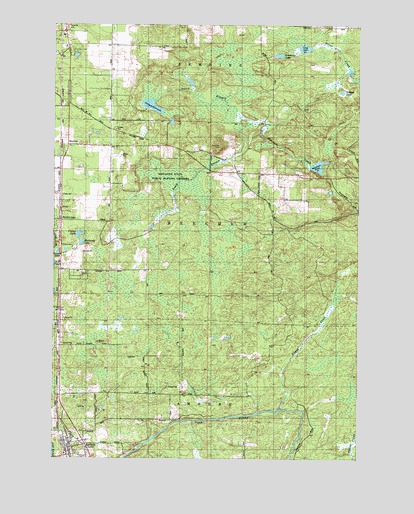
Amberg, WI USGS Topographic Map
Click on map above to begin viewing in our Map Viewer.

This topographic map contains these locations and features:
Feature Name Type Latitude Longitude GNIS ID View Map
AmbergPopulated PlaceN45.5030°W87.9937°1560815View Map
Amberg Census Designated PlaceCensusN45.5062°W87.9874°2586448View Map
Amberg Volunteer Fire DepartmentBuildingN45.5029°W87.9954°2696967View Map
BeecherPopulated PlaceN45.5883°W87.9948°1561494View Map
Beecher CreekStreamN45.5561°W87.9998°1561496View Map
Beecher LakePopulated PlaceN45.5691°W87.9976°1577511View Map
Clarey LakeLakeN45.5645°W87.9896°1563113View Map
Coles SchoolSchoolN45.5825°W87.9171°1563259View Map
Cotas LakeLakeN45.6182°W87.8974°1563420View Map
Dixon School (historical)SchoolN45.5900°W87.9926°1876843View Map
Dunbar - Pembine - Beecher Fire DepartmentBuildingN45.6164°W87.9962°2696909View Map
Faith SchoolSchoolN45.5758°W87.9965°1845559View Map
Golden LakeLakeN45.6080°W87.8865°1565609View Map
Headquarters LakeLakeN45.6015°W87.9602°1566241View Map
K C CreekStreamN45.5127°W87.9154°1567329View Map
Luedevitz LakeLakeN45.6161°W87.9080°1568798View Map
Miscauno Cedar Swamp State Natural AreaParkN45.5819°W87.9518°2057511View Map
Miscauno PondReservoirN45.5842°W87.8918°1569599View Map
Miscauno Pond DamDamN45.5852°W87.8885°1793451View Map
Miscauno State Public Hunting GroundsParkN45.5819°W87.9515°1845598View Map
Mullaney LakeLakeN45.5621°W87.9886°1570021View Map
Munot QuarryMineN45.5272°W87.9615°1876860View Map
North Branch Miscauno CreekStreamN45.5966°W87.9198°1570382View Map
Papoose LakeLakeN45.5591°W87.9990°1571017View Map
Pembine - Dunbar - Beecher Rescue SquadBuildingN45.6174°W87.9950°2698317View Map
Pike Hill Spur (historical)LocaleN45.5400°W87.9973°1876863View Map
Reformatory QuarryMineN45.5319°W87.9698°1876868View Map
Slough CreekStreamN45.5139°W87.9071°1574282View Map
South Branch Miscauno CreekStreamN45.5964°W87.9196°1574407View Map
Town of BeecherCivilN45.5689°W87.9287°1582779View Map

Note: Coordinates in the location and feature list above are referenced to NAD83 datum.


Copyright (C) 2008-2025 Ryan Niemi / Sunset Dynamics ... All Rights Reserved