TopoQuest Logo
Do you find TopoQuest useful?
Help keep TopoQuest running and adding new maps/features by donating!
Bitcoin:  19c7KJd3qBynnjoSw5npx9KScwjBe4ifkT
Litecoin:  LXs6TkuXGGXo1vDsWCkWVdjQX94eUKd6ui
Home View Maps Find Maps Find Places Resources & Links


Townsend NE, Montana Topographic Map

USGS Map Title: Townsend NE, MT
USGS Map MRC: 46111D5
DRG (GeoTIFF) Download: o46111d5.tif


Neighboring USGS Topographic Map Quads:


  Canyon Ferry SW, MT  
46111E6
 

  Canyon Ferry SE, MT  
46111E5
 

  Diamond City, MT  
46111E4
 

  Winston, MT  
46111D6
 

  Townsend NE, MT  
46111D5
 

  Gurnett Creek West, MT  
46111D4
 

  Giant Hill, MT  
46111C6
 

  Townsend, MT  
46111C5
 

  Holker, MT  
46111C4


Map MRC Location:

N47°
W112°
N47°
W111°
H8 H7 H6 H5 H4 H3 H2 H1
G8 G7 G6 G5 G4 G3 G2 G1
F8 F7 F6 F5 F4 F3 F2 F1
E8 E7 E6 E5 E4 E3 E2 E1
D8 D7 D6 D5 D4 D3 D2 D1
C8 C7 C6 C5 C4 C3 C2 C1
B8 B7 B6 B5 B4 B3 B2 B1
A8 A7 A6 A5 A4 A3 A2 A1
N46°
W112°
N46°
W111°

Townsend NE, MT USGS 1:24K Topographic Map Preview:
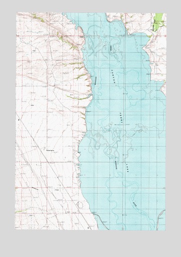
Townsend NE, MT USGS Topographic Map
Click on map above to begin viewing in our Map Viewer.

This topographic map contains these locations and features:
Feature Name Type Latitude Longitude GNIS ID View Map
07N01E03CDDD01 WellWellN46.3852°W111.5897°815933View Map
07N01E03CDDD02 WellWellN46.3852°W111.5897°815934View Map
07N02E05AB__01 WellWellN46.3977°W111.5014°816030View Map
07N02E05AB__02 WellWellN46.3977°W111.5014°816031View Map
07N02E05AB__03 WellWellN46.3977°W111.5014°816032View Map
07N02E05BD__01 WellWellN46.3941°W111.5066°815994View Map
07N02E05BD__02 WellWellN46.3941°W111.5066°815995View Map
07N02E05BD__03 WellWellN46.3941°W111.5066°815996View Map
07N02E05BD__04 WellWellN46.3941°W111.5066°815997View Map
07N02E05CD__01 WellWellN46.3869°W111.5066°815952View Map
07N02E05CD__02 WellWellN46.3869°W111.5066°815953View Map
07N02E05DC__01 WellWellN46.3869°W111.5014°815950View Map
07N02E05DC__02 WellWellN46.3869°W111.5014°815951View Map
07N02E06DA__01 WellWellN46.3905°W111.5172°815977View Map
07N02E06DA__02 WellWellN46.3905°W111.5172°815978View Map
08N01E21BA__01 SpringSpringN46.4410°W111.6119°816280View Map
08N01E21BD__01 SpringSpringN46.4365°W111.6110°816269View Map
08N01E28AD__01 SpringSpringN46.4230°W111.6014°816181View Map
08N02E06AC__01 WellWellN46.4819°W111.5225°816475View Map
08N02E06DB__01 WellWellN46.4780°W111.5225°816456View Map
08N02E06DB__02 WellWellN46.4780°W111.5225°816457View Map
08N02E07AA__01 WellWellN46.4708°W111.5172°816411View Map
08N02E07AA__02 WellWellN46.4708°W111.5172°816412View Map
08N02E08CA__01 WellWellN46.4635°W111.5066°816387View Map
08N02E17BB__01 WellWellN46.4560°W111.5119°816357View Map
08N02E18AD__01 WellWellN46.4524°W111.5172°816336View Map
08N02E20CD__01 WellWellN46.4305°W111.5066°816222View Map
08N02E20CD__02 WellWellN46.4305°W111.5066°816223View Map
08N02E29BD__01 WellWellN46.4230°W111.5066°816180View Map
08N02E29DC__01 WellWellN46.4158°W111.5014°816133View Map
08N02E29DC__02 WellWellN46.4158°W111.5014°816134View Map
08N02E30CC__01 WellWellN46.4158°W111.5330°816135View Map
08N02E32BA__01 WellWellN46.4122°W111.5066°816108View Map
08N02E32BA__02 WellWellN46.4122°W111.5066°816109View Map
08N02E32BA__03 WellWellN46.4122°W111.5066°816110View Map
08N02E32CD__01 WellWellN46.4010°W111.5066°816050View Map
08N02E32CD__02 WellWellN46.4010°W111.5066°816051View Map
08N02E32DB__01 WellWellN46.4047°W111.5014°816070View Map
08N02E32DB__02 WellWellN46.4047°W111.5014°816071View Map
09N01E34AA__01 WellWellN46.4994°W111.5805°816540View Map
09N01E35CB__01 WellWellN46.4922°W111.5752°816506View Map
09N01E35CB__02 WellWellN46.4922°W111.5752°816507View Map
09N01E36DA__01 WellWellN46.4922°W111.5389°816504View Map
09N01E36DA__02 WellWellN46.4922°W111.5389°816505View Map
09N02E31DA__01 WellWellN46.4905°W111.5161°816499View Map
Antelope SpringsSpringN46.4199°W111.5991°806274View Map
CantonPopulated PlaceN46.4138°W111.5033°769566View Map
Canton Post Office (historical)Post OfficeN46.4138°W111.5033°1762155View Map
Canyon Ferry AirportAirportN46.4149°W111.5780°806540View Map
Clow (historical)LocaleN46.4194°W111.6208°1762209View Map
Confederate GulchValleyN46.4810°W111.5405°781564View Map
Congdon CreekStreamN46.4894°W111.5125°781565View Map
Duck CreekStreamN46.4530°W111.5169°782677View Map
Fairview CemeteryCemeteryN46.4558°W111.5036°771290View Map
Horse CreekStreamN46.4822°W111.5405°785037View Map
Magnolia Post Office (historical)Post OfficeN46.4702°W111.5536°1762163View Map
Silos CampgroundLocaleN46.4133°W111.5764°1762261View Map
Silos Recreation AreaParkN46.4133°W111.5764°1762260View Map
Silos RV ParkLocaleN46.4133°W111.5764°1762258View Map
Thars Gold in Them Thar Hills Historical MarkerParkN46.4258°W111.6097°1762272View Map
The Silos Census Designated PlaceCensusN46.3984°W111.5865°2583858View Map
Whitehorse CreekStreamN46.4013°W111.5697°793227View Map

Note: Coordinates in the location and feature list above are referenced to NAD83 datum.


Copyright (C) 2008-2025 Ryan Niemi / Sunset Dynamics ... All Rights Reserved