TopoQuest Logo
Do you find TopoQuest useful?
Help keep TopoQuest running and adding new maps/features by donating!
Bitcoin:  19c7KJd3qBynnjoSw5npx9KScwjBe4ifkT
Litecoin:  LXs6TkuXGGXo1vDsWCkWVdjQX94eUKd6ui
Home View Maps Find Maps Find Places Resources & Links


Gurnett Creek West, Montana Topographic Map

USGS Map Title: Gurnett Creek West, MT
USGS Map MRC: 46111D4
DRG (GeoTIFF) Download: o46111d4.tif


Neighboring USGS Topographic Map Quads:


  Canyon Ferry SE, MT  
46111E5
 

  Diamond City, MT  
46111E4
 

  Boulder Baldy, MT  
46111E3
 

  Townsend NE, MT  
46111D5
 

  Gurnett Creek West, MT  
46111D4
 

  Gurnett Creek East, MT  
46111D3
 

  Townsend, MT  
46111C5
 

  Holker, MT  
46111C4
 

  Lippert Gulch, MT  
46111C3


Map MRC Location:

N47°
W112°
N47°
W111°
H8 H7 H6 H5 H4 H3 H2 H1
G8 G7 G6 G5 G4 G3 G2 G1
F8 F7 F6 F5 F4 F3 F2 F1
E8 E7 E6 E5 E4 E3 E2 E1
D8 D7 D6 D5 D4 D3 D2 D1
C8 C7 C6 C5 C4 C3 C2 C1
B8 B7 B6 B5 B4 B3 B2 B1
A8 A7 A6 A5 A4 A3 A2 A1
N46°
W112°
N46°
W111°

Gurnett Creek West, MT USGS 1:24K Topographic Map Preview:
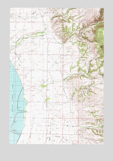
Gurnett Creek West, MT USGS Topographic Map
Click on map above to begin viewing in our Map Viewer.

This topographic map contains these locations and features:
Feature Name Type Latitude Longitude GNIS ID View Map
07N02E02BB__01 SpringSpringN46.3977°W111.4489°816023View Map
07N02E02BD__01 WellWellN46.3941°W111.4436°815988View Map
07N02E02CA__01 SpringSpringN46.3905°W111.4436°815974View Map
07N02E03AD__01 WellWellN46.3941°W111.4541°815989View Map
07N02E03ADDA01 WellWellN46.3924°W111.4522°815985View Map
07N02E03BC__01 WellWellN46.3941°W111.4700°815990View Map
07N02E03BC__02 WellWellN46.3941°W111.4700°815991View Map
07N02E03BCBA01 WellWellN46.3949°W111.4708°816002View Map
07N02E03CB__01 WellWellN46.3905°W111.4700°815975View Map
07N02E04AA__01 WellWellN46.3977°W111.4750°816024View Map
07N02E04AB__01 WellWellN46.3977°W111.4802°816025View Map
07N02E04AD__01 WellWellN46.3941°W111.4750°815992View Map
07N02E04AD__02 WellWellN46.3941°W111.4750°815993View Map
07N02E04BA__01 WellWellN46.3977°W111.4855°816026View Map
07N02E04BA__02 WellWellN46.3977°W111.4855°816027View Map
07N02E04BA__03 WellWellN46.3977°W111.4855°816028View Map
07N02E04BA__04 WellWellN46.3977°W111.4855°816029View Map
07N02E04CD__01 WellWellN46.3869°W111.4855°815948View Map
07N02E04CD__02 WellWellN46.3869°W111.4855°815949View Map
07N02E04DB__01 WellWellN46.3905°W111.4802°815976View Map
07N02E04DD__01 WellWellN46.3869°W111.4750°815945View Map
07N02E04DD__02 WellWellN46.3869°W111.4750°815946View Map
07N02E04DD__03 WellWellN46.3869°W111.4750°815947View Map
07N02E08AA__01 WellWellN46.3833°W111.4961°815921View Map
07N02E08AD__01 WellWellN46.3797°W111.4961°815885View Map
07N02E08AD__02 WellWellN46.3797°W111.4961°815886View Map
07N02E08AD__03 WellWellN46.3797°W111.4961°815887View Map
07N02E09AA__01 WellWellN46.3833°W111.4750°815916View Map
07N02E09AABB01 WellWellN46.3841°W111.4766°815927View Map
07N02E09AB__01 WellWellN46.3833°W111.4802°815917View Map
07N02E09AC__01 WellWellN46.3797°W111.4802°815883View Map
07N02E09AC__02 WellWellN46.3797°W111.4802°815884View Map
07N02E09BA__01 WellWellN46.3833°W111.4855°815918View Map
07N02E09BA__02 WellWellN46.3833°W111.4855°815919View Map
07N02E09BA__03 WellWellN46.3833°W111.4855°815920View Map
07N02E09CA__01 WellWellN46.3760°W111.4855°815860View Map
07N02E09DA__01 WellWellN46.3760°W111.4750°815858View Map
07N02E09DB__01 WellWellN46.3760°W111.4802°815859View Map
07N02E10AD__01 WellWellN46.3797°W111.4541°815881View Map
07N02E10BB__01 WellWellN46.3833°W111.4700°815915View Map
07N02E10BD__01 WellWellN46.3797°W111.4647°815882View Map
07N02E10DA__01 WellWellN46.3760°W111.4541°815857View Map
08N02E03DC__01 WellWellN46.4744°W111.4594°816432View Map
08N02E03DC__02 WellWellN46.4744°W111.4594°816433View Map
08N02E03DD__01 WellWellN46.4744°W111.4541°816431View Map
08N02E09BC__01 WellWellN46.4672°W111.4908°816392View Map
08N02E10AA__01 WellWellN46.4708°W111.4541°816410View Map
08N02E11AB__01 WellWellN46.4708°W111.4383°816409View Map
08N02E14BB__01 WellWellN46.4560°W111.4489°816356View Map
08N02E14BBBC01 WellWellN46.4558°W111.4494°816354View Map
08N02E20AA__01 WellWellN46.4413°W111.4961°816282View Map
08N02E21CA__01 WellWellN46.4341°W111.4855°816250View Map
08N02E21CD__01 WellWellN46.4305°W111.4855°816221View Map
08N02E23CBBA01 WellWellN46.4347°W111.4489°816255View Map
08N02E23CC__01 WellWellN46.4305°W111.4489°816218View Map
08N02E23CC__02 WellWellN46.4305°W111.4489°816219View Map
08N02E23CC__03 WellWellN46.4305°W111.4489°816220View Map
08N02E28AC__01 WellWellN46.4230°W111.4802°816177View Map
08N02E28AC__02 WellWellN46.4230°W111.4802°816178View Map
08N02E28CB__01 WellWellN46.4194°W111.4908°816153View Map
08N02E28CD__01 WellWellN46.4158°W111.4855°816130View Map
08N02E29AD__01 WellWellN46.4230°W111.4961°816179View Map
08N02E29DD__01 WellWellN46.4158°W111.4961°816131View Map
08N02E29DD__02 WellWellN46.4158°W111.4961°816132View Map
08N02E32AA__01 WellWellN46.4122°W111.4961°816107View Map
08N02E33BC__01 WellWellN46.4085°W111.4908°816082View Map
08N02E33BC__02 WellWellN46.4085°W111.4908°816083View Map
08N02E33BC__03 WellWellN46.4085°W111.4908°816084View Map
08N02E33DA__01 WellWellN46.4047°W111.4750°816066View Map
08N02E33DB__01 WellWellN46.4047°W111.4802°816067View Map
08N02E33DB__02 WellWellN46.4047°W111.4802°816068View Map
08N02E33DB__03 WellWellN46.4047°W111.4802°816069View Map
08N02E34BA__01 WellWellN46.4122°W111.4647°816106View Map
08N02E34CB__01 WellWellN46.4047°W111.4700°816065View Map
08N02E34CD__01 WellWellN46.4010°W111.4647°816049View Map
08N02E35BCDD01 WellWellN46.4063°W111.4466°816075View Map
08N03E30AA__01 WellWellN46.4247°W111.3908°816190View Map
08N03E30AA__02 WellWellN46.4247°W111.3908°816191View Map
09N02E33CD__01 WellWellN46.4869°W111.4844°816491View Map
09N02E34DAAA01 WellWellN46.4935°W111.4519°816512View Map
Black ButteSummitN46.4647°W111.3772°806273View Map
Canton School (historical)SchoolN46.4141°W111.4833°769567View Map
Doggett RanchLocaleN46.4958°W111.4511°770707View Map
Domer RanchLocaleN46.4697°W111.4244°770714View Map
Dry GulchValleyN46.4155°W111.4222°794776View Map
Duck Creek Fire DepartmentBuildingN46.4719°W111.4519°2546649View Map
Duck Creek School (historical)SchoolN46.4713°W111.4519°770874View Map
Duck Fields DamDamN46.4883°W111.4675°798469View Map
Gurnett CreekStreamN46.4194°W111.4766°784419View Map
Highland DitchCanalN46.4297°W111.4277°772394View Map
Irish DitchCanalN46.3810°W111.4877°772718View Map
Little Cottonwood CreekStreamN46.3797°W111.4611°806271View Map
Mahoney RanchLocaleN46.4210°W111.4947°773819View Map
Marks RanchLocaleN46.3930°W111.4455°773888View Map
Mary Smith RanchLocaleN46.4302°W111.4477°773912View Map
Merritt RanchLocaleN46.4016°W111.4669°774113View Map
Middle Fork Duck CreekStreamN46.4866°W111.3783°787270View Map
Mill GulchValleyN46.4727°W111.4002°794777View Map
Montana DitchCanalN46.3927°W111.4700°774344View Map
Myer RanchLocaleN46.4291°W111.4864°774531View Map
NE NW Section 5 MineMineN46.4838°W111.3800°802671View Map
North Fork Duck CreekStreamN46.4714°W111.4837°778823View Map
North Fork Ray CreekStreamN46.3908°W111.3800°788233View Map
NW SE Section 5 MineMineN46.4777°W111.3769°802534View Map
NW SE Section 6 MineMineN46.4747°W111.3936°802672View Map
Rattlesnake GulchValleyN46.4388°W111.3969°806270View Map
Ray CreekStreamN46.3948°W111.4695°775604View Map
Roberts SpringSpringN46.4534°W111.3881°806272View Map
Round Grove RanchLocaleN46.4180°W111.4511°775983View Map
Saint Josephs ChurchChurchN46.4074°W111.4452°776115View Map
Townsend East DivisionCivilN46.4266°W111.3781°1940729View Map
Weiferich RanchLocaleN46.4047°W111.4819°778171View Map
Whaley RanchLocaleN46.3852°W111.4725°778333View Map
Whaley School (historical)SchoolN46.3835°W111.4719°778334View Map
Yankee DitchCanalN46.4019°W111.4941°778722View Map

Note: Coordinates in the location and feature list above are referenced to NAD83 datum.


Copyright (C) 2008-2025 Ryan Niemi / Sunset Dynamics ... All Rights Reserved