TopoQuest Logo
Do you find TopoQuest useful?
Help keep TopoQuest running and adding new maps/features by donating!
Bitcoin:  19c7KJd3qBynnjoSw5npx9KScwjBe4ifkT
Litecoin:  LXs6TkuXGGXo1vDsWCkWVdjQX94eUKd6ui
Home View Maps Find Maps Find Places Resources & Links


Holker, Montana Topographic Map

USGS Map Title: Holker, MT
USGS Map MRC: 46111C4
DRG (GeoTIFF) Download: o46111c4.tif


Neighboring USGS Topographic Map Quads:


  Townsend NE, MT  
46111D5
 

  Gurnett Creek West, MT  
46111D4
 

  Gurnett Creek East, MT  
46111D3
 

  Townsend, MT  
46111C5
 

  Holker, MT  
46111C4
 

  Lippert Gulch, MT  
46111C3
 

  Parker, MT  
46111B5
 

  Toston, MT  
46111B4
 

  Deer Park, MT  
46111B3


Map MRC Location:

N47°
W112°
N47°
W111°
H8 H7 H6 H5 H4 H3 H2 H1
G8 G7 G6 G5 G4 G3 G2 G1
F8 F7 F6 F5 F4 F3 F2 F1
E8 E7 E6 E5 E4 E3 E2 E1
D8 D7 D6 D5 D4 D3 D2 D1
C8 C7 C6 C5 C4 C3 C2 C1
B8 B7 B6 B5 B4 B3 B2 B1
A8 A7 A6 A5 A4 A3 A2 A1
N46°
W112°
N46°
W111°

Holker, MT USGS 1:24K Topographic Map Preview:
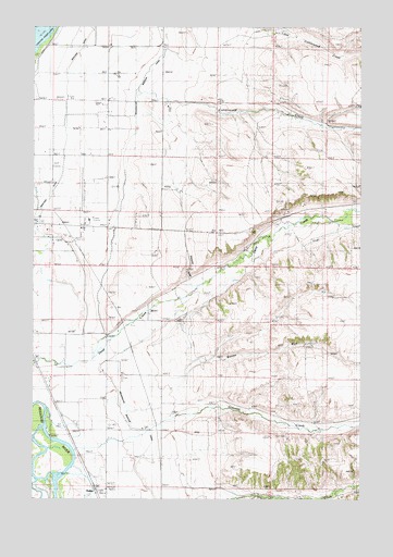
Holker, MT USGS Topographic Map
Click on map above to begin viewing in our Map Viewer.

This topographic map contains these locations and features:
Feature Name Type Latitude Longitude GNIS ID View Map
06N02E02AA__01 WellWellN46.3099°W111.4333°815330View Map
06N02E02CA__01 WellWellN46.3027°W111.4439°815261View Map
06N02E02DB__01 WellWellN46.3027°W111.4386°815260View Map
06N02E03DD__01 WellWellN46.2991°W111.4544°815229View Map
06N02E04AC__01 WellWellN46.3063°W111.4805°815295View Map
06N02E04BC__01 WellWellN46.3063°W111.4911°815297View Map
06N02E04BD__01 WellWellN46.3063°W111.4858°815296View Map
06N02E04CD__01 WellWellN46.2991°W111.4858°815230View Map
06N02E04CD__02 WellWellN46.2991°W111.4858°815231View Map
06N02E04DB__01 WellWellN46.3027°W111.4805°815262View Map
06N02E05DA__01 WellWellN46.3027°W111.4964°815263View Map
06N02E08AACC01 WellWellN46.2938°W111.4989°815158View Map
06N02E09BA__01 WellWellN46.2952°W111.4858°815170View Map
06N02E09BA__02 WellWellN46.2952°W111.4858°815171View Map
06N02E09BA__03 WellWellN46.2952°W111.4858°815172View Map
06N02E09BACD01 WellWellN46.2944°W111.4855°815162View Map
06N02E09BB__01 WellWellN46.2952°W111.4911°815173View Map
06N02E09BB__02 WellWellN46.2952°W111.4911°815174View Map
06N02E09BC__01 WellWellN46.2916°W111.4911°815135View Map
06N02E09CB__01 WellWellN46.2880°W111.4911°815101View Map
06N02E09CC__01 WellWellN46.2844°W111.4911°815065View Map
06N02E09CD__01 WellWellN46.2844°W111.4858°815064View Map
06N02E09DD__01 WellWellN46.2844°W111.4752°815062View Map
06N02E09DD__02 WellWellN46.2844°W111.4752°815063View Map
06N02E10BA__01 WellWellN46.2952°W111.4650°815169View Map
06N02E11BB__01 WellWellN46.2952°W111.4491°815168View Map
06N02E12AA__01 WellWellN46.2952°W111.4122°815167View Map
06N02E14CA__01 WellWellN46.2735°W111.4439°814987View Map
06N02E14CC__01 WellWellN46.2699°W111.4491°814964View Map
06N02E15BB__01 WellWellN46.2808°W111.4702°815039View Map
06N02E15DC__01 WellWellN46.2699°W111.4597°814965View Map
06N02E16AA__01 WellWellN46.2808°W111.4752°815040View Map
06N02E16BB__01 WellWellN46.2808°W111.4911°815041View Map
06N02E16BBAA01 WellWellN46.2819°W111.4894°815043View Map
06N02E16CD__01 WellWellN46.2699°W111.4858°814966View Map
06N02E16DB__01 WellWellN46.2735°W111.4805°814988View Map
06N02E17AD__01 WellWellN46.2772°W111.4964°815018View Map
06N02E21AB__01 WellWellN46.2660°W111.4805°814931View Map
06N02E21DAAA01 WellWellN46.2605°W111.4733°814887View Map
06N02E22AB__01 WellWellN46.2660°W111.4597°814928View Map
06N02E22BB__01 WellWellN46.2660°W111.4702°814929View Map
06N02E22BB__02 WellWellN46.2660°W111.4702°814930View Map
06N02E23ABAB01 WellWellN46.2672°W111.4377°814945View Map
06N02E23DBCA01 WellWellN46.2583°W111.4394°814868View Map
06N02E27BB__01 WellWellN46.2516°W111.4702°814796View Map
06N02E27BB__02 WellWellN46.2516°W111.4702°814797View Map
06N02E28AA__01 WellWellN46.2516°W111.4752°814798View Map
06N02E28AA__02 WellWellN46.2516°W111.4752°814799View Map
07N02E08DD__01 WellWellN46.3724°W111.4961°815829View Map
07N02E09CC__01 WellWellN46.3724°W111.4908°815826View Map
07N02E09CC__02 WellWellN46.3724°W111.4908°815827View Map
07N02E09CC__03 WellWellN46.3724°W111.4908°815828View Map
07N02E09CD__01 WellWellN46.3724°W111.4855°815825View Map
07N02E10CC__01 WellWellN46.3724°W111.4700°815824View Map
07N02E15CB__01 WellWellN46.3616°W111.4700°815729View Map
07N02E15CBAB01 WellWellN46.3619°W111.4689°815735View Map
07N02E15CC__01 WellWellN46.3580°W111.4700°815700View Map
07N02E16BA__01 WellWellN46.3688°W111.4855°815787View Map
07N02E16BB__01 WellWellN46.3688°W111.4908°815788View Map
07N02E16CC__01 WellWellN46.3580°W111.4908°815702View Map
07N02E16CD__01 WellWellN46.3580°W111.4855°815701View Map
07N02E17AA__01 WellWellN46.3688°W111.4961°815789View Map
07N02E17DA__01 WellWellN46.3616°W111.4961°815730View Map
07N02E20DD__01 WellWellN46.3433°W111.4961°815609View Map
07N02E20DDCD01 WellWellN46.3419°W111.4964°815599View Map
07N02E21CC__01 WellWellN46.3433°W111.4908°815608View Map
07N02E21DCDD01 WellWellN46.3410°W111.4789°815596View Map
07N02E22BB__01 WellWellN46.3541°W111.4700°815662View Map
07N02E22CB__01 WellWellN46.3469°W111.4700°815630View Map
07N02E27CC__01 WellWellN46.3288°W111.4700°815493View Map
07N02E28AD__01 WellWellN46.3360°W111.4750°815548View Map
07N02E28BC__01 WellWellN46.3360°W111.4908°815549View Map
07N02E29DDCD01 WellWellN46.3266°W111.4989°815476View Map
07N02E32DA__01 WellWellN46.3180°W111.4961°815399View Map
07N02E33ABCD01 WellWellN46.3233°W111.4839°815442View Map
07N02E33CBBC01 WellWellN46.3177°W111.4933°815396View Map
07N02E33CD__01 WellWellN46.3144°W111.4855°815362View Map
07N02E33CD__02 WellWellN46.3144°W111.4855°815363View Map
07N02E33CD__03 WellWellN46.3144°W111.4855°815364View Map
07N02E33CDDA01 WellWellN46.3130°W111.4811°815351View Map
07N02E34ABBD01 WellWellN46.3247°W111.4605°815459View Map
07N02E36DB__01 WellWellN46.3180°W111.4172°815398View Map
07N03E07BBBC01 WellWellN46.3741°W111.4083°815845View Map
07N03E29CC__01 WellWellN46.3277°W111.3866°815488View Map
07N03E31BB__01 WellWellN46.3241°W111.4075°815453View Map
07N03E31BB__02 WellWellN46.3241°W111.4075°815454View Map
07N03E31BB__03 WellWellN46.3241°W111.4075°815455View Map
Boone RunStreamN46.2758°W111.4722°806264View Map
Broadwater CountyCivilN46.3324°W111.4955°1719625View Map
Broadwater County Fair and Rodeo GroundsLocaleN46.3235°W111.4800°1762264View Map
Broadwater County Rest HomeHospitalN46.3216°W111.4905°1762252View Map
Cottonwood CreekStreamN46.3627°W111.4877°781721View Map
Daniels RanchLocaleN46.3535°W111.4130°770452View Map
Deep Creek (historical)Populated PlaceN46.3222°W111.4230°1762206View Map
Deep Creek CemeteryCemeteryN46.2819°W111.4652°1762266View Map
Deep Dale Fishing Access SiteLocaleN46.2760°W111.4964°1744445View Map
Deepdale Post Office (historical)Post OfficeN46.2860°W111.4675°1762158View Map
Diamond GulchValleyN46.3085°W111.4414°806263View Map
Fairchild DitchCanalN46.2544°W111.4416°771286View Map
Greyson CreekStreamN46.2633°W111.4850°784331View Map
HolkerPopulated PlaceN46.2544°W111.4780°772471View Map
Holy Cross CemeteryCemeteryN46.3183°W111.4838°772489View Map
Manley DitchCanalN46.3541°W111.4925°773859View Map
Old Baldy Golf CourseLocaleN46.3374°W111.4925°1762265View Map
Townsend AirportAirportN46.3275°W111.4811°806539View Map
Townsend ReservoirReservoirN46.3144°W111.4605°777722View Map
Townsend ValleyValleyN46.3035°W111.4950°777723View Map
Welch RanchLocaleN46.2660°W111.4719°778177View Map
Yorks IslandsIslandN46.2624°W111.4911°1853836View Map

Note: Coordinates in the location and feature list above are referenced to NAD83 datum.


Copyright (C) 2008-2024 Ryan Niemi / Sunset Dynamics ... All Rights Reserved