TopoQuest Logo
Do you find TopoQuest useful?
Help keep TopoQuest running and adding new maps/features by donating!
Bitcoin:  19c7KJd3qBynnjoSw5npx9KScwjBe4ifkT
Litecoin:  LXs6TkuXGGXo1vDsWCkWVdjQX94eUKd6ui
Home View Maps Find Maps Find Places Resources & Links


Waters Lake, Florida Topographic Map

USGS Map Title: Waters Lake, FL
USGS Map MRC: 29082F6
DRG (GeoTIFF) Download: o29082f6.tif


Neighboring USGS Topographic Map Quads:


  Bell, FL  
29082G7
 

  High Springs SW, FL  
29082G6
 

  High Springs, FL  
29082G5
 

  Fourmile Lake, FL  
29082F7
 

  Waters Lake, FL  
29082F6
 

  Newberry, FL  
29082F5
 

  Trenton, FL  
29082E7
 

  Newberry SW, FL  
29082E6
 

  Archer, FL  
29082E5


Map MRC Location:

N30°
W83°
N30°
W82°
H8 H7 H6 H5 H4 H3 H2 H1
G8 G7 G6 G5 G4 G3 G2 G1
F8 F7 F6 F5 F4 F3 F2 F1
E8 E7 E6 E5 E4 E3 E2 E1
D8 D7 D6 D5 D4 D3 D2 D1
C8 C7 C6 C5 C4 C3 C2 C1
B8 B7 B6 B5 B4 B3 B2 B1
A8 A7 A6 A5 A4 A3 A2 A1
N29°
W83°
N29°
W82°

Waters Lake, FL USGS 1:24K Topographic Map Preview:
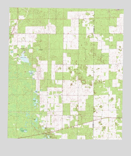
Waters Lake, FL USGS Topographic Map
Click on map above to begin viewing in our Map Viewer.

This topographic map contains these locations and features:
Feature Name Type Latitude Longitude GNIS ID View Map
Bogg PondLakeN29.7040°W82.7398°279132View Map
Camp PondLakeN29.6826°W82.7233°279928View Map
Center Hill ChurchChurchN29.7258°W82.7407°280238View Map
Christmas LakeLakeN29.6884°W82.7250°280434View Map
Clear PondLakeN29.6354°W82.7107°280537View Map
Corinth ChurchChurchN29.7052°W82.6476°280831View Map
Dinner PondLakeN29.6704°W82.7192°281576View Map
Dry Prairie HammockIslandN29.7091°W82.7165°281802View Map
Fivemile PondLakeN29.6596°W82.7199°282533View Map
Gilchrist County Fire and Rescue Station 4BuildingN29.6369°W82.6899°2644354View Map
Iris Railroad StationLocaleN29.6480°W82.6732°300167View Map
Jeb Knight PondLakeN29.6431°W82.7187°284733View Map
Knighting LakeLakeN29.6324°W82.7325°285163View Map
Leech PondLakeN29.6269°W82.7049°285439View Map
Mona Railroad StationLocaleN29.6477°W82.6604°300166View Map
Oak Tree LandingAirportN29.7203°W82.6575°309490View Map
Osceola CemeteryCemeteryN29.7402°W82.6648°288261View Map
Rush AirportAirportN29.6909°W82.7303°2676656View Map
ThamesPopulated PlaceN29.6805°W82.6921°300168View Map
Thames Junction (historical)LocaleN29.7002°W82.6651°300169View Map
Union ChurchChurchN29.6464°W82.6821°292659View Map
Waters LakeLakeN29.7023°W82.7328°292935View Map
Waters LakePopulated PlaceN29.7091°W82.7326°292936View Map

Note: Coordinates in the location and feature list above are referenced to NAD83 datum.


Copyright (C) 2008-2025 Ryan Niemi / Sunset Dynamics ... All Rights Reserved