TopoQuest Logo
Do you find TopoQuest useful?
Help keep TopoQuest running and adding new maps/features by donating!
Bitcoin:  19c7KJd3qBynnjoSw5npx9KScwjBe4ifkT
Litecoin:  LXs6TkuXGGXo1vDsWCkWVdjQX94eUKd6ui
Home View Maps Find Maps Find Places Resources & Links


Trenton East, Missouri Topographic Map

USGS Map Title: Trenton East, MO
USGS Map MRC: 40093A5
DRG (GeoTIFF) Download: o40093a5.tif


Neighboring USGS Topographic Map Quads:


  Brimson, MO  
40093B6
 

  Spickard, MO  
40093B5
 

  Galt, MO  
40093B4
 

  Trenton West, MO  
40093A6
 

  Trenton East, MO  
40093A5
 

  Laredo, MO  
40093A4
 

  Shearwood, MO  
39093H6
 

  Farmersville, MO  
39093H5
 

  Chula, MO  
39093H4


Map MRC Location:

N41°
W94°
N41°
W93°
H8 H7 H6 H5 H4 H3 H2 H1
G8 G7 G6 G5 G4 G3 G2 G1
F8 F7 F6 F5 F4 F3 F2 F1
E8 E7 E6 E5 E4 E3 E2 E1
D8 D7 D6 D5 D4 D3 D2 D1
C8 C7 C6 C5 C4 C3 C2 C1
B8 B7 B6 B5 B4 B3 B2 B1
A8 A7 A6 A5 A4 A3 A2 A1
N40°
W94°
N40°
W93°

Trenton East, MO USGS 1:24K Topographic Map Preview:
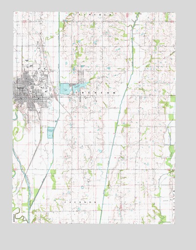
Trenton East, MO USGS Topographic Map
Click on map above to begin viewing in our Map Viewer.

This topographic map contains these locations and features:
Feature Name Type Latitude Longitude GNIS ID View Map
Baker SchoolSchoolN40.1047°W93.6041°713577View Map
Beckner BranchStreamN40.0425°W93.5033°713846View Map
Belshe SchoolSchoolN40.0467°W93.5708°713936View Map
City of TrentonCivilN40.0819°W93.6030°2397050View Map
County Farm CemeteryCemeteryN40.0945°W93.5474°1782161View Map
Drummond CemeteryCemeteryN40.1053°W93.5724°1782162View Map
Fairview ChurchChurchN40.0039°W93.5802°717789View Map
Grummond CemeteryCemeteryN40.1047°W93.5716°718909View Map
Grundy Center CemeteryCemeteryN40.1192°W93.5585°1782163View Map
Grundy Center ChurchChurchN40.1183°W93.5572°718910View Map
Grundy Center SchoolSchoolN40.1220°W93.5569°718911View Map
Grundy CountyCivilN40.1139°W93.5653°758494View Map
Grundy County HomeBuildingN40.0906°W93.5561°741505View Map
Grundy County Rural Fire Protection District Station 1BuildingN40.0822°W93.6088°2621472View Map
Grundy County Sheriff's OfficeBuildingN40.0732°W93.6194°2752117View Map
Independence School (historical)SchoolN40.0161°W93.5313°720099View Map
KTTN-AM (Trenton)TowerN40.0833°W93.5586°759286View Map
KTTN-FM (Trenton)TowerN40.0833°W93.5586°754232View Map
Lake TrentonReservoirN40.0792°W93.5801°737952View Map
Lancaster CemeteryCemeteryN40.0945°W93.5794°1782164View Map
Mack and Woodard Lake Section 35 DamDamN40.0433°W93.5569°762438View Map
Mount Pleasant School (historical)SchoolN40.1017°W93.5141°722877View Map
Muddy CreekStreamN40.0078°W93.6119°723039View Map
Old Channel Thompson RiverStreamN40.0000°W93.6122°723739View Map
Old City CemeteryCemeteryN40.0686°W93.6160°1782169View Map
Pleasant View Elementary SchoolSchoolN40.0448°W93.5223°2545187View Map
Prairie View ChurchChurchN40.0464°W93.5274°724895View Map
Ream School (historical)SchoolN40.0756°W93.5602°725146View Map
Redenbaugh CemeteryCemeteryN40.0395°W93.5385°1782166View Map
Reed School (historical)SchoolN40.0570°W93.5280°725191View Map
Resthaven CemeteryCemeteryN40.1203°W93.6049°1782167View Map
Saint Joseph Catholic CemeteryCemeteryN40.0681°W93.6202°1782170View Map
Section BranchStreamN40.0150°W93.5110°726179View Map
Skinner CemeteryCemeteryN40.0217°W93.5863°1782168View Map
Skinner School (historical)SchoolN40.0142°W93.5785°726513View Map
Tipton Lake DamDamN40.1067°W93.5752°762443View Map
Township of TrentonCivilN40.0756°W93.5750°766710View Map
TrentonPopulated PlaceN40.0789°W93.6166°727769View Map
Trenton Fire DepartmentBuildingN40.0822°W93.6087°2621254View Map
Trenton High SchoolSchoolN40.0807°W93.6017°2545150View Map
Trenton Junction (historical)LocaleN40.0986°W93.6183°740273View Map
Trenton Lower LakeReservoirN40.0795°W93.5850°760776View Map
Trenton Lower Lake DamDamN40.0750°W93.5852°760775View Map
Trenton Middle SchoolSchoolN40.0808°W93.6015°2545281View Map
Trenton Municipal AirportAirportN40.0791°W93.5917°758969View Map
Trenton Police DepartmentBuildingN40.0731°W93.6193°2752402View Map
Trenton Post OfficePost OfficeN40.0763°W93.6188°2782568View Map
Trenton Upper LakeReservoirN40.0808°W93.5747°760774View Map
Trenton Upper Lake DamDamN40.0800°W93.5802°760773View Map
Wright Memorial HospitalHospitalN40.0676°W93.5815°2655018View Map

Note: Coordinates in the location and feature list above are referenced to NAD83 datum.


Copyright (C) 2008-2025 Ryan Niemi / Sunset Dynamics ... All Rights Reserved