TopoQuest Logo
Do you find TopoQuest useful?
Help keep TopoQuest running and adding new maps/features by donating!
Bitcoin:  19c7KJd3qBynnjoSw5npx9KScwjBe4ifkT
Litecoin:  LXs6TkuXGGXo1vDsWCkWVdjQX94eUKd6ui
Home View Maps Find Maps Find Places Resources & Links


Triple Springs, North Carolina Topographic Map

USGS Map Title: Triple Springs, NC
USGS Map MRC: 36078D7
DRG (GeoTIFF) Download: o36078d7.tif


Neighboring USGS Topographic Map Quads:


  Cluster Springs, VA  
36078E8
 

  Virgilina, VA  
36078E7
 

  Nelson, VA  
36078E6
 

  Roxboro, NC  
36078D8
 

  Triple Springs, NC  
36078D7
 

  Satterwhite, NC  
36078D6
 

  Timberlake, NC  
36078C8
 

  Moriah, NC  
36078C7
 

  Berea, NC  
36078C6


Map MRC Location:

N37°
W79°
N37°
W78°
H8 H7 H6 H5 H4 H3 H2 H1
G8 G7 G6 G5 G4 G3 G2 G1
F8 F7 F6 F5 F4 F3 F2 F1
E8 E7 E6 E5 E4 E3 E2 E1
D8 D7 D6 D5 D4 D3 D2 D1
C8 C7 C6 C5 C4 C3 C2 C1
B8 B7 B6 B5 B4 B3 B2 B1
A8 A7 A6 A5 A4 A3 A2 A1
N36°
W79°
N36°
W78°

Triple Springs, NC USGS 1:24K Topographic Map Preview:
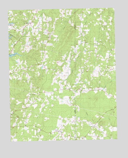
Triple Springs, NC USGS Topographic Map
Click on map above to begin viewing in our Map Viewer.

This topographic map contains these locations and features:
Feature Name Type Latitude Longitude GNIS ID View Map
Allensville Volunteer Fire DepartmentBuildingN36.3888°W78.8651°2639532View Map
Burma Church (historical)ChurchN36.4240°W78.8075°1951346View Map
CatilinaPopulated PlaceN36.3760°W78.8125°1951496View Map
Denny StorePopulated PlaceN36.3835°W78.8206°1019951View Map
Durgy MineMineN36.4438°W78.8308°1951349View Map
Five Fork School (historical)SchoolN36.4204°W78.8253°1951350View Map
GoshenLocaleN36.4035°W78.7539°1003739View Map
Goshen ChurchChurchN36.4024°W78.7614°985848View Map
Halloway (historical)Populated PlaceN36.4868°W78.8011°1951497View Map
Lawsons Chapel (historical)ChurchN36.4396°W78.8547°1951352View Map
Mount Gideon ChurchChurchN36.4188°W78.8475°990388View Map
Olive Branch Baptist ChurchChurchN36.4735°W78.8258°991636View Map
Olive Branch CemeteryCemeteryN36.4737°W78.8253°1951355View Map
Saint Pauls ChurchChurchN36.4321°W78.8542°994101View Map
Sappony State Designated Tribal Statistical AreaCensusN36.4931°W78.8584°2418630View Map
Sharon ChurchChurchN36.3876°W78.7764°1003738View Map
Sharon SchoolSchoolN36.3865°W78.7797°994596View Map
Smith SchoolSchoolN36.4835°W78.7622°994994View Map
Township of AllensvilleCivilN36.3944°W78.8585°1027044View Map
Township of HollowayCivilN36.4938°W78.8591°1027048View Map
Triple SpringsPopulated PlaceN36.4876°W78.8483°984230View Map
Triple Springs Volunteer Fire DepartmentBuildingN36.4852°W78.8471°2638334View Map
Vernon Hill ChurchChurchN36.4238°W78.8058°996607View Map
Webb ChurchChurchN36.4271°W78.8017°996912View Map

Note: Coordinates in the location and feature list above are referenced to NAD83 datum.


Copyright (C) 2008-2025 Ryan Niemi / Sunset Dynamics ... All Rights Reserved