TopoQuest Logo
Do you find TopoQuest useful?
Help keep TopoQuest running and adding new maps/features by donating!
Bitcoin:  19c7KJd3qBynnjoSw5npx9KScwjBe4ifkT
Litecoin:  LXs6TkuXGGXo1vDsWCkWVdjQX94eUKd6ui
Home View Maps Find Maps Find Places Resources & Links


Trout Creek, Montana Topographic Map

USGS Map Title: Trout Creek, MT
USGS Map MRC: 47115G5
DRG (GeoTIFF) Download: o47115g5.tif


Neighboring USGS Topographic Map Quads:


  Noxon Rapids Dam, MT  
47115H6
 

  Goat Peak, MT  
47115H5
 

  Silver Butte Pass, MT  
47115H4
 

  Larchwood, MT  
47115G6
 

  Trout Creek, MT  
47115G5
 

  Seven Point Mountain, MT  
47115G4
 

  Black Peak, MT  
47115F6
 

  Helwick Peak, MT  
47115F5
 

  Belknap, MT  
47115F4


Map MRC Location:

N48°
W116°
N48°
W115°
H8 H7 H6 H5 H4 H3 H2 H1
G8 G7 G6 G5 G4 G3 G2 G1
F8 F7 F6 F5 F4 F3 F2 F1
E8 E7 E6 E5 E4 E3 E2 E1
D8 D7 D6 D5 D4 D3 D2 D1
C8 C7 C6 C5 C4 C3 C2 C1
B8 B7 B6 B5 B4 B3 B2 B1
A8 A7 A6 A5 A4 A3 A2 A1
N47°
W116°
N47°
W115°

Trout Creek, MT USGS 1:24K Topographic Map Preview:
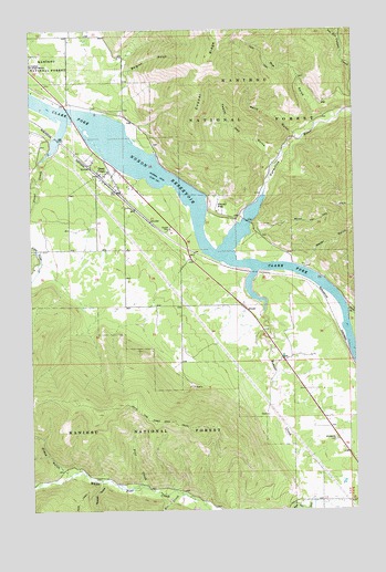
Trout Creek, MT USGS Topographic Map
Click on map above to begin viewing in our Map Viewer.

This topographic map contains these locations and features:
Feature Name Type Latitude Longitude GNIS ID View Map
24N31W05BCBA01 WellWellN47.8724°W115.6102°825136View Map
24N31W07AA__01 WellWellN47.8599°W115.6121°825110View Map
24N31W17DBAA01 WellWellN47.8391°W115.5952°825079View Map
24N31W17DDDC01 WellWellN47.8324°W115.5916°825058View Map
Alger (historical)LocaleN47.8027°W115.5107°1780977View Map
Alger Post Office (historical)Post OfficeN47.7902°W115.5288°1780955View Map
Beaver CreekStreamN47.8124°W115.5393°1890065View Map
Belgian GulchValleyN47.8541°W115.6021°779664View Map
Berry GulchValleyN47.8469°W115.5232°779728View Map
Canyon CreekStreamN47.8544°W115.5004°780904View Map
Copper RidgeRidgeN47.8624°W115.5607°781660View Map
Grays GulchValleyN47.7594°W115.6110°784253View Map
Honey FlatFlatN47.8283°W115.5513°784978View Map
Kirby GulchValleyN47.8019°W115.5038°785768View Map
Larchwood (historical)LocaleN47.8513°W115.6232°1780939View Map
Larchwood Post Office (historical)Post OfficeN47.8513°W115.6232°1780966View Map
North Shore CampgroundLocaleN47.8610°W115.6038°1780911View Map
Pine CreekStreamN47.7566°W115.5841°788879View Map
Reader GulchValleyN47.7574°W115.5957°789427View Map
Roe GulchValleyN47.8505°W115.5157°789742View Map
Schulder (historical)LocaleN47.8194°W115.5704°1780993View Map
Set CreekStreamN47.7541°W115.5679°790242View Map
Thompson Falls-West End DivisionCivilN47.8304°W115.6222°1940726View Map
Trout CreekPopulated PlaceN47.8369°W115.5982°792392View Map
Trout CreekStreamN47.8408°W115.6218°792401View Map
Trout CreekLocaleN47.8369°W115.5982°1780940View Map
Trout Creek Census Designated PlaceCensusN47.8331°W115.5836°2409350View Map
Trout Creek Community ChurchChurchN47.8372°W115.5968°1780866View Map
Trout Creek Community ClinicHospitalN47.8369°W115.5982°1780884View Map
Trout Creek Elementary SchoolSchoolN47.8374°W115.5991°1780848View Map
Trout Creek Motel and RV ParkLocaleN47.8369°W115.5982°1780904View Map
Trout Creek Post OfficePost OfficeN47.8364°W115.5882°1780965View Map
Trout Creek Rural Fire DepartmentBuildingN47.8334°W115.5869°2546648View Map
Twenty Odd (historical)LocaleN47.8410°W115.5329°1781032View Map
Twenty Odd GulchValleyN47.8399°W115.5318°792489View Map
Vermilion Post Office (historical)Post OfficeN47.8124°W115.5177°1781030View Map
Vermilion RiverStreamN47.8319°W115.5357°792696View Map
Water GulchValleyN47.8130°W115.5204°792871View Map
West Fork Canyon CreekStreamN47.8730°W115.5057°792995View Map
White Pine CreekStreamN47.7530°W115.5182°793203View Map
White Pine Ridge TrailTrailN47.7741°W115.5813°793206View Map
Whitepine CemeteryCemeteryN47.7683°W115.5088°793231View Map

Note: Coordinates in the location and feature list above are referenced to NAD83 datum.


Copyright (C) 2008-2025 Ryan Niemi / Sunset Dynamics ... All Rights Reserved