TopoQuest Logo
Do you find TopoQuest useful?
Help keep TopoQuest running and adding new maps/features by donating!
Bitcoin:  19c7KJd3qBynnjoSw5npx9KScwjBe4ifkT
Litecoin:  LXs6TkuXGGXo1vDsWCkWVdjQX94eUKd6ui
Home View Maps Find Maps Find Places Resources & Links


Larchwood, Montana Topographic Map

USGS Map Title: Larchwood, MT
USGS Map MRC: 47115G6
DRG (GeoTIFF) Download: o47115g6.tif


Neighboring USGS Topographic Map Quads:


  Noxon, MT  
47115H7
 

  Noxon Rapids Dam, MT  
47115H6
 

  Goat Peak, MT  
47115H5
 

  Bloom Peak, MT  
47115G7
 

  Larchwood, MT  
47115G6
 

  Trout Creek, MT  
47115G5
 

  Murray, ID  
47115F7
 

  Black Peak, MT  
47115F6
 

  Helwick Peak, MT  
47115F5


Map MRC Location:

N48°
W116°
N48°
W115°
H8 H7 H6 H5 H4 H3 H2 H1
G8 G7 G6 G5 G4 G3 G2 G1
F8 F7 F6 F5 F4 F3 F2 F1
E8 E7 E6 E5 E4 E3 E2 E1
D8 D7 D6 D5 D4 D3 D2 D1
C8 C7 C6 C5 C4 C3 C2 C1
B8 B7 B6 B5 B4 B3 B2 B1
A8 A7 A6 A5 A4 A3 A2 A1
N47°
W116°
N47°
W115°

Larchwood, MT USGS 1:24K Topographic Map Preview:
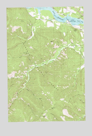
Larchwood, MT USGS Topographic Map
Click on map above to begin viewing in our Map Viewer.

This topographic map contains these locations and features:
Feature Name Type Latitude Longitude GNIS ID View Map
Ambassador MineMineN47.7752°W115.6999°778998View Map
Ambassador/Lulu MineMineN47.7749°W115.6999°805132View Map
Beecher PeakSummitN47.8374°W115.6810°779649View Map
Bennet GulchValleyN47.8308°W115.6577°779694View Map
Bennet Gulch MineMineN47.8333°W115.6632°805130View Map
Black Peak TrailTrailN47.7572°W115.6977°780015View Map
Burton CreekStreamN47.8560°W115.7024°780663View Map
East Fork Trout CreekStreamN47.8049°W115.7182°782916View Map
Eightmile PeakSummitN47.7555°W115.6949°783014View Map
Granite CreekStreamN47.7888°W115.7232°784161View Map
Jew CreekStreamN47.7760°W115.7368°785474View Map
LarchwoodPopulated PlaceN47.8502°W115.6279°785963View Map
Little Trout CreekStreamN47.8283°W115.6327°786390View Map
Minton CreekStreamN47.8119°W115.7057°787488View Map
Minton Creek PassGapN47.8249°W115.7174°787489View Map
Noxon ReservoirReservoirN47.8607°W115.6580°788330View Map
Sage GulchValleyN47.8310°W115.6593°789915View Map
Trout Creek CampgroundLocaleN47.8616°W115.6307°792403View Map
Trout Creek Ranger StationLocaleN47.8663°W115.6252°792404View Map
Tuscor CreekStreamN47.8680°W115.6982°792481View Map
Veals GulchValleyN47.8149°W115.6885°792685View Map
West Fork Trout CreekStreamN47.8049°W115.7182°793091View Map
White Penny MineMineN47.8374°W115.6538°805129View Map
Wilton CreekStreamN47.8122°W115.6929°793396View Map
Windfall Peak TrailTrailN47.7880°W115.7443°793402View Map
Woodchuck PeakSummitN47.7644°W115.6813°793498View Map

Note: Coordinates in the location and feature list above are referenced to NAD83 datum.


Copyright (C) 2008-2024 Ryan Niemi / Sunset Dynamics ... All Rights Reserved