TopoQuest Logo
Do you find TopoQuest useful?
Help keep TopoQuest running and adding new maps/features by donating!
Bitcoin:  19c7KJd3qBynnjoSw5npx9KScwjBe4ifkT
Litecoin:  LXs6TkuXGGXo1vDsWCkWVdjQX94eUKd6ui
Home View Maps Find Maps Find Places Resources & Links


Juniper Mountains, Arizona Topographic Map

USGS Map Title: Juniper Mountains, AZ
USGS Map MRC: 34112H8
DRG (GeoTIFF) Download: o34112h8.tif


Neighboring USGS Topographic Map Quads:


  Anvil Rock, AZ  
35113A1
 

  Turkey Canyon, AZ  
35112A8
 

  Red Mountain, AZ  
35112A7
 

  Mount Hope, AZ  
34113H1
 

  Juniper Mountains, AZ  
34112H8
 

  Indian Peak, AZ  
34112H7
 

  Scratch Canyon, AZ  
34113G1
 

  Camp Wood, AZ  
34112G8
 

  Seepage Mountain, AZ  
34112G7


Map MRC Location:

N35°
W113°
N35°
W112°
H8 H7 H6 H5 H4 H3 H2 H1
G8 G7 G6 G5 G4 G3 G2 G1
F8 F7 F6 F5 F4 F3 F2 F1
E8 E7 E6 E5 E4 E3 E2 E1
D8 D7 D6 D5 D4 D3 D2 D1
C8 C7 C6 C5 C4 C3 C2 C1
B8 B7 B6 B5 B4 B3 B2 B1
A8 A7 A6 A5 A4 A3 A2 A1
N34°
W113°
N34°
W112°

Juniper Mountains, AZ USGS 1:24K Topographic Map Preview:
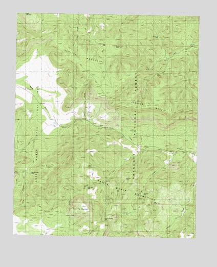
Juniper Mountains, AZ USGS Topographic Map
Click on map above to begin viewing in our Map Viewer.

This topographic map contains these locations and features:
Feature Name Type Latitude Longitude GNIS ID View Map
Apache Creek SeepSpringN34.8911°W112.8841°38218View Map
Apache Creek WildernessReserveN34.8780°W112.9053°41547View Map
Bear MountainSummitN34.9139°W112.9769°26097View Map
Bear Mountain TankReservoirN34.9101°W112.9890°40967View Map
Bull SpringSpringN34.9460°W112.9298°38289View Map
Dairy SpringSpringN34.9109°W112.9963°38391View Map
Datry SpringSpringN34.9109°W112.9963°28284View Map
Deer TankReservoirN34.9009°W112.9305°38401View Map
Deer TankReservoirN34.9831°W112.9449°38402View Map
East Turkey TankReservoirN34.8941°W112.9047°38431View Map
George Wood CanyonValleyN34.9383°W112.9505°29303View Map
Gobbler KnobSummitN34.9822°W112.9319°29366View Map
Government SpringSpringN34.8962°W112.9376°38466View Map
Hunt RanchLocaleN34.9209°W112.8777°30291View Map
Juniper CatchmentReservoirN34.9681°W112.9394°40969View Map
Juniper MesaSummitN34.9436°W112.8932°30661View Map
Juniper Mesa WildernessReserveN34.9588°W112.9075°40982View Map
Juniper Trick TankReservoirN34.9739°W112.9405°38548View Map
Lee SpringSpringN34.9352°W112.9192°38564View Map
Little Old SpringSpringN34.8850°W112.8963°38572View Map
Mud SpringSpringN34.9698°W112.9090°38652View Map
North Fork Walnut CreekStreamN34.9250°W112.9044°32372View Map
Pine Flat TankReservoirN34.9827°W112.8815°32939View Map
Pine SpringSpringN34.9713°W112.8971°32976View Map
Pine SpringsSpringN34.9669°W112.9042°38698View Map
Pot Hole TankReservoirN34.9080°W112.9238°38713View Map
Red TankReservoirN34.9142°W112.9479°38745View Map
Section Thirtythree TankReservoirN34.9880°W112.9034°38790View Map
Seep TankReservoirN34.9395°W112.9735°38797View Map
South Fork TankReservoirN34.9031°W112.9501°38825View Map
South Fork Walnut CreekStreamN34.9253°W112.9041°34670View Map
Table Top MountainSummitN34.8911°W112.9502°35109View Map
The Pines TankReservoirN34.8884°W112.9213°38870View Map
Trick TankReservoirN34.9414°W112.9482°40968View Map
Turkey CreekStreamN34.9222°W112.8907°35541View Map
Turkey Creek WellWellN34.9111°W112.9030°38894View Map
Two Lion TankReservoirN34.8994°W112.9119°38900View Map
Warren Mountain TankReservoirN34.8850°W112.9386°38928View Map

Note: Coordinates in the location and feature list above are referenced to NAD83 datum.


Copyright (C) 2008-2025 Ryan Niemi / Sunset Dynamics ... All Rights Reserved