TopoQuest Logo
Do you find TopoQuest useful?
Help keep TopoQuest running and adding new maps/features by donating!
Bitcoin:  19c7KJd3qBynnjoSw5npx9KScwjBe4ifkT
Litecoin:  LXs6TkuXGGXo1vDsWCkWVdjQX94eUKd6ui
Home View Maps Find Maps Find Places Resources & Links


Mount Nebo, New Mexico Topographic Map

USGS Map Title: Mount Nebo, NM
USGS Map MRC: 36107H7
DRG (GeoTIFF) Download: o36107h7.tif


Neighboring USGS Topographic Map Quads:


  Long Mountain, CO  
37107A8
 

  Bondad Hill, CO  
37107A7
 

  Ignacio, CO  
37107A6
 

  Cedar Hill, NM  
36107H8
 

  Mount Nebo, NM  
36107H7
 

  Anastacio Spring, NM  
36107H6
 

  Aztec, NM  
36107G8
 

  Turley, NM  
36107G7
 

  Archuleta, NM  
36107G6


Map MRC Location:

N37°
W108°
N37°
W107°
H8 H7 H6 H5 H4 H3 H2 H1
G8 G7 G6 G5 G4 G3 G2 G1
F8 F7 F6 F5 F4 F3 F2 F1
E8 E7 E6 E5 E4 E3 E2 E1
D8 D7 D6 D5 D4 D3 D2 D1
C8 C7 C6 C5 C4 C3 C2 C1
B8 B7 B6 B5 B4 B3 B2 B1
A8 A7 A6 A5 A4 A3 A2 A1
N36°
W108°
N36°
W107°

Mount Nebo, NM USGS 1:24K Topographic Map Preview:
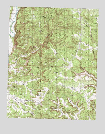
Mount Nebo, NM USGS Topographic Map
Click on map above to begin viewing in our Map Viewer.

This topographic map contains these locations and features:
Feature Name Type Latitude Longitude GNIS ID View Map
Arch RockSpringN36.8822°W107.8367°902601View Map
Arch RockArchN36.8908°W107.8492°900069View Map
Arch Rock SpringSpringN36.8806°W107.8395°900071View Map
Beanie PocketsBasinN36.8989°W107.7840°900146View Map
Beanie Pockets SpringSpringN36.9025°W107.7687°900066View Map
C C ReservoirReservoirN36.9012°W107.8303°900067View Map
Cabin CanyonValleyN36.8750°W107.7723°900584View Map
Cattail SpringSpringN36.9887°W107.8274°900054View Map
Garrison SpringSpringN36.9014°W107.8578°900068View Map
Hidden SpringsSpringN36.9340°W107.8155°900142View Map
Hog SpringSpringN36.9807°W107.7684°900056View Map
Ice SpringSpringN36.9489°W107.8081°900060View Map
John Brown SpringSpringN36.8997°W107.7906°900070View Map
Last Chance SpringSpringN36.9258°W107.8090°900063View Map
Line CanyonValleyN36.9956°W107.8635°184465View Map
Long GladeFlatN36.9111°W107.7890°900065View Map
Mesa MountainsSummitN36.9914°W107.8406°900057View Map
Miller SpringSpringN36.9092°W107.8672°900141View Map
Mount NeboSummitN36.9658°W107.8503°892402View Map
Pine CanyonValleyN36.9269°W107.7648°893277View Map
Pipeline SpringSpringN36.9521°W107.7789°900058View Map
Ralston DitchCanalN36.9833°W107.8670°203015View Map
Rawhide SpringSpringN36.9555°W107.7574°900059View Map
Shovel SpringSpringN36.9890°W107.8241°900055View Map
Stephel SpringSpringN36.9214°W107.8334°900064View Map
Tank MountainSummitN36.9419°W107.8156°897487View Map
Tank Mountain SpringSpringN36.9328°W107.8348°900061View Map
Tank SpringsSpringN36.9347°W107.7567°900062View Map
Twin Rock DitchCanalN36.9833°W107.8737°203012View Map

Note: Coordinates in the location and feature list above are referenced to NAD83 datum.


Copyright (C) 2008-2024 Ryan Niemi / Sunset Dynamics ... All Rights Reserved