TopoQuest Logo
Do you find TopoQuest useful?
Help keep TopoQuest running and adding new maps/features by donating!
Bitcoin:  19c7KJd3qBynnjoSw5npx9KScwjBe4ifkT
Litecoin:  LXs6TkuXGGXo1vDsWCkWVdjQX94eUKd6ui
Home View Maps Find Maps Find Places Resources & Links


Bluff Springs, New Mexico Topographic Map

USGS Map Title: Bluff Springs, NM
USGS Map MRC: 32105G6
DRG (GeoTIFF) Download: o32105g6.tif


Neighboring USGS Topographic Map Quads:


  High Rolls, NM  
32105H7
 

  Cloudcroft, NM  
32105H6
 

  Harvey Ranch, NM  
32105H5
 

  Sacramento Peak, NM  
32105G7
 

  Bluff Springs, NM  
32105G6
 

  Sacramento, NM  
32105G5
 

  Bug Scuffle Canyon, NM  
32105F7
 

  Rogers Ruins, NM  
32105F6
 

  Bear Spring, NM  
32105F5


Map MRC Location:

N33°
W106°
N33°
W105°
H8 H7 H6 H5 H4 H3 H2 H1
G8 G7 G6 G5 G4 G3 G2 G1
F8 F7 F6 F5 F4 F3 F2 F1
E8 E7 E6 E5 E4 E3 E2 E1
D8 D7 D6 D5 D4 D3 D2 D1
C8 C7 C6 C5 C4 C3 C2 C1
B8 B7 B6 B5 B4 B3 B2 B1
A8 A7 A6 A5 A4 A3 A2 A1
N32°
W106°
N32°
W105°

Bluff Springs, NM USGS 1:24K Topographic Map Preview:
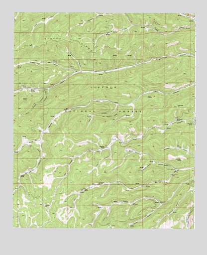
Bluff Springs, NM USGS Topographic Map
Click on map above to begin viewing in our Map Viewer.

This topographic map contains these locations and features:
Feature Name Type Latitude Longitude GNIS ID View Map
Bear CanyonValleyN32.8220°W105.6791°903620View Map
Bear SpringSpringN32.8265°W105.6576°903667View Map
Behringer SpringSpringN32.8108°W105.6270°903722View Map
Benson CanyonValleyN32.8398°W105.7078°903750View Map
Benson RidgeRidgeN32.8581°W105.7111°903752View Map
Benson SpringSpringN32.8461°W105.7230°903753View Map
Bluff SpringsSpringN32.8298°W105.7386°903970View Map
Camp WehinahpayLocaleN32.7648°W105.6686°904325View Map
Charles SpringSpringN32.8245°W105.7410°905035View Map
Cloud CanyonValleyN32.7632°W105.6833°905215View Map
Copper Flat GroupMineN32.8293°W105.7378°916467View Map
Cridebring SpringSpringN32.7846°W105.6383°905504View Map
Delworth SpringSpringN32.8440°W105.7477°905716View Map
Hay Canyon SpringSpringN32.8128°W105.6382°906881View Map
Hidden SpringSpringN32.7868°W105.6436°913288View Map
Hoosier CanyonValleyN32.7618°W105.6255°907074View Map
Hubbell CanyonValleyN32.8012°W105.7316°907135View Map
Hubbell SpringSpringN32.7801°W105.7452°907136View Map
Lightning LakeLakeN32.7632°W105.7285°907953View Map
Little Bear SpringSpringN32.7901°W105.6348°907989View Map
Masterson SpringSpringN32.7966°W105.6863°908458View Map
Mauldin SpringSpringN32.7942°W105.7497°908467View Map
MaxonPopulated PlaceN32.7534°W105.6305°913287View Map
Mayhill Volunteer Fire Department Substation 1BuildingN32.8705°W105.6254°2658054View Map
Newman CanyonValleyN32.8418°W105.7041°909079View Map
Pepper CanyonValleyN32.7645°W105.6472°909561View Map
Pepper SpringSpringN32.7521°W105.6696°909562View Map
Pine Springs CampLocaleN32.7812°W105.6416°909684View Map
Prestridge HillSummitN32.8209°W105.6380°909847View Map
Prestridge SpringSpringN32.8106°W105.6438°913289View Map
Round House CanyonValleyN32.7890°W105.6536°910440View Map
Sacramento Ranger DistrictForestN32.8173°W105.6433°2038661View Map
Skyridge CampLocaleN32.7765°W105.6278°911122View Map
Snap CanyonValleyN32.7979°W105.6841°911168View Map
Telephone CanyonValleyN32.7845°W105.6375°911590View Map
Willie White CanyonValleyN32.8312°W105.7258°912395View Map
Wilmeth CanyonValleyN32.8681°W105.6683°912421View Map
York SpringSpringN32.7728°W105.7007°912529View Map

Note: Coordinates in the location and feature list above are referenced to NAD83 datum.


Copyright (C) 2008-2024 Ryan Niemi / Sunset Dynamics ... All Rights Reserved