TopoQuest Logo
Do you find TopoQuest useful?
Help keep TopoQuest running and adding new maps/features by donating!
Bitcoin:  19c7KJd3qBynnjoSw5npx9KScwjBe4ifkT
Litecoin:  LXs6TkuXGGXo1vDsWCkWVdjQX94eUKd6ui
Home View Maps Find Maps Find Places Resources & Links


Twin Bridges, Tennessee Topographic Map

USGS Map Title: Twin Bridges, TN
USGS Map MRC: 36084B7
DRG (GeoTIFF) Download: o36084b7.tif


Neighboring USGS Topographic Map Quads:


  Grimsley, TN  
36084C8
 

  Burrville, TN  
36084C7
 

  Rugby, TN  
36084C6
 

  Jones Knob, TN  
36084B8
 

  Twin Bridges, TN  
36084B7
 

  Pilot Mountain, TN  
36084B6
 

  Fox Creek, TN  
36084A8
 

  Hebbertsburg, TN  
36084A7
 

  Lancing, TN  
36084A6


Map MRC Location:

N37°
W85°
N37°
W84°
H8 H7 H6 H5 H4 H3 H2 H1
G8 G7 G6 G5 G4 G3 G2 G1
F8 F7 F6 F5 F4 F3 F2 F1
E8 E7 E6 E5 E4 E3 E2 E1
D8 D7 D6 D5 D4 D3 D2 D1
C8 C7 C6 C5 C4 C3 C2 C1
B8 B7 B6 B5 B4 B3 B2 B1
A8 A7 A6 A5 A4 A3 A2 A1
N36°
W85°
N36°
W84°

Twin Bridges, TN USGS 1:24K Topographic Map Preview:
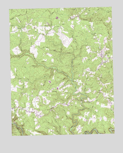
Twin Bridges, TN USGS Topographic Map
Click on map above to begin viewing in our Map Viewer.

This topographic map contains these locations and features:
Feature Name Type Latitude Longitude GNIS ID View Map
Adams Hill CemeteryCemeteryN36.1703°W84.8474°1646593View Map
Adams Hill ChurchChurchN36.1698°W84.8477°1647194View Map
Adkins MillPopulated PlaceN36.1817°W84.8619°1314564View Map
Alexander CreekStreamN36.2053°W84.8538°1275558View Map
Bethel CemeteryCemeteryN36.1415°W84.7794°1277115View Map
Branstetter BranchStreamN36.1273°W84.8163°1278239View Map
Branstetters CemeteryCemeteryN36.1520°W84.8236°1305397View Map
Brown BranchStreamN36.1953°W84.8394°1278510View Map
BucklickPopulated PlaceN36.1673°W84.8588°1314759View Map
Bucklick CreekStreamN36.2037°W84.8719°1278876View Map
Carden BranchStreamN36.1404°W84.8005°1279652View Map
Clarence B Lane Memorial Park and Firehall / Chestnut Ridge Volunteer Fire DepartmentBuildingN36.1448°W84.8357°2654994View Map
Commissioner District 4CivilN36.1469°W84.7612°2464072View Map
Cook CreekStreamN36.1784°W84.7999°1281120View Map
Dan BranchStreamN36.2056°W84.8522°1282003View Map
Daniel BranchStreamN36.1370°W84.8711°1282020View Map
Deer LodgePopulated PlaceN36.2015°W84.7591°1306319View Map
Deer Lodge AcademySchoolN36.2309°W84.8594°1282298View Map
Deer Lodge Elementary SchoolSchoolN36.2020°W84.7649°1643334View Map
Deer Lodge First Baptist ChurchChurchN36.2015°W84.7633°1643769View Map
Deer Lodge Post OfficePost OfficeN36.1964°W84.7624°1649990View Map
Deer Lodge Volunteer Fire DepartmentBuildingN36.2059°W84.7649°2654842View Map
Douglas BranchStreamN36.1487°W84.7761°1282721View Map
Englewood SchoolSchoolN36.1509°W84.8247°1283793View Map
Flat RockPopulated PlaceN36.1528°W84.8666°1647198View Map
Flat Rock CemeteryCemeteryN36.1515°W84.8630°1646620View Map
Flat Rock ChurchChurchN36.1520°W84.8622°1284418View Map
Flat Rock SchoolSchoolN36.1601°W84.8716°1284420View Map
Four Mile CreekStreamN36.1376°W84.8738°1284718View Map
GladesPopulated PlaceN36.2426°W84.7899°1315117View Map
Green BranchStreamN36.1509°W84.7852°1286066View Map
Greenwood ChapelChurchN36.2487°W84.7947°1647200View Map
Gut BranchStreamN36.1292°W84.7730°1269612View Map
Hall CemeteryCemeteryN36.1465°W84.8730°1647201View Map
Hawn CemeteryCemeteryN36.1570°W84.7827°1287199View Map
High PointPopulated PlaceN36.1503°W84.8261°1315234View Map
Howard CemeteryCemeteryN36.1323°W84.8283°1306590View Map
LavenderPopulated PlaceN36.1895°W84.7677°1309671View Map
Lavender BridgeBridgeN36.1590°W84.7883°1290769View Map
Lavender CemeteryCemeteryN36.1876°W84.7769°1290771View Map
Little CreekStreamN36.1651°W84.7983°1291445View Map
Long BranchStreamN36.1815°W84.8036°1291887View Map
Lovetts BranchStreamN36.1831°W84.8286°1292162View Map
Luke Hall Mill BranchStreamN36.1423°W84.8700°1292267View Map
McClintock BranchStreamN36.1634°W84.7838°1293159View Map
Meister Hill CemeteryCemeteryN36.2323°W84.8541°1646633View Map
Milender CreekStreamN36.2051°W84.7994°1293773View Map
Mount Hope CemeteryCemeteryN36.2059°W84.7680°1294640View Map
Muddy BranchStreamN36.1787°W84.8594°1295029View Map
Myers CemeteryCemeteryN36.2278°W84.8180°1295186View Map
Neil CemeteryCemeteryN36.1967°W84.8322°1646641View Map
Norris FordCrossingN36.1373°W84.8725°1315609View Map
Pine Flat CemeteryCemeteryN36.1653°W84.7824°1297524View Map
Pine Grove ChurchChurchN36.1979°W84.8316°1297533View Map
Pine Thicket BranchStreamN36.2065°W84.8122°1297588View Map
Pleasant Green ChurchChurchN36.1676°W84.8241°1297796View Map
Rock CreekStreamN36.2012°W84.7952°1299743View Map
Rocky BranchStreamN36.1334°W84.8638°1299863View Map
Shell CreekStreamN36.1915°W84.8211°1270001View Map
Spots BranchStreamN36.1556°W84.8711°1271024View Map
StowersPopulated PlaceN36.2315°W84.8169°1314344View Map
Stowers CreekStreamN36.2204°W84.8277°1303869View Map
Sulphur Spring BranchStreamN36.1595°W84.8722°1271809View Map
Toms BranchStreamN36.1917°W84.7991°1272761View Map
Twin BridgesLocaleN36.1781°W84.7994°1273115View Map
White FordCrossingN36.1295°W84.8027°1314498View Map
Witt CreekStreamN36.2012°W84.7955°1304643View Map

Note: Coordinates in the location and feature list above are referenced to NAD83 datum.


Copyright (C) 2008-2025 Ryan Niemi / Sunset Dynamics ... All Rights Reserved