TopoQuest Logo
Do you find TopoQuest useful?
Help keep TopoQuest running and adding new maps/features by donating!
Bitcoin:  19c7KJd3qBynnjoSw5npx9KScwjBe4ifkT
Litecoin:  LXs6TkuXGGXo1vDsWCkWVdjQX94eUKd6ui
Home View Maps Find Maps Find Places Resources & Links


Rugby, Tennessee Topographic Map

USGS Map Title: Rugby, TN
USGS Map MRC: 36084C6
DRG (GeoTIFF) Download: o36084c6.tif


Neighboring USGS Topographic Map Quads:


  Stockton, TN  
36084D7
 

  Honey Creek, TN  
36084D6
 

  Oneida South, TN  
36084D5
 

  Burrville, TN  
36084C7
 

  Rugby, TN  
36084C6
 

  Robbins, TN  
36084C5
 

  Twin Bridges, TN  
36084B7
 

  Pilot Mountain, TN  
36084B6
 

  Gobey, TN  
36084B5


Map MRC Location:

N37°
W85°
N37°
W84°
H8 H7 H6 H5 H4 H3 H2 H1
G8 G7 G6 G5 G4 G3 G2 G1
F8 F7 F6 F5 F4 F3 F2 F1
E8 E7 E6 E5 E4 E3 E2 E1
D8 D7 D6 D5 D4 D3 D2 D1
C8 C7 C6 C5 C4 C3 C2 C1
B8 B7 B6 B5 B4 B3 B2 B1
A8 A7 A6 A5 A4 A3 A2 A1
N36°
W85°
N36°
W84°

Rugby, TN USGS 1:24K Topographic Map Preview:
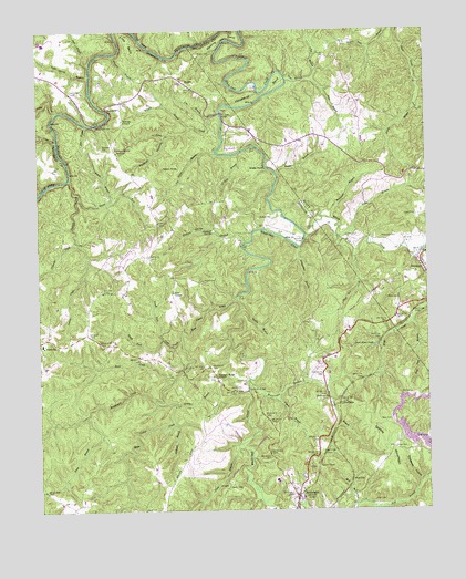
Rugby, TN USGS Topographic Map
Click on map above to begin viewing in our Map Viewer.

This topographic map contains these locations and features:
Feature Name Type Latitude Longitude GNIS ID View Map
Barger BranchStreamN36.3376°W84.6733°1304955View Map
Big CreekStreamN36.3542°W84.7427°1277281View Map
Black Wolf CreekStreamN36.3217°W84.6638°1269353View Map
Bone Camp CreekStreamN36.3051°W84.6869°1277935View Map
Brewster BridgeBridgeN36.3506°W84.7316°1278304View Map
Brewster CemeteryCemeteryN36.3448°W84.7291°1278305View Map
BrewstertownPopulated PlaceN36.3448°W84.7249°1309631View Map
Buck CreekStreamN36.2840°W84.7072°1278806View Map
Burrville Elementary SchoolSchoolN36.2937°W84.7491°1643332View Map
Burrville Volunteer Fire DepartmentBuildingN36.2940°W84.7491°2654577View Map
Byrd CemeteryCemeteryN36.2503°W84.7166°1279252View Map
C and M East Farm DamDamN36.3667°W84.7149°1302545View Map
C and M East Farm PondReservoirN36.3667°W84.7149°1302544View Map
Cal Hurst BranchStreamN36.3431°W84.6927°1279300View Map
Cave BranchStreamN36.3467°W84.7438°1279919View Map
Christ Episcopal ChurchChurchN36.3604°W84.6997°1643333View Map
Cochran CreekStreamN36.3195°W84.7372°1306010View Map
Coon BranchStreamN36.2665°W84.6863°1281158View Map
Coon CreekStreamN36.2945°W84.7044°1281163View Map
Coon HollowValleyN36.2662°W84.6870°1309649View Map
Cox BranchStreamN36.3515°W84.6952°1281478View Map
Davis BranchStreamN36.2748°W84.7352°1282124View Map
Davis CreekStreamN36.3162°W84.6272°1282178View Map
Dawn CemeteryCemeteryN36.3270°W84.6283°1282212View Map
Dead Mans PondLakeN36.2927°W84.6419°1282251View Map
Diden CemeteryCemeteryN36.2659°W84.6322°1282465View Map
Flat BranchStreamN36.3506°W84.7341°1284370View Map
Fletcher BranchStreamN36.3692°W84.7249°1284467View Map
Freels CemeteryCemeteryN36.3098°W84.6969°1306462View Map
Glenmary Baptist ChurchChurchN36.3112°W84.6255°1318769View Map
Glenmary School (historical)SchoolN36.3087°W84.6261°1318770View Map
Goad Spring BranchStreamN36.3631°W84.7330°1269595View Map
Grassy BranchStreamN36.2776°W84.7063°1285879View Map
Grassy MountainSummitN36.2762°W84.6486°1285909View Map
Graveyard HollowValleyN36.2565°W84.6282°1285978View Map
Griffith CemeteryCemeteryN36.3217°W84.6472°1286282View Map
Gum BranchStreamN36.3629°W84.6699°1286400View Map
Hall CemeteryCemeteryN36.2523°W84.6427°1286578View Map
Hambright BridgeBridgeN36.2812°W84.6827°1286628View Map
Hickory SpringSpringN36.3231°W84.6941°1287618View Map
Hickory Spring BranchStreamN36.3198°W84.6827°1287619View Map
Higby BranchStreamN36.3551°W84.6288°1287681View Map
Horseshoe BendBendN36.3587°W84.6772°1288435View Map
HuffmanPopulated PlaceN36.2792°W84.6533°1315272View Map
Indian CreekStreamN36.3367°W84.7399°1288949View Map
InglesideBuildingN36.3606°W84.7027°1643335View Map
Ivy BranchStreamN36.3626°W84.6616°1289120View Map
Kingstone LisleBuildingN36.3604°W84.7008°1643336View Map
Lewallen CemeteryCemeteryN36.3237°W84.6638°1291057View Map
Little BendBendN36.3720°W84.7202°1291381View Map
Little CreekStreamN36.3531°W84.6911°1291451View Map
Martin RoostBuildingN36.3629°W84.7038°1643338View Map
Mary Bull HollowValleyN36.3612°W84.6267°1292857View Map
Massingale BranchStreamN36.2840°W84.6827°1292914View Map
Massingale CreekStreamN36.2787°W84.7127°1292915View Map
Mathews BridgeBridgeN36.3206°W84.6647°1292926View Map
Meeting BendBendN36.3734°W84.6902°1293541View Map
MidwayPopulated PlaceN36.2792°W84.6569°1647204View Map
Midway ChurchChurchN36.2790°W84.6569°1293741View Map
Mill BranchStreamN36.2512°W84.6483°1293803View Map
Morris CemeteryCemeteryN36.2559°W84.6894°1294422View Map
Mud CutGapN36.2579°W84.6499°1295009View Map
Neely CemeteryCemeteryN36.2990°W84.6655°1306813View Map
North Fork Coon CreekStreamN36.2948°W84.7105°1295874View Map
Nydeck CemeteryCemeteryN36.3259°W84.6791°1306844View Map
Oilwell HollowValleyN36.3546°W84.6285°1296260View Map
Parker CemeteryCemeteryN36.3687°W84.6572°1296817View Map
Pemperton CemeteryCemeteryN36.3209°W84.6397°1297136View Map
Pigeon BranchStreamN36.2784°W84.6730°1297436View Map
Pleasant Ridge CemeteryCemeteryN36.2840°W84.6922°1646658View Map
Pleasant Ridge ChurchChurchN36.2845°W84.6930°1297918View Map
Polecat HollowValleyN36.3476°W84.7090°1298047View Map
Potato KnobSummitN36.3387°W84.7102°1298339View Map
Potter BranchStreamN36.3259°W84.6558°1269873View Map
Price BranchStreamN36.3431°W84.6855°1298492View Map
Raven ForkStreamN36.3312°W84.7369°1298969View Map
Red CliffCliffN36.3548°W84.7277°1299042View Map
Rhodas BranchStreamN36.3029°W84.6847°1299281View Map
Rock Falls BranchStreamN36.3001°W84.6291°1299759View Map
Rose ChapelChurchN36.3067°W84.7069°1300068View Map
RoslynBuildingN36.3576°W84.6955°1643342View Map
RugbyPopulated PlaceN36.3604°W84.7008°1306975View Map
Rugby CemeteryCemeteryN36.3687°W84.6983°1300241View Map
Rugby School (historical)SchoolN36.3598°W84.7002°1643343View Map
RuraliaBuildingN36.3623°W84.7105°1643345View Map
Saltpeter BranchStreamN36.2726°W84.7069°1300602View Map
Sandusky BranchStreamN36.3259°W84.6558°1300729View Map
Scott BranchStreamN36.2823°W84.6577°1300923View Map
Sheep RockCliffN36.3392°W84.6772°1269965View Map
Short BranchStreamN36.3662°W84.7327°1270180View Map
Sixteen TunnelTunnelN36.2609°W84.6608°1270409View Map
South Fork Coon CreekStreamN36.2948°W84.7105°1270856View Map
Stonecipher BranchStreamN36.3184°W84.6661°1271504View Map
Sunbright Division (historical)CensusN36.2556°W84.7155°1648892View Map
The LindensBuildingN36.3604°W84.7047°1643348View Map
Thomas Hughes Public LibraryBuildingN36.3431°W84.6994°1643349View Map
Twin OaksBuildingN36.3623°W84.7116°1643350View Map
Walton CourtBuildingN36.3590°W84.6986°1643351View Map
Webb CemeteryCemeteryN36.3051°W84.6383°1274018View Map
Whaley BranchStreamN36.3498°W84.7008°1274271View Map
Whiteoak BridgeBridgeN36.3537°W84.6911°1274428View Map
Wolf Pen BranchStreamN36.3159°W84.6477°1274970View Map
Young BranchStreamN36.3304°W84.7269°1275315View Map

Note: Coordinates in the location and feature list above are referenced to NAD83 datum.


Copyright (C) 2008-2024 Ryan Niemi / Sunset Dynamics ... All Rights Reserved