TopoQuest Logo
Do you find TopoQuest useful?
Help keep TopoQuest running and adding new maps/features by donating!
Bitcoin:  19c7KJd3qBynnjoSw5npx9KScwjBe4ifkT
Litecoin:  LXs6TkuXGGXo1vDsWCkWVdjQX94eUKd6ui
Home View Maps Find Maps Find Places Resources & Links


Twin City SE, Georgia Topographic Map

USGS Map Title: Twin City SE, GA
USGS Map MRC: 32082E1
DRG (GeoTIFF) Download: o32082e1.tif


Neighboring USGS Topographic Map Quads:


  Canoochee, GA  
32082F2
 

  Garfield, GA  
32082F1
 

  Four Points, GA  
32081F8
 

  Twin City, GA  
32082E2
 

  Twin City SE, GA  
32082E1
 

  Portal, GA  
32081E8
 

  Stillmore, GA  
32082D2
 

  Metter, GA  
32082D1
 

  Pulaski, GA  
32081D8


Map MRC Location:

N33°
W83°
N33°
W82°
H8 H7 H6 H5 H4 H3 H2 H1
G8 G7 G6 G5 G4 G3 G2 G1
F8 F7 F6 F5 F4 F3 F2 F1
E8 E7 E6 E5 E4 E3 E2 E1
D8 D7 D6 D5 D4 D3 D2 D1
C8 C7 C6 C5 C4 C3 C2 C1
B8 B7 B6 B5 B4 B3 B2 B1
A8 A7 A6 A5 A4 A3 A2 A1
N32°
W83°
N32°
W82°

Twin City SE, GA USGS 1:24K Topographic Map Preview:
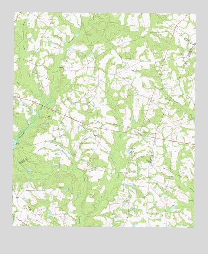
Twin City SE, GA USGS Topographic Map
Click on map above to begin viewing in our Map Viewer.

This topographic map contains these locations and features:
Feature Name Type Latitude Longitude GNIS ID View Map
Banks BridgeBridgeN32.5321°W82.0523°342850View Map
Bethel CemeteryCemeteryN32.5649°W82.0990°347540View Map
Bethel ChurchChurchN32.5643°W82.0990°311179View Map
Bowen LakeReservoirN32.5077°W82.0990°341602View Map
Bowen Lake DamDamN32.5052°W82.0982°341601View Map
Cypress CreekStreamN32.6193°W82.0704°313242View Map
Donaldson LakeReservoirN32.5009°W82.0411°340243View Map
Donaldson Lake DamDamN32.5002°W82.0415°340242View Map
Donaldson North DamDamN32.5085°W82.0415°335969View Map
El Bethel CemeteryCemeteryN32.5524°W82.0662°342862View Map
El Bethel ChurchChurchN32.5532°W82.0660°355653View Map
Emmit Brown BridgeBridgeN32.5354°W82.0926°342864View Map
Friendship CemeteryCemeteryN32.5924°W82.0912°347541View Map
Friendship ChurchChurchN32.5924°W82.0907°355932View Map
George L Smith II State ParkParkN32.5621°W82.1107°347511View Map
Hendley PondReservoirN32.6185°W82.0398°341009View Map
Hendley Pond DamDamN32.6185°W82.0398°341008View Map
Lotts LakeReservoirN32.5116°W82.0146°341604View Map
Lotts Lake DamDamN32.5118°W82.0132°341603View Map
Mercer Grove ChurchChurchN32.5079°W82.0273°318037View Map
Nathan CreekStreamN32.5757°W82.1057°319210View Map
New Beulah ChurchChurchN32.5102°W82.1146°319290View Map
Paddy Ford BridgeBridgeN32.5307°W82.0762°342889View Map
Parris Grove ChurchChurchN32.5546°W82.0329°320247View Map
Piney Grove ChurchChurchN32.5160°W82.0004°320713View Map
Rosemary School (historical)SchoolN32.5077°W82.1123°342892View Map
Saint Pauls ChurchChurchN32.5985°W82.0465°322266View Map
Sams CreekStreamN32.5043°W82.0760°322391View Map
Simon CreekStreamN32.5710°W82.1054°323013View Map
Watson PondReservoirN32.5499°W82.1230°324921View Map
Watson Pond DamDamN32.5449°W82.1246°337789View Map
Williams CemeteryCemeteryN32.5338°W82.0657°342906View Map
Wolf BranchStreamN32.5579°W82.1154°325478View Map

Note: Coordinates in the location and feature list above are referenced to NAD83 datum.


Copyright (C) 2008-2024 Ryan Niemi / Sunset Dynamics ... All Rights Reserved