TopoQuest Logo
Do you find TopoQuest useful?
Help keep TopoQuest running and adding new maps/features by donating!
Bitcoin:  19c7KJd3qBynnjoSw5npx9KScwjBe4ifkT
Litecoin:  LXs6TkuXGGXo1vDsWCkWVdjQX94eUKd6ui
Home View Maps Find Maps Find Places Resources & Links


Twin City, Georgia Topographic Map

USGS Map Title: Twin City, GA
USGS Map MRC: 32082E2
DRG (GeoTIFF) Download: o32082e2.tif


Neighboring USGS Topographic Map Quads:


  Summertown, GA  
32082F3
 

  Canoochee, GA  
32082F2
 

  Garfield, GA  
32082F1
 

  Swainsboro, GA  
32082E3
 

  Twin City, GA  
32082E2
 

  Twin City SE, GA  
32082E1
 

  Nunez, GA  
32082D3
 

  Stillmore, GA  
32082D2
 

  Metter, GA  
32082D1


Map MRC Location:

N33°
W83°
N33°
W82°
H8 H7 H6 H5 H4 H3 H2 H1
G8 G7 G6 G5 G4 G3 G2 G1
F8 F7 F6 F5 F4 F3 F2 F1
E8 E7 E6 E5 E4 E3 E2 E1
D8 D7 D6 D5 D4 D3 D2 D1
C8 C7 C6 C5 C4 C3 C2 C1
B8 B7 B6 B5 B4 B3 B2 B1
A8 A7 A6 A5 A4 A3 A2 A1
N32°
W83°
N32°
W82°

Twin City, GA USGS 1:24K Topographic Map Preview:
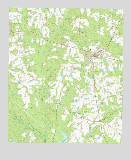
Twin City, GA USGS Topographic Map
Click on map above to begin viewing in our Map Viewer.

This topographic map contains these locations and features:
Feature Name Type Latitude Longitude GNIS ID View Map
Alligator BranchStreamN32.5132°W82.1940°310474View Map
Antioch Baptist ChurchChurchN32.5496°W82.2126°354340View Map
Antioch CemeteryCemeteryN32.5477°W82.2129°347516View Map
Brown LakeReservoirN32.5662°W82.1442°341434View Map
Brown Lake DamDamN32.5652°W82.1432°341433View Map
Canoochee CreekStreamN32.5043°W82.2090°312323View Map
City of Twin CityCivilN32.5829°W82.1575°2405618View Map
Coleman LakeReservoirN32.5604°W82.1907°341440View Map
Coleman Lake DamDamN32.5585°W82.1898°341439View Map
DurdenvillePopulated PlaceN32.5366°W82.1935°326252View Map
Emanuel Probation Detention CenterBuildingN32.5722°W82.1609°2735758View Map
Fulmer LakeReservoirN32.5360°W82.1505°341430View Map
Fulmer Lake DamDamN32.5368°W82.1498°341429View Map
Hudson LakeReservoirN32.6002°W82.2132°341442View Map
Hudson Lake DamDamN32.6002°W82.2132°341441View Map
Johnson LakeReservoirN32.5559°W82.1318°341432View Map
Johnson LakeReservoirN32.5700°W82.1420°341436View Map
Johnson Lake DamDamN32.5568°W82.1298°341431View Map
Johnson Lake DamDamN32.5685°W82.1415°341435View Map
Lanier CemeteryCemeteryN32.5168°W82.1296°342879View Map
Little Canoochee CreekStreamN32.5043°W82.2087°316982View Map
Old Canoochee CemeteryCemeteryN32.5999°W82.2165°347515View Map
Old Canoochee ChurchChurchN32.5988°W82.2168°319954View Map
Reedy CreekStreamN32.5752°W82.2179°321466View Map
Roundtree Grove CemeteryCemeteryN32.5940°W82.1726°347514View Map
Rountree Grove ChurchChurchN32.6143°W82.1846°321965View Map
Scarboro ChurchChurchN32.5279°W82.1785°322619View Map
Thick CreekStreamN32.5113°W82.1921°319600View Map
Twin CityPopulated PlaceN32.5829°W82.1551°356602View Map
Twin City CemeteryCemeteryN32.5896°W82.1429°347512View Map
Twin City DivisionCivilN32.5464°W82.1717°1936603View Map
Twin City Emergency Medical ServicesBuildingN32.5828°W82.1563°2604326View Map
Twin City Police DeptBuildingN32.5829°W82.1557°2733826View Map
Twin City Primary SchoolSchoolN32.5874°W82.1607°347513View Map
Whitefield LakeReservoirN32.5103°W82.1594°341428View Map
Whitefield LakeReservoirN32.5660°W82.1818°341438View Map
Whitfield Lake DamDamN32.5102°W82.1598°341427View Map
Whitfield Lake DamDamN32.5652°W82.1815°341437View Map
Willow Spring ChurchChurchN32.6013°W82.2232°325408View Map

Note: Coordinates in the location and feature list above are referenced to NAD83 datum.


Copyright (C) 2008-2024 Ryan Niemi / Sunset Dynamics ... All Rights Reserved