TopoQuest Logo
Do you find TopoQuest useful?
Help keep TopoQuest running and adding new maps/features by donating!
Bitcoin:  19c7KJd3qBynnjoSw5npx9KScwjBe4ifkT
Litecoin:  LXs6TkuXGGXo1vDsWCkWVdjQX94eUKd6ui
Home View Maps Find Maps Find Places Resources & Links


Showers Mountain, California Topographic Map

USGS Map Title: Showers Mountain, CA
USGS Map MRC: 40123E6
DRG (GeoTIFF) Download: o40123e6.tif


Neighboring USGS Topographic Map Quads:


  Mad River Buttes, CA  
40123F7
 

  Board Camp Mountain, CA  
40123F6
 

  Sims Mountain, CA  
40123F5
 

  Yager Junction, CA  
40123E7
 

  Showers Mountain, CA  
40123E6
 

  Blake Mountain, CA  
40123E5
 

  Bridgeville, CA  
40123D7
 

  Larabee Valley, CA  
40123D6
 

  Dinsmore, CA  
40123D5


Map MRC Location:

N41°
W124°
N41°
W123°
H8 H7 H6 H5 H4 H3 H2 H1
G8 G7 G6 G5 G4 G3 G2 G1
F8 F7 F6 F5 F4 F3 F2 F1
E8 E7 E6 E5 E4 E3 E2 E1
D8 D7 D6 D5 D4 D3 D2 D1
C8 C7 C6 C5 C4 C3 C2 C1
B8 B7 B6 B5 B4 B3 B2 B1
A8 A7 A6 A5 A4 A3 A2 A1
N40°
W124°
N40°
W123°

Showers Mountain, CA USGS 1:24K Topographic Map Preview:
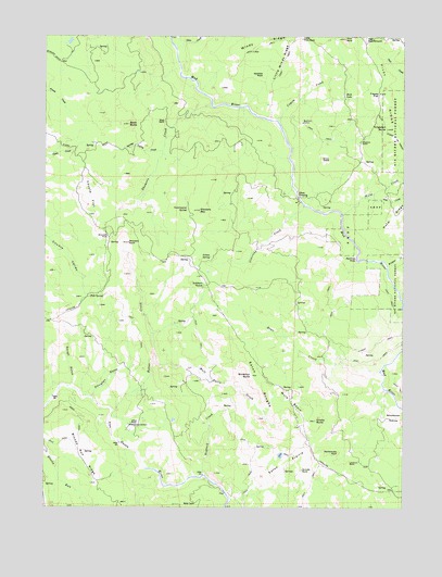
Showers Mountain, CA USGS Topographic Map
Click on map above to begin viewing in our Map Viewer.

This topographic map contains these locations and features:
Feature Name Type Latitude Longitude GNIS ID View Map
Ackley RanchLocaleN40.5221°W123.7212°217959View Map
Amelia ButteSummitN40.5229°W123.6564°218226View Map
Baker CreekStreamN40.5254°W123.7273°218541View Map
Bear CreekStreamN40.5360°W123.6339°218814View Map
Becham CabinLocaleN40.6018°W123.6614°218951View Map
Black ButteSummitN40.6015°W123.7217°219343View Map
Bloody Run RidgeRidgeN40.5146°W123.7389°219466View Map
Brinkman ButteSummitN40.5349°W123.6784°219843View Map
Coyote CreekStreamN40.6024°W123.6695°221740View Map
Coyote FlatFlatN40.5826°W123.7353°221744View Map
Deer CreekStreamN40.6215°W123.7050°233774View Map
Eaton PrairieFlatN40.5118°W123.6670°222952View Map
Eaton RoughsRidgeN40.5335°W123.6753°222953View Map
Ellington GulchValleyN40.5299°W123.7339°223151View Map
Filaree FlatFlatN40.6093°W123.6348°223496View Map
Government SpringSpringN40.5791°W123.7013°224367View Map
Guy CreekStreamN40.5821°W123.6398°224750View Map
High Salt GroundAreaN40.6240°W123.6392°225279View Map
Hogback CreekStreamN40.5085°W123.6956°225424View Map
Holm CreekStreamN40.5776°W123.6473°225461View Map
Indian SpringSpringN40.5665°W123.6935°225905View Map
Little Pilot RockPillarN40.6243°W123.6614°227327View Map
Little Windy RidgeRidgeN40.6168°W123.6687°227409View Map
Lookout RockPillarN40.5118°W123.6445°227645View Map
Mule BasinBasinN40.5276°W123.6650°254960View Map
Mule BasinBasinN40.5540°W123.6853°1665258View Map
Mule Basin CreekStreamN40.5385°W123.7128°229297View Map
Olmstead CreekStreamN40.5801°W123.6603°230022View Map
Olsen CrossingCrossingN40.5824°W123.6625°1659302View Map
Pilot RidgeRidgeN40.6115°W123.6345°234469View Map
Pilot Ridge TrailTrailN40.5988°W123.6295°234470View Map
Pilot RockPillarN40.6240°W123.6467°230667View Map
Rattlesnake RockPillarN40.5149°W123.6484°231272View Map
Renfroe HoleBendN40.5663°W123.6423°231494View Map
Rock LakeLakeN40.6093°W123.6467°231739View Map
Rough GulchValleyN40.5324°W123.7417°231951View Map
Schoolhouse OpeningAreaN40.5240°W123.6292°232684View Map
Showers CreekStreamN40.6065°W123.6931°233064View Map
Showers MountainSummitN40.5788°W123.6973°233065View Map
Showers PassGapN40.5718°W123.7292°233066View Map
Showers RockPillarN40.5701°W123.7223°233067View Map
Singleton ButteSummitN40.6004°W123.6317°233173View Map
Singleton RanchLocaleN40.5971°W123.6412°233175View Map
Snow GladeFlatN40.5915°W123.6534°234774View Map
Soldiers GroveWoodsN40.5590°W123.6953°234872View Map
Spotted RockPillarN40.6146°W123.6748°235218View Map
Spring Valley CreekStreamN40.5943°W123.7103°235280View Map
Stapp RanchLocaleN40.6021°W123.7095°235382View Map
Suicide RockPillarN40.5096°W123.6609°235683View Map
Tule SpringSpringN40.5562°W123.7352°236608View Map
Wildcat CreekStreamN40.5640°W123.6320°237793View Map
Windy RidgeRidgeN40.6235°W123.6728°238036View Map

Note: Coordinates in the location and feature list above are referenced to NAD83 datum.


Copyright (C) 2008-2025 Ryan Niemi / Sunset Dynamics ... All Rights Reserved