TopoQuest Logo
Do you find TopoQuest useful?
Help keep TopoQuest running and adding new maps/features by donating!
Bitcoin:  19c7KJd3qBynnjoSw5npx9KScwjBe4ifkT
Litecoin:  LXs6TkuXGGXo1vDsWCkWVdjQX94eUKd6ui
Home View Maps Find Maps Find Places Resources & Links


Udell, Michigan Topographic Map

USGS Map Title: Udell, MI
USGS Map MRC: 44086B1
DRG (GeoTIFF) Download: o44086b1.tif


Neighboring USGS Topographic Map Quads:


  Marilla, MI  
44085C8
 

  Star Corners, MI  
44086B2
 

  Udell, MI  
44086B1
 

  Wellston, MI  
44085B8
 

  Free Soil, MI  
44086A2
 

  Millerton, MI  
44086A1
 

  Peacock, MI  
44085A8


Map MRC Location:

N45°
W87°
N45°
W86°
H8 H7 H6 H5 H4 H3 H2 H1
G8 G7 G6 G5 G4 G3 G2 G1
F8 F7 F6 F5 F4 F3 F2 F1
E8 E7 E6 E5 E4 E3 E2 E1
D8 D7 D6 D5 D4 D3 D2 D1
C8 C7 C6 C5 C4 C3 C2 C1
B8 B7 B6 B5 B4 B3 B2 B1
A8 A7 A6 A5 A4 A3 A2 A1
N44°
W87°
N44°
W86°

Udell, MI USGS 1:24K Topographic Map Preview:
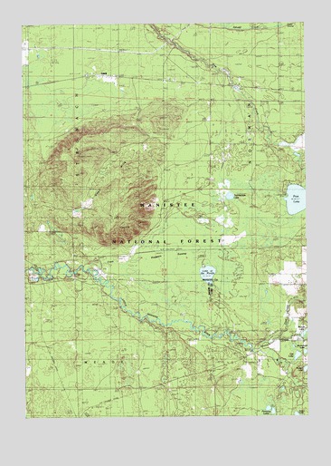
Udell, MI USGS Topographic Map
Click on map above to begin viewing in our Map Viewer.

This topographic map contains these locations and features:
Feature Name Type Latitude Longitude GNIS ID View Map
Bear Track CampgroundLocaleN44.1472°W86.0308°2513273View Map
Beaver LakeLakeN44.1514°W86.0012°1619145View Map
Buckwheat LakeLakeN44.1453°W86.0013°1619359View Map
Cool CreekStreamN44.1503°W86.0131°1619569View Map
Glenoak SchoolLocaleN44.2497°W86.1015°1620028View Map
Hoppers SwampSwampN44.1772°W86.0611°2104128View Map
Lake of the WoodsLakeN44.1703°W86.0441°1622216View Map
List LakeLakeN44.1441°W86.0049°1620524View Map
Ninemile BridgeBridgeN44.1711°W86.1040°1623527View Map
Pine LakeLakeN44.1937°W86.0044°1621247View Map
Pomeroy LakesLakeN44.1275°W86.0169°1621282View Map
Stronach CreekStreamN44.1458°W86.0251°1621797View Map
Tank CreekStreamN44.1722°W86.0967°2104129View Map
Timmerman LakeLakeN44.1950°W86.0340°1621914View Map
UdellPopulated PlaceN44.2336°W86.0915°1621994View Map
Udell HillsSummitN44.2039°W86.0856°1621995View Map
Udell Lookout TowerTowerN44.2078°W86.0998°1623680View Map
Walton LakeLakeN44.1398°W86.0012°1622054View Map
Wellston Medical CenterHospitalN44.2292°W86.0111°2499851View Map

Note: Coordinates in the location and feature list above are referenced to NAD83 datum.


Copyright (C) 2008-2024 Ryan Niemi / Sunset Dynamics ... All Rights Reserved