TopoQuest Logo
Do you find TopoQuest useful?
Help keep TopoQuest running and adding new maps/features by donating!
Bitcoin:  19c7KJd3qBynnjoSw5npx9KScwjBe4ifkT
Litecoin:  LXs6TkuXGGXo1vDsWCkWVdjQX94eUKd6ui
Home View Maps Find Maps Find Places Resources & Links


Union Church, Mississippi Topographic Map

USGS Map Title: Union Church, MS
USGS Map MRC: 31090F7
DRG (GeoTIFF) Download: o31090f7.tif


Neighboring USGS Topographic Map Quads:


  Red Lick, MS  
31090G8
 

  McBride, MS  
31090G7
 

  Barlow, MS  
31090G6
 

  Gin Branch, MS  
31090F8
 

  Union Church, MS  
31090F7
 

  Caseyville, MS  
31090F6
 

  Kirby, MS  
31090E8
 

  Eddiceton, MS  
31090E7
 

  McCall Creek, MS  
31090E6


Map MRC Location:

N32°
W91°
N32°
W90°
H8 H7 H6 H5 H4 H3 H2 H1
G8 G7 G6 G5 G4 G3 G2 G1
F8 F7 F6 F5 F4 F3 F2 F1
E8 E7 E6 E5 E4 E3 E2 E1
D8 D7 D6 D5 D4 D3 D2 D1
C8 C7 C6 C5 C4 C3 C2 C1
B8 B7 B6 B5 B4 B3 B2 B1
A8 A7 A6 A5 A4 A3 A2 A1
N31°
W91°
N31°
W90°

Union Church, MS USGS 1:24K Topographic Map Preview:
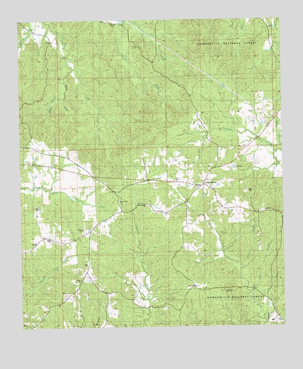
Union Church, MS USGS Topographic Map
Click on map above to begin viewing in our Map Viewer.

This topographic map contains these locations and features:
Feature Name Type Latitude Longitude GNIS ID View Map
Bear Skull CreekStreamN31.7032°W90.7859°692495View Map
Bell Hill ChurchChurchN31.6616°W90.8618°705297View Map
Brown BranchStreamN31.6488°W90.7695°692719View Map
Buie BranchStreamN31.6271°W90.7587°692760View Map
Buie CemeteryCemeteryN31.6493°W90.8443°692761View Map
Burl BranchStreamN31.6379°W90.7662°692770View Map
Caney BranchStreamN31.6982°W90.7501°692834View Map
Foster CreekStreamN31.7482°W90.8229°693251View Map
Griffin BranchStreamN31.7452°W90.8145°693368View Map
Gupton BranchStreamN31.7185°W90.8551°693391View Map
Hickory Block CemeteryCemeteryN31.6763°W90.8284°693459View Map
Hickory Block ChurchChurchN31.6743°W90.8151°693460View Map
Knight SchoolSchoolN31.6849°W90.8137°693667View Map
Leedo (historical)Populated PlaceN31.6474°W90.8445°707698View Map
McKay BranchStreamN31.7354°W90.8512°693922View Map
Mount Moriah ChurchChurchN31.6716°W90.7584°694064View Map
Nebo ChurchChurchN31.6402°W90.8479°694150View Map
Norton CemeteryCemeteryN31.7390°W90.8179°694214View Map
PerthPopulated PlaceN31.6593°W90.8679°694349View Map
Piedmont ChurchChurchN31.6388°W90.7782°694364View Map
Saint Regis Paper Company DamDamN31.7168°W90.7818°680847View Map
Shelton BranchStreamN31.7479°W90.8595°694761View Map
Singletary CemeteryCemeteryN31.7488°W90.8293°694800View Map
Supervisor District 1CivilN31.7086°W90.8270°711909View Map
Union ChurchPopulated PlaceN31.6829°W90.7876°695045View Map
Union Church CemeteryCemeteryN31.6821°W90.7901°1805813View Map
Union Church Post OfficePost OfficeN31.6831°W90.7866°712609View Map
Zion Hill Academy (historical)SchoolN31.6696°W90.8654°705224View Map

Note: Coordinates in the location and feature list above are referenced to NAD83 datum.


Copyright (C) 2008-2025 Ryan Niemi / Sunset Dynamics ... All Rights Reserved