TopoQuest Logo
Do you find TopoQuest useful?
Help keep TopoQuest running and adding new maps/features by donating!
Bitcoin:  19c7KJd3qBynnjoSw5npx9KScwjBe4ifkT
Litecoin:  LXs6TkuXGGXo1vDsWCkWVdjQX94eUKd6ui
Home View Maps Find Maps Find Places Resources & Links


Red Lick, Mississippi Topographic Map

USGS Map Title: Red Lick, MS
USGS Map MRC: 31090G8
DRG (GeoTIFF) Download: o31090g8.tif


Neighboring USGS Topographic Map Quads:


  Widows Creek, MS  
31091H1
 

  Port Gibson, MS  
31090H8
 

  Hermanville, MS  
31090H7
 

  Lorman, MS  
31091G1
 

  Red Lick, MS  
31090G8
 

  McBride, MS  
31090G7
 

  Fayette, MS  
31091F1
 

  Gin Branch, MS  
31090F8
 

  Union Church, MS  
31090F7


Map MRC Location:

N32°
W91°
N32°
W90°
H8 H7 H6 H5 H4 H3 H2 H1
G8 G7 G6 G5 G4 G3 G2 G1
F8 F7 F6 F5 F4 F3 F2 F1
E8 E7 E6 E5 E4 E3 E2 E1
D8 D7 D6 D5 D4 D3 D2 D1
C8 C7 C6 C5 C4 C3 C2 C1
B8 B7 B6 B5 B4 B3 B2 B1
A8 A7 A6 A5 A4 A3 A2 A1
N31°
W91°
N31°
W90°

Red Lick, MS USGS 1:24K Topographic Map Preview:
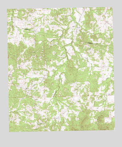
Red Lick, MS USGS Topographic Map
Click on map above to begin viewing in our Map Viewer.

This topographic map contains these locations and features:
Feature Name Type Latitude Longitude GNIS ID View Map
Beech Hill CemeteryCemeteryN31.7774°W90.9684°666756View Map
Blue HillSummitN31.7627°W90.8937°667286View Map
Brady CreekStreamN31.8177°W90.9304°667512View Map
Brick ChurchChurchN31.8082°W90.9984°667558View Map
Cherry Hill CemeteryCemeteryN31.7965°W90.9898°668371View Map
Church of GodChurchN31.7860°W90.9718°668456View Map
Darden CemeteryCemeteryN31.8682°W90.8876°669109View Map
Dennis CrossroadsPopulated PlaceN31.7582°W90.9595°691809View Map
East Mount Olive Baptist ChurchChurchN31.7827°W90.9682°674123View Map
Homeless CemeteryCemeteryN31.7793°W90.9182°671377View Map
J O Brady Lake DamDamN31.8002°W90.9468°680898View Map
Little Zion CemeteryCemeteryN31.7868°W90.8818°672716View Map
Mizpah ChurchChurchN31.7521°W90.9695°673714View Map
Providence ChurchChurchN31.8329°W90.9020°676375View Map
Red LickPopulated PlaceN31.7924°W90.9793°676540View Map
Red Lick CemeteryCemeteryN31.8082°W90.9982°707701View Map
Redlick Oil FieldOilfieldN31.8271°W90.9907°691015View Map
Rose Hill ChurchChurchN31.8307°W90.9709°676855View Map
Stephens CemeteryCemeteryN31.7574°W90.9620°678270View Map
TillmanPopulated PlaceN31.8546°W90.9162°690937View Map
Tillman ChapelChurchN31.8563°W90.9198°678762View Map
Wade CemeteryCemeteryN31.8382°W90.9484°679235View Map
Wall Hill ChurchChurchN31.7916°W90.9204°679284View Map
Whetstone CreekStreamN31.8643°W90.9209°679558View Map
Zion ChurchChurchN31.7843°W90.8893°679992View Map
Zion CreekStreamN31.8010°W90.8843°680004View Map

Note: Coordinates in the location and feature list above are referenced to NAD83 datum.


Copyright (C) 2008-2024 Ryan Niemi / Sunset Dynamics ... All Rights Reserved