TopoQuest Logo
Do you find TopoQuest useful?
Help keep TopoQuest running and adding new maps/features by donating!
Bitcoin:  19c7KJd3qBynnjoSw5npx9KScwjBe4ifkT
Litecoin:  LXs6TkuXGGXo1vDsWCkWVdjQX94eUKd6ui
Home View Maps Find Maps Find Places Resources & Links


Unity Pond, Maine Topographic Map

USGS Map Title: Unity Pond, ME
USGS Map MRC: 44069F3
DRG (GeoTIFF) Download: o44069f3.tif


Neighboring USGS Topographic Map Quads:


  Pittsfield, ME  
44069G4
 

  Newport, ME  
44069G3
 

  Plymouth, ME  
44069G2
 

  Burnham, ME  
44069F4
 

  Unity Pond, ME  
44069F3
 

  Dixmont, ME  
44069F2
 

  Albion, ME  
44069E4
 

  Unity, ME  
44069E3
 

  Brooks West, ME  
44069E2


Map MRC Location:

N45°
W70°
N45°
W69°
H8 H7 H6 H5 H4 H3 H2 H1
G8 G7 G6 G5 G4 G3 G2 G1
F8 F7 F6 F5 F4 F3 F2 F1
E8 E7 E6 E5 E4 E3 E2 E1
D8 D7 D6 D5 D4 D3 D2 D1
C8 C7 C6 C5 C4 C3 C2 C1
B8 B7 B6 B5 B4 B3 B2 B1
A8 A7 A6 A5 A4 A3 A2 A1
N44°
W70°
N44°
W69°

Unity Pond, ME USGS 1:24K Topographic Map Preview:
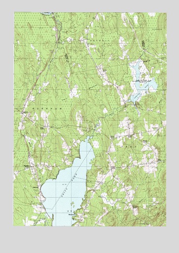
Unity Pond, ME USGS Topographic Map
Click on map above to begin viewing in our Map Viewer.

This topographic map contains these locations and features:
Feature Name Type Latitude Longitude GNIS ID View Map
Beartrap BrookStreamN44.7495°W69.3412°561880View Map
Beech HillSummitN44.7167°W69.3033°561984View Map
Bithers BrookStreamN44.6440°W69.3156°562380View Map
Bog BrookStreamN44.6381°W69.2931°562667View Map
Burnham Fire Department Station 2BuildingN44.6591°W69.3616°2553205View Map
Carlton BogSwampN44.7115°W69.2698°563564View Map
Carlton PondReservoirN44.7083°W69.2634°563570View Map
Carlton Pond DamDamN44.6980°W69.2835°1774167View Map
Carlton Pond Waterfowl Production AreaParkN44.7083°W69.2710°2765230View Map
Carlton StreamStreamN44.6773°W69.3123°563571View Map
Chain MeadowsSwampN44.7040°W69.3228°563792View Map
Chandler CemeteryCemeteryN44.6667°W69.3280°563820View Map
Cooks CornerPopulated PlaceN44.6790°W69.2798°579210View Map
Dodge CornerPopulated PlaceN44.6837°W69.3481°579245View Map
Fairview CemeteryCemeteryN44.6703°W69.2600°566006View Map
Gerrish CornerPopulated PlaceN44.6376°W69.2781°579328View Map
Greens CornerPopulated PlaceN44.6587°W69.2948°579367View Map
Hales CornerPopulated PlaceN44.6634°W69.2564°579377View Map
Meadow BrookStreamN44.6501°W69.3498°571079View Map
Mitchell CornerPopulated PlaceN44.6740°W69.2667°579526View Map
OakwoodPopulated PlaceN44.6490°W69.3539°579584View Map
Reynolds CemeteryCemeteryN44.6458°W69.3530°574150View Map
Reynolds CornerPopulated PlaceN44.6598°W69.3600°574151View Map
Sandy StreamStreamN44.6323°W69.3464°574895View Map
Shaw BrookStreamN44.7059°W69.2584°575316View Map
Smarts CornerPopulated PlaceN44.6762°W69.2939°579700View Map
Town of TroyCivilN44.6791°W69.2536°582769View Map
Troy CenterPopulated PlaceN44.6826°W69.2567°579778View Map
Troy Central SchoolSchoolN44.6633°W69.2614°577363View Map
Troy Volunteer Fire StationBuildingN44.6629°W69.2597°2552910View Map
Twitchell CornerPopulated PlaceN44.6912°W69.3667°579781View Map
Unity PondLakeN44.6460°W69.3301°577561View Map
Webb CemeteryCemeteryN44.6393°W69.2588°2725335View Map
WindemerePopulated PlaceN44.6315°W69.3239°578562View Map

Note: Coordinates in the location and feature list above are referenced to NAD83 datum.


Copyright (C) 2008-2025 Ryan Niemi / Sunset Dynamics ... All Rights Reserved