TopoQuest Logo
Do you find TopoQuest useful?
Help keep TopoQuest running and adding new maps/features by donating!
Bitcoin:  19c7KJd3qBynnjoSw5npx9KScwjBe4ifkT
Litecoin:  LXs6TkuXGGXo1vDsWCkWVdjQX94eUKd6ui
Home View Maps Find Maps Find Places Resources & Links


Utica East, Missouri Topographic Map

USGS Map Title: Utica East, MO
USGS Map MRC: 39093F5
DRG (GeoTIFF) Download: o39093f5.tif


Neighboring USGS Topographic Map Quads:


  Sampsel, MO  
39093G6
 

  Chillicothe, MO  
39093G5
 

  Wheeling, MO  
39093G4
 

  Utica West, MO  
39093F6
 

  Utica East, MO  
39093F5
 

  Avalon, MO  
39093F4
 

  Plymouth, MO  
39093E6
 

  Coloma, MO  
39093E5
 

  Tina, MO  
39093E4


Map MRC Location:

N40°
W94°
N40°
W93°
H8 H7 H6 H5 H4 H3 H2 H1
G8 G7 G6 G5 G4 G3 G2 G1
F8 F7 F6 F5 F4 F3 F2 F1
E8 E7 E6 E5 E4 E3 E2 E1
D8 D7 D6 D5 D4 D3 D2 D1
C8 C7 C6 C5 C4 C3 C2 C1
B8 B7 B6 B5 B4 B3 B2 B1
A8 A7 A6 A5 A4 A3 A2 A1
N39°
W94°
N39°
W93°

Utica East, MO USGS 1:24K Topographic Map Preview:
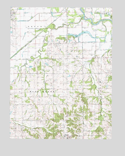
Utica East, MO USGS Topographic Map
Click on map above to begin viewing in our Map Viewer.

This topographic map contains these locations and features:
Feature Name Type Latitude Longitude GNIS ID View Map
Barry School (historical)SchoolN39.6570°W93.6108°734301View Map
Baxter School (historical)SchoolN39.6584°W93.5594°713748View Map
Blackwell BranchStreamN39.7475°W93.5349°714337View Map
Blue MoundPopulated PlaceN39.6278°W93.5580°739978View Map
Blue Mound CemeteryCemeteryN39.6353°W93.5627°714414View Map
Blue Mound Post OfficePost OfficeN39.6278°W93.5585°1930452View Map
Blue Mound School (historical)SchoolN39.6278°W93.5583°1994445View Map
Bowman School (historical)SchoolN39.6875°W93.6010°734300View Map
Brush CreekStreamN39.7036°W93.5888°714830View Map
Christian CemeteryCemeteryN39.6981°W93.5741°715814View Map
ClearyPopulated PlaceN39.7434°W93.5316°759647View Map
Condron School (historical)SchoolN39.6295°W93.5174°716187View Map
Englert LakeReservoirN39.6962°W93.5806°760799View Map
Englert Lake DamDamN39.6967°W93.5835°760798View Map
Kincaid School (historical)SchoolN39.6875°W93.5544°730126View Map
Leeper BranchStreamN39.7372°W93.5002°720895View Map
Liberty ChurchChurchN39.6870°W93.5560°720978View Map
Mayberry CemeteryCemeteryN39.6506°W93.5035°722004View Map
McCleary School (historical)LocaleN39.7222°W93.5205°722042View Map
Mononame 58 LakeReservoirN39.6752°W93.5063°760852View Map
Moore Lake DamDamN39.7184°W93.5535°762415View Map
Mound CreekStreamN39.7381°W93.5110°722692View Map
Roach LakeLakeN39.7255°W93.5379°725367View Map
Savage Lake DamDamN39.6750°W93.5069°760851View Map
Shoal CreekStreamN39.7411°W93.5372°726392View Map
Smith Campbell School (historical)SchoolN39.6878°W93.5172°726582View Map
Swain School (historical)SchoolN39.7089°W93.5552°727352View Map
Township of Blue MoundCivilN39.6644°W93.5885°766926View Map
Township of GreenCivilN39.7325°W93.6160°766931View Map
Vaughn SchoolSchoolN39.6586°W93.5169°728159View Map
Welsh CemeteryCemeteryN39.6570°W93.5969°2702427View Map
Wolf CreekStreamN39.7297°W93.5799°729051View Map
Wolf Grove CreekStreamN39.7128°W93.5002°729057View Map

Note: Coordinates in the location and feature list above are referenced to NAD83 datum.


Copyright (C) 2008-2025 Ryan Niemi / Sunset Dynamics ... All Rights Reserved