TopoQuest Logo
Do you find TopoQuest useful?
Help keep TopoQuest running and adding new maps/features by donating!
Bitcoin:  19c7KJd3qBynnjoSw5npx9KScwjBe4ifkT
Litecoin:  LXs6TkuXGGXo1vDsWCkWVdjQX94eUKd6ui
Home View Maps Find Maps Find Places Resources & Links


Wheeling, Missouri Topographic Map

USGS Map Title: Wheeling, MO
USGS Map MRC: 39093G4
DRG (GeoTIFF) Download: o39093g4.tif


Neighboring USGS Topographic Map Quads:


  Farmersville, MO  
39093H5
 

  Chula, MO  
39093H4
 

  Eversonville, MO  
39093H3
 

  Chillicothe, MO  
39093G5
 

  Wheeling, MO  
39093G4
 

  Meadville, MO  
39093G3
 

  Utica East, MO  
39093F5
 

  Avalon, MO  
39093F4
 

  Fountain Grove, MO  
39093F3


Map MRC Location:

N40°
W94°
N40°
W93°
H8 H7 H6 H5 H4 H3 H2 H1
G8 G7 G6 G5 G4 G3 G2 G1
F8 F7 F6 F5 F4 F3 F2 F1
E8 E7 E6 E5 E4 E3 E2 E1
D8 D7 D6 D5 D4 D3 D2 D1
C8 C7 C6 C5 C4 C3 C2 C1
B8 B7 B6 B5 B4 B3 B2 B1
A8 A7 A6 A5 A4 A3 A2 A1
N39°
W94°
N39°
W93°

Wheeling, MO USGS 1:24K Topographic Map Preview:
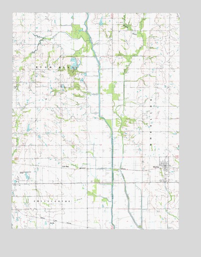
Wheeling, MO USGS Topographic Map
Click on map above to begin viewing in our Map Viewer.

This topographic map contains these locations and features:
Feature Name Type Latitude Longitude GNIS ID View Map
Bradford School (historical)SchoolN39.7978°W93.4644°714615View Map
Butler School (historical)SchoolN39.7659°W93.4827°715127View Map
Campbell DamDamN39.7784°W93.4852°761323View Map
Campbell LakeReservoirN39.7784°W93.4852°761324View Map
Chillicothe Municipal AirportAirportN39.7802°W93.4957°758637View Map
Circle BranchStreamN39.7711°W93.4313°715850View Map
City of WheelingCivilN39.7861°W93.3860°2397298View Map
Cooke Lake Dam SouthDamN39.8434°W93.4519°762341View Map
Cooke Lake North DamDamN39.8500°W93.4535°760457View Map
Cooke Recreation LakeReservoirN39.8500°W93.4535°760458View Map
Cream RidgePopulated PlaceN39.7853°W93.4627°740774View Map
Cream Ridge Post OfficePost OfficeN39.7847°W93.4627°1930467View Map
Demitt Lake DamDamN39.7967°W93.3752°761716View Map
Hall Lake DamDamN39.8434°W93.4552°760849View Map
Jackspine SchoolSchoolN39.7611°W93.4427°720201View Map
Leopolis (historical)Populated PlaceN39.8720°W93.4213°759649View Map
McCormick SchoolSchoolN39.8572°W93.4844°722059View Map
Missouri Department of Conservation Forestry Northwest Regional Field Fire Office ChillicotheBuildingN39.7751°W93.4870°2621304View Map
Mononame 57 LakeReservoirN39.8434°W93.4552°760850View Map
New York SchoolSchoolN39.8575°W93.3830°723324View Map
Norman BranchStreamN39.8628°W93.4038°723419View Map
NorvillePopulated PlaceN39.7545°W93.4724°741110View Map
Pleasant Grove Church (historical)ChurchN39.7772°W93.4830°724495View Map
Pond School (historical)SchoolN39.8195°W93.4624°724734View Map
Prairie Valley School (historical)SchoolN39.8659°W93.4238°724890View Map
Ross CemeteryCemeteryN39.8428°W93.4652°725578View Map
Sapp BranchStreamN39.8606°W93.4510°726055View Map
Slagle School (historical)SchoolN39.8386°W93.4538°726528View Map
Township of Rich HillCivilN39.8348°W93.4829°766936View Map
Township of WheelingCivilN39.8063°W93.3935°766938View Map
Trager Lake East DamDamN39.8067°W93.4885°761770View Map
WheelingPopulated PlaceN39.7867°W93.3855°728695View Map
Wheeling Post OfficePost OfficeN39.7859°W93.3857°2782690View Map
Wheeling Rural Fire DepartmentBuildingN39.7838°W93.3845°2621430View Map

Note: Coordinates in the location and feature list above are referenced to NAD83 datum.


Copyright (C) 2008-2025 Ryan Niemi / Sunset Dynamics ... All Rights Reserved