TopoQuest Logo
Do you find TopoQuest useful?
Help keep TopoQuest running and adding new maps/features by donating!
Bitcoin:  19c7KJd3qBynnjoSw5npx9KScwjBe4ifkT
Litecoin:  LXs6TkuXGGXo1vDsWCkWVdjQX94eUKd6ui
Home View Maps Find Maps Find Places Resources & Links


Chillicothe, Missouri Topographic Map

USGS Map Title: Chillicothe, MO
USGS Map MRC: 39093G5
DRG (GeoTIFF) Download: o39093g5.tif


Neighboring USGS Topographic Map Quads:


  Shearwood, MO  
39093H6
 

  Farmersville, MO  
39093H5
 

  Chula, MO  
39093H4
 

  Sampsel, MO  
39093G6
 

  Chillicothe, MO  
39093G5
 

  Wheeling, MO  
39093G4
 

  Utica West, MO  
39093F6
 

  Utica East, MO  
39093F5
 

  Avalon, MO  
39093F4


Map MRC Location:

N40°
W94°
N40°
W93°
H8 H7 H6 H5 H4 H3 H2 H1
G8 G7 G6 G5 G4 G3 G2 G1
F8 F7 F6 F5 F4 F3 F2 F1
E8 E7 E6 E5 E4 E3 E2 E1
D8 D7 D6 D5 D4 D3 D2 D1
C8 C7 C6 C5 C4 C3 C2 C1
B8 B7 B6 B5 B4 B3 B2 B1
A8 A7 A6 A5 A4 A3 A2 A1
N39°
W94°
N39°
W93°

Chillicothe, MO USGS 1:24K Topographic Map Preview:
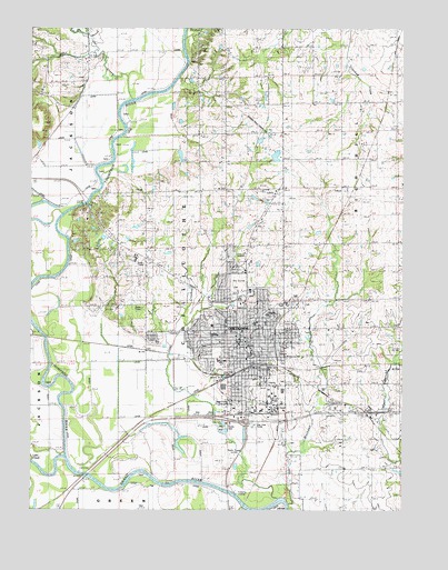
Chillicothe, MO USGS Topographic Map
Click on map above to begin viewing in our Map Viewer.

This topographic map contains these locations and features:
Feature Name Type Latitude Longitude GNIS ID View Map
Adams SchoolSchoolN39.8195°W93.5013°713150View Map
Bishop Hogan Memorial SchoolSchoolN39.7986°W93.5504°2545348View Map
Bliss School (historical)SchoolN39.7603°W93.5591°714372View Map
Carlton Lake DamDamN39.8433°W93.5752°762432View Map
Central SchoolSchoolN39.7903°W93.5511°2545359View Map
ChillicothePopulated PlaceN39.7953°W93.5524°715783View Map
Chillicothe Alternative Center for EducationSchoolN39.7741°W93.5504°2545500View Map
Chillicothe Correctional CenterBuildingN39.8322°W93.5389°2735650View Map
Chillicothe Fire DepartmentBuildingN39.7886°W93.5528°2620295View Map
Chillicothe High SchoolSchoolN39.8209°W93.5561°2545314View Map
Chillicothe Middle SchoolSchoolN39.7956°W93.5635°2545431View Map
Chillicothe Police DepartmentBuildingN39.7938°W93.5556°2752272View Map
Chillicothe Post OfficePost OfficeN39.7816°W93.5521°2782743View Map
City of ChillicotheCivilN39.7948°W93.5498°2393517View Map
Coon CreekStreamN39.7531°W93.5419°738437View Map
Copeland Lake DamDamN39.8467°W93.5485°762420View Map
Dewey SchoolSchoolN39.7965°W93.5597°2545087View Map
Edgewood CemeteryCemeteryN39.8001°W93.5647°2702421View Map
Field Elementary SchoolSchoolN39.7985°W93.5464°2545100View Map
Garrison SchoolSchoolN39.7844°W93.5475°2545459View Map
Girdner SchoolSchoolN39.8614°W93.6113°718470View Map
Graham Mill Bridge (historical)BridgeN39.8325°W93.6033°718659View Map
Grand River Technical SchoolSchoolN39.7990°W93.5597°2545444View Map
Green Grove School (historical)SchoolN39.8559°W93.5222°718794View Map
Hamilton Lake East DamDamN39.8200°W93.6019°762426View Map
Hamilton Lake West DamDamN39.8200°W93.6119°762428View Map
Hedrick Medical CenterHospitalN39.8170°W93.5511°2655102View Map
Jones School (historical)SchoolN39.7975°W93.5024°720423View Map
KCHI-AM (Chillicothe)TowerN39.7642°W93.5560°754267View Map
KCHI-FM (Chillicothe)TowerN39.8145°W93.5891°759141View Map
Lake CreekStreamN39.7620°W93.6227°720748View Map
Linville School (historical)SchoolN39.8514°W93.5599°721136View Map
Litton Lake North DamDamN39.8233°W93.5519°762430View Map
Litton Lake South DamDamN39.8134°W93.5485°762421View Map
Livingston CountyCivilN39.7821°W93.5483°758513View Map
Livingston County Sheriff's OfficeBuildingN39.7945°W93.5551°2752155View Map
Minor SchoolSchoolN39.8150°W93.5408°722447View Map
Number 56 LakeReservoirN39.8420°W93.5430°760848View Map
Oak Grove SchoolSchoolN39.7667°W93.5210°723605View Map
Olenhouse Lake DamDamN39.8433°W93.5452°760847View Map
Owl CreekStreamN39.8567°W93.5913°738424View Map
Smith Lake DamDamN39.8467°W93.6219°762431View Map
Thistlethwait Lake DamDamN39.8167°W93.5785°762429View Map
Thompson RiverStreamN39.7639°W93.6144°730228View Map
Township of ChillicotheCivilN39.7852°W93.5279°766927View Map
Verelle Peniston State SchoolSchoolN39.7918°W93.5631°2545382View Map
Willard School (historical)SchoolN39.7881°W93.5858°747001View Map
Woodland SchoolSchoolN39.8256°W93.5883°729105View Map

Note: Coordinates in the location and feature list above are referenced to NAD83 datum.


Copyright (C) 2008-2025 Ryan Niemi / Sunset Dynamics ... All Rights Reserved