TopoQuest Logo
Do you find TopoQuest useful?
Help keep TopoQuest running and adding new maps/features by donating!
Bitcoin:  19c7KJd3qBynnjoSw5npx9KScwjBe4ifkT
Litecoin:  LXs6TkuXGGXo1vDsWCkWVdjQX94eUKd6ui
Home View Maps Find Maps Find Places Resources & Links


Valle San Antonio, New Mexico Topographic Map

USGS Map Title: Valle San Antonio, NM
USGS Map MRC: 35106H5
DRG (GeoTIFF) Download: o35106h5.tif


Neighboring USGS Topographic Map Quads:


  Jarosa, NM  
36106A6
 

  Cerro del Grant, NM  
36106A5
 

  Polvadera Peak, NM  
36106A4
 

  Seven Springs, NM  
35106H6
 

  Valle San Antonio, NM  
35106H5
 

  Valle Toledo, NM  
35106H4
 

  Jemez Springs, NM  
35106G6
 

  Redondo Peak, NM  
35106G5
 

  Bland, NM  
35106G4


Map MRC Location:

N36°
W107°
N36°
W106°
H8 H7 H6 H5 H4 H3 H2 H1
G8 G7 G6 G5 G4 G3 G2 G1
F8 F7 F6 F5 F4 F3 F2 F1
E8 E7 E6 E5 E4 E3 E2 E1
D8 D7 D6 D5 D4 D3 D2 D1
C8 C7 C6 C5 C4 C3 C2 C1
B8 B7 B6 B5 B4 B3 B2 B1
A8 A7 A6 A5 A4 A3 A2 A1
N35°
W107°
N35°
W106°

Valle San Antonio, NM USGS 1:24K Topographic Map Preview:
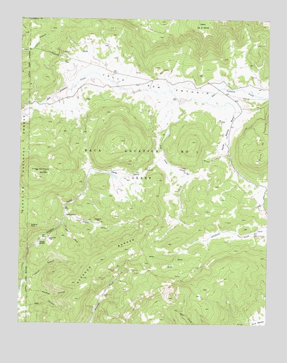
Valle San Antonio, NM USGS Topographic Map
Click on map above to begin viewing in our Map Viewer.

This topographic map contains these locations and features:
Feature Name Type Latitude Longitude GNIS ID View Map
Alamo CanyonValleyN35.9189°W106.6023°928677View Map
Cerro de la GaritaSummitN35.9989°W106.5303°918133View Map
Cerros de TrasquilarSummitN35.9425°W106.5067°2038779View Map
Electric SpringSpringN35.9072°W106.6173°914263View Map
Footbath SpringSpringN35.9080°W106.6158°914280View Map
Freelove CanyonValleyN35.8911°W106.6245°906389View Map
Kidney and Stomach Trouble SpringSpringN35.9086°W106.6161°902598View Map
Ladies Bath HouseSpringN35.9064°W106.6161°902610View Map
Laxitive SpringSpringN35.9075°W106.6178°914308View Map
Lemonade SpringSpringN35.9072°W106.6161°914298View Map
Mens Bath HouseSpringN35.9067°W106.6159°902616View Map
Mormon CanyonValleyN35.8872°W106.6242°908914View Map
Redondo BorderRidgeN35.9011°W106.5842°910093View Map
San Antonio MountainSummitN35.9375°W106.6159°918339View Map
San Antonio Warm SpringSpringN35.9715°W106.5611°902625View Map
San Luis CreekStreamN35.9670°W106.5450°910659View Map
Short CanyonValleyN35.9170°W106.6031°911023View Map
Steam Well MineMineN35.8892°W106.5709°939832View Map
Steam Well MineMineN35.9170°W106.5861°939649View Map
Steam Well MineMineN35.9189°W106.6023°939650View Map
Sulphur Bank GroupMineN35.9084°W106.6175°916356View Map
Sulphur PointSummitN35.9147°W106.6198°918374View Map
Sulphur SpringsSpringN35.9081°W106.6164°2038705View Map
Sulphur SpringsMineN35.9070°W106.6145°916250View Map
Sulphur SpringsPopulated PlaceN35.9075°W106.6159°918375View Map
Sulphur Springs Post Office (historical)Post OfficeN35.9075°W106.6159°937776View Map
Turkey SpringSpringN35.9139°W106.6075°914376View Map
Valle San AntonioValleyN35.9639°W106.6164°928835View Map
Valle Santa RosaValleyN35.9661°W106.5320°928836View Map
Valle SecoValleyN35.9372°W106.5900°918396View Map
Valles CalderaCraterN35.9000°W106.5506°897537View Map
Valles Caldera National PreserveParkN35.9168°W106.5196°2035517View Map

Note: Coordinates in the location and feature list above are referenced to NAD83 datum.


Copyright (C) 2008-2025 Ryan Niemi / Sunset Dynamics ... All Rights Reserved