TopoQuest Logo
Do you find TopoQuest useful?
Help keep TopoQuest running and adding new maps/features by donating!
Bitcoin:  19c7KJd3qBynnjoSw5npx9KScwjBe4ifkT
Litecoin:  LXs6TkuXGGXo1vDsWCkWVdjQX94eUKd6ui
Home View Maps Find Maps Find Places Resources & Links


Van Cleve, Missouri Topographic Map

USGS Map Title: Van Cleve, MO
USGS Map MRC: 38092B2
DRG (GeoTIFF) Download: o38092b2.tif


Neighboring USGS Topographic Map Quads:


  Saint Elizabeth, MO  
38092C3
 

  Meta, MO  
38092C2
 

  Argyle, MO  
38092C1
 

  Saint Anthony, MO  
38092B3
 

  Van Cleve, MO  
38092B2
 

  Brinktown, MO  
38092B1
 

  Iberia, MO  
38092A3
 

  Brays, MO  
38092A2
 

  Big Bend, MO  
38092A1


Map MRC Location:

N39°
W93°
N39°
W92°
H8 H7 H6 H5 H4 H3 H2 H1
G8 G7 G6 G5 G4 G3 G2 G1
F8 F7 F6 F5 F4 F3 F2 F1
E8 E7 E6 E5 E4 E3 E2 E1
D8 D7 D6 D5 D4 D3 D2 D1
C8 C7 C6 C5 C4 C3 C2 C1
B8 B7 B6 B5 B4 B3 B2 B1
A8 A7 A6 A5 A4 A3 A2 A1
N38°
W93°
N38°
W92°

Van Cleve, MO USGS 1:24K Topographic Map Preview:
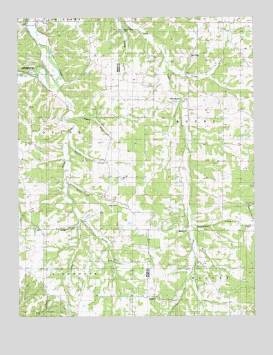
Van Cleve, MO USGS Topographic Map
Click on map above to begin viewing in our Map Viewer.

This topographic map contains these locations and features:
Feature Name Type Latitude Longitude GNIS ID View Map
Barnhart CemeteryCemeteryN38.2339°W92.2088°713688View Map
BarnhartsLocaleN38.1673°W92.1616°744488View Map
Baumhoer SchoolSchoolN38.2239°W92.2230°729424View Map
Berry CreekStreamN38.1578°W92.1563°713996View Map
Boeckman Bridge State Wildlife AreaParkN38.2278°W92.2385°741851View Map
Brown SchoolSchoolN38.1475°W92.2110°714784View Map
Brown School (historical)SchoolN38.1481°W92.1943°744542View Map
Cainby (historical)LocaleN38.1745°W92.2080°744702View Map
Camp Ground SchoolSchoolN38.2259°W92.1602°715270View Map
Campground ChurchChurchN38.2259°W92.1610°744483View Map
Carnes BranchStreamN38.2281°W92.1707°715267View Map
Crisman CemeteryCemeteryN38.1642°W92.1274°716502View Map
Dake CreekStreamN38.1659°W92.2168°716640View Map
Duncan BranchStreamN38.1836°W92.2249°717173View Map
Duncan CemeteryCemeteryN38.1750°W92.2004°717178View Map
Greasy CreekStreamN38.1656°W92.2168°729266View Map
Hatton BranchStreamN38.2114°W92.2224°719208View Map
Iberia Rural Fire Protection District Station 3BuildingN38.1443°W92.2135°2620898View Map
Jim-Matt Lawson CemeteryCemeteryN38.1828°W92.1957°720324View Map
Lawson CemeteryCemeteryN38.1598°W92.1835°720847View Map
Meddleberger BranchStreamN38.1645°W92.1585°722191View Map
MeyerstownPopulated PlaceN38.1614°W92.1616°741063View Map
New Toff SchoolSchoolN38.1809°W92.1407°729579View Map
Old Van CleveLocaleN38.2142°W92.1691°723797View Map
Pendleton CemeteryCemeteryN38.2245°W92.1874°724198View Map
Red School (historical)SchoolN38.1831°W92.1732°744486View Map
Ricker ChurchChurchN38.2373°W92.1552°725285View Map
Ricker Memorial Church (historical)ChurchN38.2409°W92.1541°744485View Map
Shelton BranchStreamN38.1986°W92.2235°726314View Map
Smyrna ChurchChurchN38.1639°W92.1746°726648View Map
Smyrnah ChurchChurchN38.1642°W92.1743°744487View Map
Spring Valley LakeReservoirN38.2450°W92.1952°726955View Map
Stokes CemeteryCemeteryN38.2367°W92.1304°727123View Map
SudheimerPopulated PlaceN38.1331°W92.1788°741301View Map
TavernPopulated PlaceN38.1625°W92.1296°741312View Map
Van ClevePopulated PlaceN38.2350°W92.1574°728113View Map
Wheeler ChurchChurchN38.1459°W92.1529°744489View Map
Wheeler SchoolSchoolN38.1459°W92.1527°728693View Map
White SchoolSchoolN38.1773°W92.2274°728767View Map
Wiemer CreekStreamN38.2228°W92.2299°739965View Map

Note: Coordinates in the location and feature list above are referenced to NAD83 datum.


Copyright (C) 2008-2025 Ryan Niemi / Sunset Dynamics ... All Rights Reserved