TopoQuest Logo
Do you find TopoQuest useful?
Help keep TopoQuest running and adding new maps/features by donating!
Bitcoin:  19c7KJd3qBynnjoSw5npx9KScwjBe4ifkT
Litecoin:  LXs6TkuXGGXo1vDsWCkWVdjQX94eUKd6ui
Home View Maps Find Maps Find Places Resources & Links


Saint Anthony, Missouri Topographic Map

USGS Map Title: Saint Anthony, MO
USGS Map MRC: 38092B3
DRG (GeoTIFF) Download: o38092b3.tif


Neighboring USGS Topographic Map Quads:


  Eugene, MO  
38092C4
 

  Saint Elizabeth, MO  
38092C3
 

  Meta, MO  
38092C2
 

  Tuscumbia, MO  
38092B4
 

  Saint Anthony, MO  
38092B3
 

  Van Cleve, MO  
38092B2
 

  Brumley, MO  
38092A4
 

  Iberia, MO  
38092A3
 

  Brays, MO  
38092A2


Map MRC Location:

N39°
W93°
N39°
W92°
H8 H7 H6 H5 H4 H3 H2 H1
G8 G7 G6 G5 G4 G3 G2 G1
F8 F7 F6 F5 F4 F3 F2 F1
E8 E7 E6 E5 E4 E3 E2 E1
D8 D7 D6 D5 D4 D3 D2 D1
C8 C7 C6 C5 C4 C3 C2 C1
B8 B7 B6 B5 B4 B3 B2 B1
A8 A7 A6 A5 A4 A3 A2 A1
N38°
W93°
N38°
W92°

Saint Anthony, MO USGS 1:24K Topographic Map Preview:
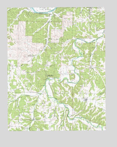
Saint Anthony, MO USGS Topographic Map
Click on map above to begin viewing in our Map Viewer.

This topographic map contains these locations and features:
Feature Name Type Latitude Longitude GNIS ID View Map
Bailey BranchStreamN38.1278°W92.3474°713539View Map
Barren ForkStreamN38.1624°W92.3341°713696View Map
Berry IslandIslandN38.2459°W92.3407°713997View Map
Brushy CreekStreamN38.2170°W92.2616°714894View Map
Brushy ForkStreamN38.1675°W92.3268°714908View Map
CappsPopulated PlaceN38.2423°W92.3210°729455View Map
Capps SchoolSchoolN38.2364°W92.3230°715385View Map
Elliott School (historical)SchoolN38.1323°W92.3196°717486View Map
Fairview ChurchChurchN38.1342°W92.3221°744541View Map
Haw CreekStreamN38.1592°W92.3613°719219View Map
Heltzell HollowValleyN38.1467°W92.3002°719360View Map
High PointSummitN38.2000°W92.3555°739993View Map
House MoundsSummitN38.1720°W92.3074°738931View Map
Humphrey CreekStreamN38.2445°W92.3160°719991View Map
Humphrey Creek ChurchChurchN38.2325°W92.3196°729520View Map
Iberia Rural Fire Protection District Station 2BuildingN38.1562°W92.2760°2621301View Map
Mountain View ChurchChurchN38.1611°W92.3727°729572View Map
Mountain View ChurchChurchN38.1534°W92.3741°722998View Map
Panther CreekStreamN38.2470°W92.3441°723982View Map
Pilkinton BranchStreamN38.1528°W92.3096°724344View Map
Rabbithead CreekStreamN38.1292°W92.2652°766168View Map
Ramsey BranchStreamN38.2003°W92.3391°725087View Map
Ramsey CemeteryCemeteryN38.1889°W92.3643°725092View Map
Saint AnthonyPopulated PlaceN38.1556°W92.2741°740018View Map
Strump School (historical)SchoolN38.2234°W92.2730°727190View Map
Sullivan BranchStreamN38.2448°W92.3157°727269View Map
Township of OsageCivilN38.2333°W92.2929°767020View Map
Wilson Camp State Wildlife AreaParkN38.1806°W92.3207°741848View Map
Wilson CemeteryCemeteryN38.1706°W92.3510°728960View Map
Wilson School (historical)SchoolN38.1856°W92.3363°728981View Map

Note: Coordinates in the location and feature list above are referenced to NAD83 datum.


Copyright (C) 2008-2025 Ryan Niemi / Sunset Dynamics ... All Rights Reserved