TopoQuest Logo
Do you find TopoQuest useful?
Help keep TopoQuest running and adding new maps/features by donating!
Bitcoin:  19c7KJd3qBynnjoSw5npx9KScwjBe4ifkT
Litecoin:  LXs6TkuXGGXo1vDsWCkWVdjQX94eUKd6ui
Home View Maps Find Maps Find Places Resources & Links


Vardaman, Mississippi Topographic Map

USGS Map Title: Vardaman, MS
USGS Map MRC: 33089H2
DRG (GeoTIFF) Download: o33089h2.tif


Neighboring USGS Topographic Map Quads:


  Sarepta, MS  
34089A3
 

  Robbs, MS  
34089A2
 

  Houlka, MS  
34089A1
 

  Bruce, MS  
33089H3
 

  Vardaman, MS  
33089H2
 

  Houston West, MS  
33089H1
 

  Calhoun City, MS  
33089G3
 

  Atlanta, MS  
33089G2
 

  Woodland, MS  
33089G1


Map MRC Location:

N34°
W90°
N34°
W89°
H8 H7 H6 H5 H4 H3 H2 H1
G8 G7 G6 G5 G4 G3 G2 G1
F8 F7 F6 F5 F4 F3 F2 F1
E8 E7 E6 E5 E4 E3 E2 E1
D8 D7 D6 D5 D4 D3 D2 D1
C8 C7 C6 C5 C4 C3 C2 C1
B8 B7 B6 B5 B4 B3 B2 B1
A8 A7 A6 A5 A4 A3 A2 A1
N33°
W90°
N33°
W89°

Vardaman, MS USGS 1:24K Topographic Map Preview:
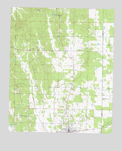
Vardaman, MS USGS Topographic Map
Click on map above to begin viewing in our Map Viewer.

This topographic map contains these locations and features:
Feature Name Type Latitude Longitude GNIS ID View Map
Bailey Lake DamDamN33.9484°W89.2451°682412View Map
Billy Alexander Pond DamDamN33.9651°W89.1417°682420View Map
Church of the Lord Jesus ChristChurchN33.8765°W89.1728°683368View Map
Cook CreekStreamN33.9207°W89.1926°683370View Map
Cook Lake DamDamN33.9034°W89.1851°682394View Map
Dry CreekStreamN33.8868°W89.1951°669423View Map
Elzy (historical)LocaleN33.9201°W89.1751°705967View Map
First Baptist ChurchChurchN33.8784°W89.1773°683373View Map
Forest Murphy Pond DamDamN33.9918°W89.2034°682429View Map
Friendship Missionary Baptist ChurchChurchN33.9201°W89.1287°670238View Map
Georgies ChapelChurchN33.9637°W89.1287°670362View Map
Hurricane CreekStreamN33.9296°W89.1878°671613View Map
LoydPopulated PlaceN33.9582°W89.2220°672937View Map
Loyd CemeteryCemeteryN33.9579°W89.2259°705969View Map
Mount Herman CemeteryCemeteryN33.8907°W89.2267°705971View Map
Mount Herman ChurchChurchN33.8904°W89.2270°674024View Map
New Hope ChurchChurchN33.9312°W89.1740°674728View Map
New LibertyPopulated PlaceN33.8915°W89.2362°683385View Map
New Liberty Baptist ChurchChurchN33.8909°W89.2353°674770View Map
New Liberty CemeteryCemeteryN33.8912°W89.2348°705973View Map
Poplar Springs (historical)LocaleN33.9932°W89.1931°683390View Map
Poplar Springs CemeteryCemeteryN33.9918°W89.1959°705977View Map
Poplar Springs ChurchChurchN33.9932°W89.1953°676244View Map
Reid Lookout TowerTowerN33.9926°W89.1940°711302View Map
Taylor ChurchChurchN33.9207°W89.2409°678590View Map
Town of VardamanCivilN33.8822°W89.1778°2406793View Map
VardamanPopulated PlaceN33.8757°W89.1773°679189View Map
Vardaman CemeteryCemeteryN33.8837°W89.1745°705983View Map
Vardaman Elementary SchoolSchoolN33.8757°W89.1745°705984View Map
Vardaman High SchoolSchoolN33.8771°W89.1706°705985View Map
Vardaman Post OfficePost OfficeN33.8770°W89.1757°2768708View Map
Vardaman United Methodist ChurchChurchN33.8793°W89.1778°683395View Map
Vardaman Volunteer Fire DepartmentBuildingN33.8767°W89.1760°2666052View Map
Walnut CreekStreamN33.9362°W89.1865°679296View Map
Youngs ChapelChurchN33.9196°W89.1751°679972View Map

Note: Coordinates in the location and feature list above are referenced to NAD83 datum.


Copyright (C) 2008-2024 Ryan Niemi / Sunset Dynamics ... All Rights Reserved